Park nearby Piktortégla park
Hungary
Park nearby Piktortégla park
Piktortégla park
Budaörs Hungary
contacts phone
:
+36
Latitude:
47.4766975
, Longitude:
18.9493583
read more
nearest Park
621 m
Barlang
Budapest, Konkoly-Thege Miklós út 29
Park
read more
1.105 km
Budaörsi kopárok - Odvas hegy
Budaörs
Park
read more
1.133 km
Szekrényes-sziklák
Budaörs
Park
read more
1.382 km
Budaörsi kopárok - Kő-hegy
Budaörs, Máriavölgy utca 14
Park
read more
1.555 km
Rudolf király emlékpark
Budaörs
Park
read more
1.745 km
Normafa Kutyaiskola és Életmód Központ
Budapest, Konkoly-Thege Miklós út 27
Park
read more
2.096 km
Atlantis esoteric gifts
Budapest, Varjúháj utca 16
Park
read more
2.096 km
A
Budapest, Varjúháj utca 16
Park
read more
2.277 km
Rupphegy természetvédelmi terület
Budapest, Rupphegyi út 12
Park
read more
2.29 km
Zofield Kft. - fűnyírók, fűnyíró traktorok, professzionális grillek és kül- és beltéri kemencék szaküzlete
Budaörs, Károly király utca 43
Park
read more
2.385 km
Makkosi - rét
Budapest, Budakeszierdő
Park
read more
2.576 km
Ördögorom Park
Budapest, Magasút
Park
read more
2.675 km
Kaptárkő-park
Budakeszi
Park
read more
2.692 km
Botanicon Kert Klub
Budapest, Kázmér út 51.
Park
read more
3.479 km
Széchenyi emlékmű
Budapest, Széchenyi-emlék út 12
Park
read more
3.479 km
Széchenyi Monument
Budapest, Széchenyi-emlék út 12
Park
read more
3.906 km
Öntbolt.hu Kft. Budakeszi - Öntözőrendszer Szaküzlet
Budakeszi, Fő utca 264
Park
read more
3.981 km
Városkút
Budapest, Devecseri Gábor park
Park
read more
4.331 km
Olimpia-park
Budapest
Park
read more
4.375 km
Brasov Komondor park and nature trail
Budapest, Brassó út 80a
Park
read more
4.418 km
Fő utcai park
Budakeszi, Fő utca
Park
read more
4.695 km
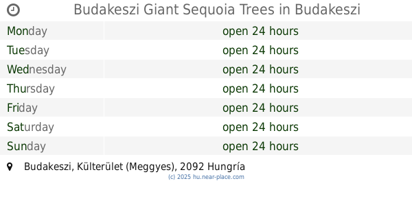
Budakeszi Giant Sequoia Trees
Budakeszi, Külterület (Meggyes)
Park
read more
4.821 km
Budakeszi focipálya
Budakeszi
Park
read more
5.287 km
Zeiss Ferenc
Törökbálint
Park
read more
5.334 km
Nagyrét
Budapeszt
Park
read more
📑
all categories
Accounting
Administrative area level 1
Administrative area level 2
Airport
Amusement park
Aquarium
Art gallery
Atm
Bakery
Bank
Bar
Beauty salon
Bicycle store
Book store
Bowling alley
Bus station
Cafe
Campground
Car dealer
Car rental
Car repair
Car wash
Casino
Cemetery
Church
City hall
Clothing store
Colloquial area
Convenience store
Country
Courthouse
Dentist
Department store
Doctor
Electrician
Electronics store
Embassy
Finance
Fire station
Florist
Food
Funeral home
Furniture store
Gas station
General contractor
Grocery or supermarket
Gym
Hair care
Hardware store
Health
Hindu Temple
Home goods store
Hospital
Insurance agency
Intersection
Jewelry store
Laundry
Lawyer
Library
Light rail station
Liquor store
Local government office
Locality
Locksmith
Lodging
Meal delivery
Meal takeaway
Mosque
Movie rental
Movie theater
Moving company
Museum
Natural feature
Neighborhood
Night club
Painter
Park
Parking
Pet store
Pharmacy
Physiotherapist
Place of worship
Plumber
Point of interest
Police
Political
Post office
Premise
Real estate agency
Restaurant
Roofing contractor
Route
Rv park, camping
School
Shoe store
Shopping mall
Spa
Stadium
Storage
Store
Subpremise
Subway station
Supermarket
Synagogue
Taxi stand
Train station
Transit station
Travel agency
University
Veterinary care
Zoo
administrative area level 3
sublocality level 1
↑