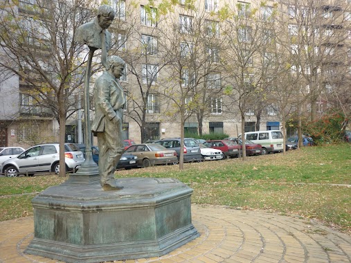
Park nearby Levendulás Park
Hungary
Park nearby Levendulás Park
Levendulás Park
28, Kanizsai utca, 1114, Budapest, HU Hungary
contacts phone
:
+36
Latitude:
47.4731279
, Longitude:
19.0396872
larger map & directions
read more
nearest Park
340 m
Feneketlen-tavi Park
Budapest, Frankfurt sétány
Park
read more
344 m
Károli játszótér
Budapest, 1114, Károli Gáspár tér 1-2
Park
read more
464 m
Park
Budapest, Fehérvári út 39
Park
read more
469 m
Feneketlen-tó
Budapest, Feneketlen-tó, 1114
Park
read more
581 m
Placid atya park
Budapest, Villányi út 16
Park
read more
592 m
Táncoló lányok parkja
Budapest, Baranyai utca 8
Park
read more
618 m
Függetlenségi park
Budapest
Park
read more
710 m
Andergarden
Budapest, Erőmű utca 5
Park
read more
767 m
Majer Imre Park
Lágymányos
Park
read more
847 m
Open Air Design Tervező és Tanácsadó Kft.
Budapest, Móricz ZSigmond körtér 1. 1. emelet
Park
read more
906 m
Budai Arborétum - Felső kert
Budapest, Ménesi út 45
Park
read more
999 m
Csillám park
Budapest, Irinyi József utca 47
Park
read more
1.006 km
Nyugdíjasok Kertje
Budapest, Fraknó utca 22
Park
read more
1.012 km
Bikás park
Budapest, Kelenföld
Park
read more
1.094 km
Bikáspark Trambulinpark
Budapest, Bártfai utca 51
Park
read more
1.122 km
Telekom Park
Budapest, Prielle Kornélia utca 53
Park
read more
1.123 km
Gárdonyi tér
Budapest
Park
read more
1.123 km
Gárdonyi tér
Budapeszt
Park
read more
1.245 km
Csillám Park
Budapest, Irinyi József utca 23
Park
read more
1.286 km
Bogdánfy Parkoló Udvar
Budapest, Bogdánfy utca 10
Park
read more
1.607 km
Fehér Marcell Emlékpark
XI. kerület
Park
read more
1.798 km
Játszótér
XI. kerület
Park
read more
1.877 km
Budai Sas-hegy Természetvédelmi terület
Budapest
Park
read more
2.017 km
Eszperantó park, Zamenhof statue
Budapest
Park
read more
2.176 km
Költők Parkja
Budapest, Menyecske utca 6
Park
read more
📑
all categories
Accounting
Administrative area level 1
Administrative area level 2
Airport
Amusement park
Aquarium
Art gallery
Atm
Bakery
Bank
Bar
Beauty salon
Bicycle store
Book store
Bowling alley
Bus station
Cafe
Campground
Car dealer
Car rental
Car repair
Car wash
Casino
Cemetery
Church
City hall
Clothing store
Colloquial area
Convenience store
Country
Courthouse
Dentist
Department store
Doctor
Electrician
Electronics store
Embassy
Finance
Fire station
Florist
Food
Funeral home
Furniture store
Gas station
General contractor
Grocery or supermarket
Gym
Hair care
Hardware store
Health
Hindu Temple
Home goods store
Hospital
Insurance agency
Intersection
Jewelry store
Laundry
Lawyer
Library
Light rail station
Liquor store
Local government office
Locality
Locksmith
Lodging
Meal delivery
Meal takeaway
Mosque
Movie rental
Movie theater
Moving company
Museum
Natural feature
Neighborhood
Night club
Painter
Park
Parking
Pet store
Pharmacy
Physiotherapist
Place of worship
Plumber
Point of interest
Police
Political
Post office
Premise
Real estate agency
Restaurant
Roofing contractor
Route
Rv park, camping
School
Shoe store
Shopping mall
Spa
Stadium
Storage
Store
Subpremise
Subway station
Supermarket
Synagogue
Taxi stand
Train station
Transit station
Travel agency
University
Veterinary care
Zoo
administrative area level 3
sublocality level 1
↑