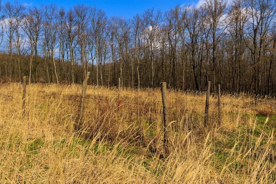
Park nearby Iron Gate Rock
Hungary
Park nearby Iron Gate Rock
Iron Gate Rock
Pilisszentkereszt, 2098 Hungary
contacts phone
:
+36
website:
www.turautak.com
Latitude:
47.6999833
, Longitude:
18.8755168
larger map & directions
read more
nearest Park
1.581 km
Zsivány-sziklák
Pilisszentkereszt
Park
read more
1.934 km
Szánkó pálya
Pilisszentkereszt, Ady Endre utca 3
Park
read more
2.161 km
László Kúpja
Pilisszántó
Park
read more
2.61 km
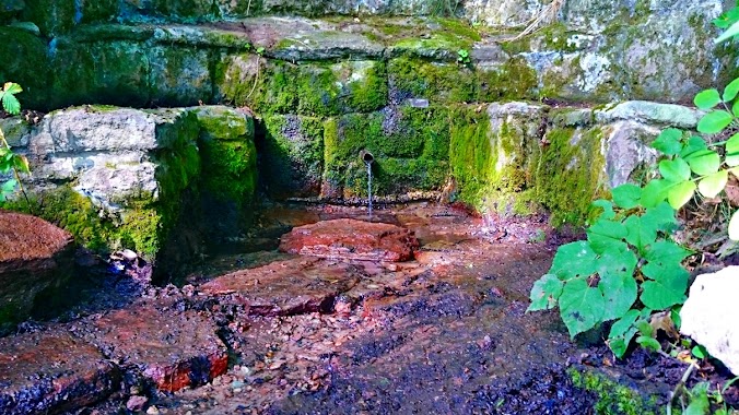
Mészégetők Kútja
Pilisszántó
Park
read more
2.65 km
Red Tree Forest
Pilisszentkereszt, Téry Ödön utca 24
Park
read more
2.735 km
Sri Chinmoy Szobra
Pilisszentkereszt
Park
read more
2.933 km
Thirring Körút
Pilisszentkereszt, Eötvös Lóránd utca 4
Park
read more
3.716 km
Dera Szurdok
Csobánka
Park
read more
3.787 km
Les
Piliscsév
Park
read more
3.997 km
UFO nyomok
Pilisszántó
Park
read more
4.489 km
Kerekes-kút forrás
Pomáz, 47.691021589, 18.9334098003
Park
read more
4.867 km
Kesztölci focipálya
Kesztölc
Park
read more
4.965 km
Rám-szakadék
Dömös, Macskások-Nyilasok dűlő
Park
read more
7.649 km
Forrás-park
Piliscsaba, Batthyány Lajos utca 1
Park
read more
7.905 km
Holdvilágárok indulás
Pomáz, Kiskovácsi 311
Park
read more
8.186 km
Spartacus-ösvény
Visegrád
Park
read more
11.48 km
Nemzeti Kőbányászati Emlékhely
Dorog
Park
read more
11.635 km
Duna-Ipoly Nemzeti Parki Igazgatóság
Esztergom
Park
read more
12.444 km
Kéktúra Pecsételőhely
Nagykovácsi, Muflon utca 20
Park
read more
13.201 km
Kisforrás park
Szentendre, Kisforrás utca 63
Park
read more
14.056 km
Global Garden Kft
Szentendre, Róka utca
Park
read more
15.052 km
Kerekerdő Kertépítő Kft.
Szentendre, Szentlászlói út 3
Park
read more
15.815 km
Kálvária park
Budakalász
Park
read more
16.982 km
Kopasz domb
Budapest, Meggy utca 42
Park
read more
17.373 km
Köztársaság téri park
Kismaros, Dózsa György út 2
Park
read more
📑
all categories
Accounting
Administrative area level 1
Administrative area level 2
Airport
Amusement park
Aquarium
Art gallery
Atm
Bakery
Bank
Bar
Beauty salon
Bicycle store
Book store
Bowling alley
Bus station
Cafe
Campground
Car dealer
Car rental
Car repair
Car wash
Casino
Cemetery
Church
City hall
Clothing store
Colloquial area
Convenience store
Country
Courthouse
Dentist
Department store
Doctor
Electrician
Electronics store
Embassy
Finance
Fire station
Florist
Food
Funeral home
Furniture store
Gas station
General contractor
Grocery or supermarket
Gym
Hair care
Hardware store
Health
Hindu Temple
Home goods store
Hospital
Insurance agency
Intersection
Jewelry store
Laundry
Lawyer
Library
Light rail station
Liquor store
Local government office
Locality
Locksmith
Lodging
Meal delivery
Meal takeaway
Mosque
Movie rental
Movie theater
Moving company
Museum
Natural feature
Neighborhood
Night club
Painter
Park
Parking
Pet store
Pharmacy
Physiotherapist
Place of worship
Plumber
Point of interest
Police
Political
Post office
Premise
Real estate agency
Restaurant
Roofing contractor
Route
Rv park, camping
School
Shoe store
Shopping mall
Spa
Stadium
Storage
Store
Subpremise
Subway station
Supermarket
Synagogue
Taxi stand
Train station
Transit station
Travel agency
University
Veterinary care
Zoo
administrative area level 3
sublocality level 1
↑