Supermarket nearby Tesco
Hungary
Supermarket nearby Tesco
Tesco
Sárvár, Rákóczi Ferenc utca 83 Hungary
contacts phone
:
+36
Latitude:
47.2466742
, Longitude:
16.956468
read more
nearest Supermarket
1.196 km
Coop abc
Sárvár, Rákóczi Ferenc utca 12
Supermarket
read more
1.25 km
Lidl
Sárvár, Rákóczi Ferenc utca 12
Supermarket
read more
1.791 km
ALDI Sárvár
Sárvár, Deák Ferenc utca 14
Supermarket
read more
2.092 km
Euro Family
Sárvár, Hunyadi János utca 2
Supermarket
read more
2.487 km
Penny Market
Sárvár, Soproni utca
Supermarket
read more
14.746 km
Supermarket Tesco Celldömölk
Celldömölk, Sági utca 41
Supermarket
read more
14.809 km
Penny Market
Celldömölk, Sági utca 56/a
Supermarket
read more
14.872 km
SPAR Szupermarket
Celldömölk, Sági utca 22
Supermarket
read more
20.831 km
Élelmiszerbolt
Szombathely, Külső-Zanati út
Supermarket
read more
22.837 km
DM
Szombathely, Varasd utca 10
Supermarket
read more
22.944 km
Tesco
Szombathely, Zanati út 70
Supermarket
read more
23.26 km
Penny Market
Szombathely, Sárvár u. 1.
Supermarket
read more
23.54 km
Lidl
Szombathely, Zanati út 42
Supermarket
read more
23.899 km
SPAR Szupermarket
Vasvár, Alkotmány utca 95
Supermarket
read more
24.513 km
Lidl
Szombathely, Kenyérvíz Straße 2.
Supermarket
read more
24.958 km
SPAR Szupermarket
Szombathely, Szent Márton utca 21
Supermarket
read more
24.962 km
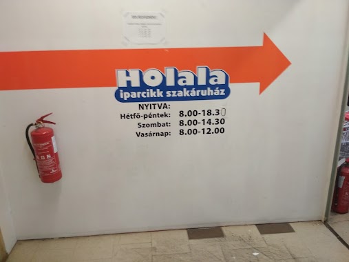
Holala iparcikk szakáruház
Szombathely, Szent Márton utca 21
Supermarket
read more
25.168 km
SPAR Szupermarket
Szombathely, 11-es Huszár út 39
Supermarket
read more
25.493 km
SPAR
Szombathely, Hefele Menyhért utca 3-5
Supermarket
read more
25.877 km
VARGA ISTVÁN
Vasvár, Vérmező utca 11
Supermarket
read more
38.451 km
SPAR Szupermarket
Petőháza, Spar út 1
Supermarket
read more
38.823 km
SPAR Szupermarket
Kapuvár, Fő tér 2
Supermarket
read more
38.879 km
SPAR Szupermarket
Kapuvár, Győri út
Supermarket
read more
55.434 km
Lidl
Tapolca, Veszprémi Straße 1.
Supermarket
read more
55.442 km
Tesco
Tapolca, Veszprémi út 5
Supermarket
read more
📑
all categories
Accounting
Administrative area level 1
Administrative area level 2
Airport
Amusement park
Aquarium
Art gallery
Atm
Bakery
Bank
Bar
Beauty salon
Bicycle store
Book store
Bowling alley
Bus station
Cafe
Campground
Car dealer
Car rental
Car repair
Car wash
Casino
Cemetery
Church
City hall
Clothing store
Colloquial area
Convenience store
Country
Courthouse
Dentist
Department store
Doctor
Electrician
Electronics store
Embassy
Finance
Fire station
Florist
Food
Funeral home
Furniture store
Gas station
General contractor
Grocery or supermarket
Gym
Hair care
Hardware store
Health
Hindu Temple
Home goods store
Hospital
Insurance agency
Intersection
Jewelry store
Laundry
Lawyer
Library
Light rail station
Liquor store
Local government office
Locality
Locksmith
Lodging
Meal delivery
Meal takeaway
Mosque
Movie rental
Movie theater
Moving company
Museum
Natural feature
Neighborhood
Night club
Painter
Park
Parking
Pet store
Pharmacy
Physiotherapist
Place of worship
Plumber
Point of interest
Police
Political
Post office
Premise
Real estate agency
Restaurant
Roofing contractor
Route
Rv park, camping
School
Shoe store
Shopping mall
Spa
Stadium
Storage
Store
Subpremise
Subway station
Supermarket
Synagogue
Taxi stand
Train station
Transit station
Travel agency
University
Veterinary care
Zoo
administrative area level 3
sublocality level 1
↑