Store nearby Krajcáros
Hungary
Store nearby Krajcáros
Krajcáros
10, Dombtető utca, 1108, Budapest, HU Magyarország
contacts phone
:
+36
Latitude:
47.4726781
, Longitude:
19.164385
larger map & directions
read more
nearest Store
116 m
National tobacco shop
Budapest, Újhegyi sétány 20
Store
read more
137 m
Dohánybolt
Budapest, Harmat utca 113
Store
read more
243 m
FagyiZó-Na Cukrászda, Gelato Art Kft
Budapest, Mádi utca, &, Sibrik Miklós út
Store
read more
426 m
Iroda Pont Kft
Budapest, Újhegyi sétány 12
Store
read more
428 m
Hapci-Illatszer BT.
Budapest, Harmat utca 129
Store
read more
453 m
Larex Trade Kft.
Budapest, Maglódi út 123
Store
read more
629 m
WOCO Ipartechnika Magyarország Kft.
Budapest, Újhegyi út 25 31
Store
read more
629 m
WOCO Industry Engineering Hungary Kft.
Budapest, Újhegyi út 25 31
Store
read more
656 m
Koral diszkont
Budapest, Újhegyi út 36
Store
read more
696 m
Papirtaskas.hu Kft.
Budapest, Maglódi út 18
Store
read more
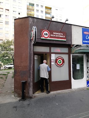
782 m
Nemzeti Dohánybolt
Budapest, Sibrik Miklós út 26-28
Store
read more
782 m
National tobacco shop
Budapest, Sibrik Miklós út 26-28
Store
read more
807 m
Non Stop
Budapest, Sörgyár utca 75
Store
read more
812 m
Bufa Budapesti Faipari Kft.
Budapest, Kozma utca 13
Store
read more
824 m
Gold Brikett (NIT telephely)
Budapest, Újhegyi út 5
Store
read more
824 m
Gold briquettes (NIT site)
Budapest, Újhegyi út 5
Store
read more
828 m
Fittsport - Futópad, sportszer és fitness áruház
Budapest, Gergely utca 112/c
Store
read more
831 m
Nemzeti dohánybolt
Budapest, Bodza utca 43
Store
read more
854 m
Nemzeti Dohánybolt
Budapest, Gyömrői út 99
Store
read more
856 m
DM
Budapest, Gergely utca 87
Store
read more
969 m
Merkapt Zrt.
Budapest, Maglódi út 14/B
Store
read more
992 m
Royal Irodatechnika Kft.
Budapest, Gyömrői út 140
Store
read more
997 m
Primero pump Kft.
Budapest, Kozma utca 7
Store
read more
1.103 km
DIRICKX Kerítés Kft.
Budapest, Harmat utca 220
Store
read more
1.116 km
Totó - lottó
Budapest, Kada utca 136
Store
read more
📑
all categories
Accounting
Administrative area level 1
Administrative area level 2
Airport
Amusement park
Aquarium
Art gallery
Atm
Bakery
Bank
Bar
Beauty salon
Bicycle store
Book store
Bowling alley
Bus station
Cafe
Campground
Car dealer
Car rental
Car repair
Car wash
Casino
Cemetery
Church
City hall
Clothing store
Colloquial area
Convenience store
Country
Courthouse
Dentist
Department store
Doctor
Electrician
Electronics store
Embassy
Finance
Fire station
Florist
Food
Funeral home
Furniture store
Gas station
General contractor
Grocery or supermarket
Gym
Hair care
Hardware store
Health
Hindu Temple
Home goods store
Hospital
Insurance agency
Intersection
Jewelry store
Laundry
Lawyer
Library
Light rail station
Liquor store
Local government office
Locality
Locksmith
Lodging
Meal delivery
Meal takeaway
Mosque
Movie rental
Movie theater
Moving company
Museum
Natural feature
Neighborhood
Night club
Painter
Park
Parking
Pet store
Pharmacy
Physiotherapist
Place of worship
Plumber
Point of interest
Police
Political
Post office
Premise
Real estate agency
Restaurant
Roofing contractor
Route
Rv park, camping
School
Shoe store
Shopping mall
Spa
Stadium
Storage
Store
Subpremise
Subway station
Supermarket
Synagogue
Taxi stand
Train station
Transit station
Travel agency
University
Veterinary care
Zoo
administrative area level 3
sublocality level 1
↑