Store nearby Kertvárosi Gazdabolt
Hungary
Store nearby Kertvárosi Gazdabolt
Kertvárosi Gazdabolt
Nyíregyháza, Tiszavasvári út 33 Hungary
contacts phone
:
+36
Latitude:
47.9573576
, Longitude:
21.690343
read more
nearest Store
57 m
Tücsök Vegyesbolt
Nyíregyháza, Tiszavasvári út
Store
read more
66 m
TomaPlast Kft.
Nyíregyháza, Tiszavasvári út 27
Store
read more
243 m
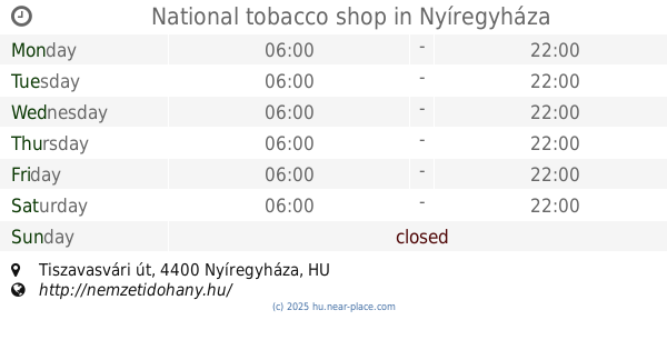
National tobacco shop
Nyíregyháza, Tiszavasvári út
Store
read more
576 m
Virág-ajándék-játék
Nyíregyháza, Prága utca 6
Store
read more
705 m
Kelet-Szerszám Kft.
Nyíregyháza, Varsó utca 4
Store
read more
754 m
Bogár Fűszer Csemege
Nyíregyháza, Bólyai tér
Store
read more
802 m
Fk Balneum Kft.
Nyíregyháza, Bethlen Gábor utca 83
Store
read more
860 m
Nyírségi Napraforgó Bt.
Nyíregyháza, Fáy András utca 15
Store
read more
929 m
COOP ABC (654. sz. COOP ABC)
Nyíregyháza, Fészek utca 141
Store
read more
929 m
Coop ABC
Nyíregyháza, Fészek utca 141
Store
read more
945 m
Garai Fagylaltozó
Nyíregyháza, Kőris utca 8
Store
read more
948 m
COOP
Nyíregyháza, Dugonics utca 23
Store
read more
957 m
Villforgó Bt.
Nyíregyháza, Rákóczi utca 90
Store
read more
980 m
Ajandekkeszites.hu
Nyíregyháza, Rákóczi utca 98
Store
read more
980 m
Netnyomda.hu
Nyíregyháza, Rákóczi utca 98
Store
read more
985 m
Plasztikkártya,plasztikkártya készítés,plasztikkártya nyomtatás
Nyíregyháza, Rákóczi utca 98
Store
read more
1.017 km
Olcsonagyker.hu
Nyíregyháza, Rákóczi utca 100
Store
read more
1.024 km
Pari Csemege
Nyíregyháza, Rákóczi utca
Store
read more
1.029 km
BHPgumi.hu Átvételi és Szerviz Pont
Nyíregyháza, Derkovits utca 106-108
Store
read more
1.029 km
BHPgumi
Nyíregyháza, Derkovits utca 106-108
Store
read more
1.077 km
Nóra Kertészet Kft
Nyíregyháza, Játszó utca 13
Store
read more
1.113 km
Magyar Kertészet
Nyírtelek, Tokaji út 1
Store
read more
1.32 km
National tobacco shop
Nyíregyháza, Petőfi tér 1
Store
read more
1.572 km
Terminus Fishing Shop
Nyíregyháza, Állomás tér 7
Store
read more
1.86 km
Nemzeti dohánybolt
Nyíregyháza, Kossuth Lajos utca 33
Store
read more
📑
all categories
Accounting
Administrative area level 1
Administrative area level 2
Airport
Amusement park
Aquarium
Art gallery
Atm
Bakery
Bank
Bar
Beauty salon
Bicycle store
Book store
Bowling alley
Bus station
Cafe
Campground
Car dealer
Car rental
Car repair
Car wash
Casino
Cemetery
Church
City hall
Clothing store
Colloquial area
Convenience store
Country
Courthouse
Dentist
Department store
Doctor
Electrician
Electronics store
Embassy
Finance
Fire station
Florist
Food
Funeral home
Furniture store
Gas station
General contractor
Grocery or supermarket
Gym
Hair care
Hardware store
Health
Hindu Temple
Home goods store
Hospital
Insurance agency
Intersection
Jewelry store
Laundry
Lawyer
Library
Light rail station
Liquor store
Local government office
Locality
Locksmith
Lodging
Meal delivery
Meal takeaway
Mosque
Movie rental
Movie theater
Moving company
Museum
Natural feature
Neighborhood
Night club
Painter
Park
Parking
Pet store
Pharmacy
Physiotherapist
Place of worship
Plumber
Point of interest
Police
Political
Post office
Premise
Real estate agency
Restaurant
Roofing contractor
Route
Rv park, camping
School
Shoe store
Shopping mall
Spa
Stadium
Storage
Store
Subpremise
Subway station
Supermarket
Synagogue
Taxi stand
Train station
Transit station
Travel agency
University
Veterinary care
Zoo
administrative area level 3
sublocality level 1
↑