Store nearby Hungaroplant Kft.
Hungary
Store nearby Hungaroplant Kft.
Hungaroplant Kft.
Pusztalöb, 2225, Üllő, HU Magyarország
contacts phone
:
+36
Latitude:
47.3516659
, Longitude:
19.3040977
larger map & directions
read more
nearest Store
2.317 km
Stan Tools And Nails Kft.
Felsőpakony
Store
read more
2.494 km
Jónás Kft
Felsőpakony, Külterület, Hétsor utca 1.
Store
read more
3.737 km
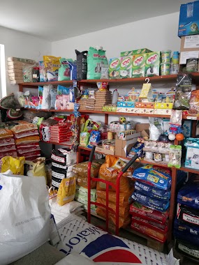
Tápfutár Takarmánybolt
Üllő, 2225, Hajcsár utca 40
Store
read more
4.02 km
Unio Telecom Kft.
Felsőpakony, Unnamed Rd, 2363
Store
read more
4.21 km
Tellér Kft.
Felsőpakony, Raktárbázis 4
Store
read more
4.312 km
Decorlight Kft. Üvegtechnikai termékeket,Neonreklámokat gyártó és forgalmazó Kft
Felsőpakony, Unnamed Road
Store
read more
4.526 km
Smaragd Kertészeti Áruda Bt.
Üllő, Pesti út 153
Store
read more
4.545 km
Várkonyi József
Üllő, Pesti út 199
Store
read more
4.567 km
Annzol Soft Kft
Üllő, Pesti út 196
Store
read more
4.567 km
troll lászló tetöfedö
Ócsa Szociálislakópark, Kőrisfa Út 4
Store
read more
4.569 km
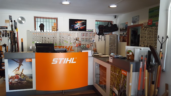
Stihl Bolt
Üllő, Pesti út 194
Store
read more
4.59 km
Herz Hungária Kft.
Üllő, Pesti út 284
Store
read more
4.609 km
Stihl Szaküzlet
勒, Annzol soft Kft 196, Pesti út 于
Store
read more
4.844 km
Friss Halbolt Bt
Üllő, Pesti út 77
Store
read more
4.853 km
Nemzeti Dohánybolt
Üllő, Pesti út 126
Store
read more
4.853 km
National tobacco shop
Üllő, Pesti út 126
Store
read more
4.873 km
Üllő HÚSBOLT Pacsi-Hús
Üllő, Pesti út 116
Store
read more
4.879 km
Lovasbolt
Üllő, Pesti út 102
Store
read more
4.88 km
Rossmann Drogéria Parfüméria
Üllő, Pesti út 100
Store
read more
4.901 km
Műszaki Áruház (Antenna Plusz Kft)
Üllő, Pesti út 39
Store
read more
5.212 km
NATI Kft.
2225 Üllő, Zsarókahegy 1
Store
read more
5.22 km
hagyomanyosan.hu
Üllő, Klapka utca 5
Store
read more
5.377 km
Fertilopharma Kft
Üllő, Táncsics Mihály utca 25/B
Store
read more
5.536 km
K-Plast Kft -- Műanyagüzem Üllő
Üllő
Store
read more
5.885 km
VL Szivattyújavító Bt.
Üllő, Bimbó utca 4
Store
read more
📑
all categories
Accounting
Administrative area level 1
Administrative area level 2
Airport
Amusement park
Aquarium
Art gallery
Atm
Bakery
Bank
Bar
Beauty salon
Bicycle store
Book store
Bowling alley
Bus station
Cafe
Campground
Car dealer
Car rental
Car repair
Car wash
Casino
Cemetery
Church
City hall
Clothing store
Colloquial area
Convenience store
Country
Courthouse
Dentist
Department store
Doctor
Electrician
Electronics store
Embassy
Finance
Fire station
Florist
Food
Funeral home
Furniture store
Gas station
General contractor
Grocery or supermarket
Gym
Hair care
Hardware store
Health
Hindu Temple
Home goods store
Hospital
Insurance agency
Intersection
Jewelry store
Laundry
Lawyer
Library
Light rail station
Liquor store
Local government office
Locality
Locksmith
Lodging
Meal delivery
Meal takeaway
Mosque
Movie rental
Movie theater
Moving company
Museum
Natural feature
Neighborhood
Night club
Painter
Park
Parking
Pet store
Pharmacy
Physiotherapist
Place of worship
Plumber
Point of interest
Police
Political
Post office
Premise
Real estate agency
Restaurant
Roofing contractor
Route
Rv park, camping
School
Shoe store
Shopping mall
Spa
Stadium
Storage
Store
Subpremise
Subway station
Supermarket
Synagogue
Taxi stand
Train station
Transit station
Travel agency
University
Veterinary care
Zoo
administrative area level 3
sublocality level 1
↑