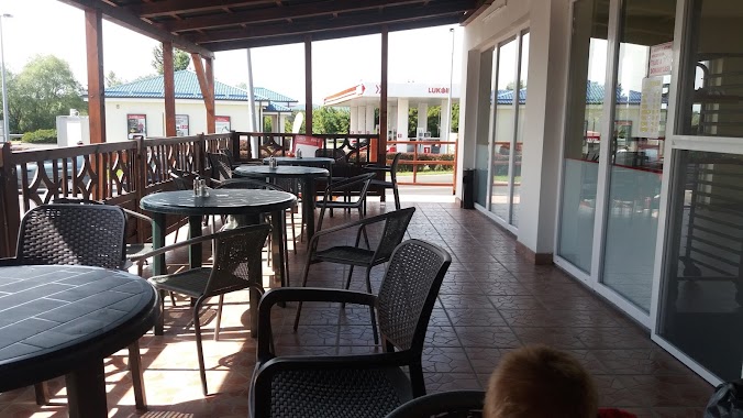
Restaurant nearby Nagyfal
Hungary
Restaurant nearby Nagyfal
Nagyfal
Dunakeszi, Nádas utca 6 Magyarország
contacts phone
:
+36
Latitude:
47.6081767
, Longitude:
19.1166843
read more
nearest Restaurant
10 m
Jack's Burger
Dunakeszi, Auchan Áruház,, Nádas utca 6
Restaurant
read more
17 m
Dunakeszi, Pizza Hut Express
Dunakeszi, Nádas utca 8
Restaurant
read more
20 m
Halpatkó
Dunakeszi, Nádas utca 8
Restaurant
read more
52 m
KFC
Dunakeszi, Auchan, Nádas utca 6
Restaurant
read more
411 m
Mc Donald
Dunakeszi, Nádas utca 6
Restaurant
read more
438 m
McDonald's
Dunakeszi, Nádas utca 6
Restaurant
read more
856 m
Colorado Étterem
Budapest, Íves út 16
Restaurant
read more
954 m
Málna Bisztró
Budapest, Ezred utca 2
Restaurant
read more
1.029 km
Dunakeszi alsó - Korona Söröző
Dunakeszi, Muskátli utca 1
Restaurant
read more
1.405 km
BrumiBarlang presszó - söröző
Budapest, Székpatak utca 1
Restaurant
read more
1.709 km
Mamma Róma
Budapest, Megyeri út 205
Restaurant
read more
1.769 km
Ipark étterem és kávézó
Budapest, Ipari park utca 10
Restaurant
read more
1.954 km
Olajbogyó Kis Bisztró
Budapest, Homoktövis utca 1
Restaurant
read more
2.233 km
Szulejmán török étterem
Dunakeszi, Fő út 1824
Restaurant
read more
2.292 km
Újpest Pizzéria
Budapest, Lakkozó utca 33
Restaurant
read more
2.368 km
Burger House
Dunakeszi, Fő út 1
Restaurant
read more
2.454 km
Sanyi Bácsi Büféje
Budakalász, Víztorony utca 1
Restaurant
read more
2.468 km
Liget Étkezde
Dunakeszi
Restaurant
read more
2.603 km
Berek Étterem
Dunakeszi, Szent István utca 24
Restaurant
read more
2.617 km
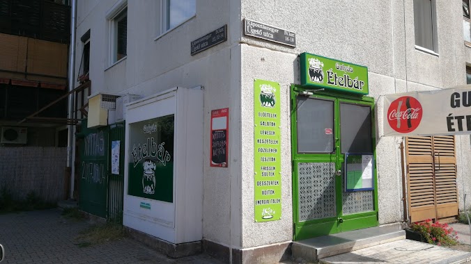
KanyarGó Ételbár
Dunakeszi, Bajcsy-Zsilinszky utca 15
Restaurant
read more
2.62 km
Zöldkagyló úszóház
Szentendrei-Dunaág
Restaurant
read more
2.686 km
Zsóka Büfé
Budapest, Járműtelep utca 19
Restaurant
read more
2.922 km
Gulyás ételbár
Budapest, Ügető utca 16
Restaurant
read more
3.044 km
Lángos Éden
Dunakeszi, Fő út 63
Restaurant
read more
3.356 km
Megyeri Csárda
Budapest, Váci út 106
Restaurant
read more
📑
all categories
Accounting
Administrative area level 1
Administrative area level 2
Airport
Amusement park
Aquarium
Art gallery
Atm
Bakery
Bank
Bar
Beauty salon
Bicycle store
Book store
Bowling alley
Bus station
Cafe
Campground
Car dealer
Car rental
Car repair
Car wash
Casino
Cemetery
Church
City hall
Clothing store
Colloquial area
Convenience store
Country
Courthouse
Dentist
Department store
Doctor
Electrician
Electronics store
Embassy
Finance
Fire station
Florist
Food
Funeral home
Furniture store
Gas station
General contractor
Grocery or supermarket
Gym
Hair care
Hardware store
Health
Hindu Temple
Home goods store
Hospital
Insurance agency
Intersection
Jewelry store
Laundry
Lawyer
Library
Light rail station
Liquor store
Local government office
Locality
Locksmith
Lodging
Meal delivery
Meal takeaway
Mosque
Movie rental
Movie theater
Moving company
Museum
Natural feature
Neighborhood
Night club
Painter
Park
Parking
Pet store
Pharmacy
Physiotherapist
Place of worship
Plumber
Point of interest
Police
Political
Post office
Premise
Real estate agency
Restaurant
Roofing contractor
Route
Rv park, camping
School
Shoe store
Shopping mall
Spa
Stadium
Storage
Store
Subpremise
Subway station
Supermarket
Synagogue
Taxi stand
Train station
Transit station
Travel agency
University
Veterinary care
Zoo
administrative area level 3
sublocality level 1
↑