Restaurant nearby Major Vendéglő
Hungary
Restaurant nearby Major Vendéglő
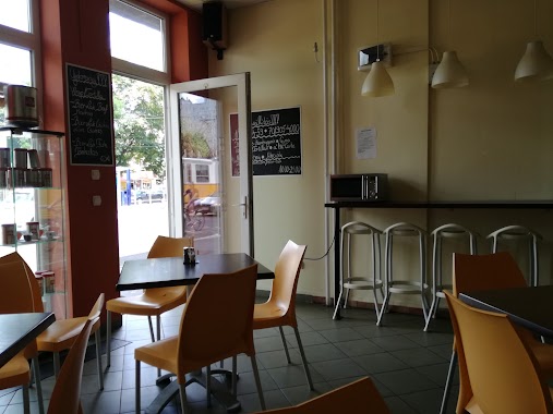
Major Vendéglő
57, major utca, 1119, Budapest, HU Magyarország
contacts phone
:
+36 1 206 2257
website:
majorvendeglo.hu
Latitude:
47.4592242
, Longitude:
19.029713
larger map & directions
read more
nearest Restaurant
Majorvendéglő
Budapest, major utca 57
Restaurant
read more
352 m
Figuráns Bistro
Budapest, Bornemissza tér 12
Restaurant
read more
424 m
Mag Kert
Budapest, Kelenvölgyi határsor 3
Restaurant
read more
426 m
Roxane Étterem
Budapest, Csorbai utca 3/c
Restaurant
read more
443 m
M4 Bisztró
Budapest, Andor utca 47-49
Restaurant
read more
553 m
Terike Büfé
Budapest, 1119, Etele út 32b
Restaurant
read more
555 m
Chil2Bistro
Budapest, Etele út 57
Restaurant
read more
562 m
Soleil Bisztro
Budapest, Rátz László utca 36
Restaurant
read more
571 m
Pizzaszelet Bàr
Budapest
Restaurant
read more
573 m
Főnökasszony Maga Főz
Budapest, Etele út 59-61
Restaurant
read more
579 m
Retro BÜFÉ
Budapest, Etele út 53
Restaurant
read more
599 m
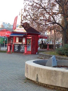
Hambi kuckó
Budapest, Tétényi út 34
Restaurant
read more
607 m
Kézzel_húzott házi rétes
Budapest, Etele út 63
Restaurant
read more
611 m
Retro 2 Gyorsétterem
Budapest, Tétényi út 63
Restaurant
read more
640 m
Döner Kebab House
Budapest, Tétényi út 63
Restaurant
read more
646 m
Somfa Étterem
Budapest, Vahot utca 8
Restaurant
read more
814 m
NoFlanc
Budapest, Andor utca 1
Restaurant
read more
866 m
Yu Cheng
Budapest, Etele tér 12
Restaurant
read more
876 m
Resti Söröző
Budapest, Etele tér 6
Restaurant
read more
883 m
Burger Station
Budapest, Etele tér 5
Restaurant
read more
915 m
Husi Zoo
Budapest, Kelenföldi út 48
Restaurant
read more
1.065 km
Bier-Lak
Budapest, 1119, Fehérvári út 88
Restaurant
read more
1.133 km
Super 8 önkiszolgáló étterem
Budapest, Fehérvári út 168
Restaurant
read more
1.165 km
Rétisas Vendéglő
Budapest, 1118, Rimaszombati út 7
Restaurant
read more
1.181 km
UB terasz
Budapest, Kondorosi út 12
Restaurant
read more
📑
all categories
Accounting
Administrative area level 1
Administrative area level 2
Airport
Amusement park
Aquarium
Art gallery
Atm
Bakery
Bank
Bar
Beauty salon
Bicycle store
Book store
Bowling alley
Bus station
Cafe
Campground
Car dealer
Car rental
Car repair
Car wash
Casino
Cemetery
Church
City hall
Clothing store
Colloquial area
Convenience store
Country
Courthouse
Dentist
Department store
Doctor
Electrician
Electronics store
Embassy
Finance
Fire station
Florist
Food
Funeral home
Furniture store
Gas station
General contractor
Grocery or supermarket
Gym
Hair care
Hardware store
Health
Hindu Temple
Home goods store
Hospital
Insurance agency
Intersection
Jewelry store
Laundry
Lawyer
Library
Light rail station
Liquor store
Local government office
Locality
Locksmith
Lodging
Meal delivery
Meal takeaway
Mosque
Movie rental
Movie theater
Moving company
Museum
Natural feature
Neighborhood
Night club
Painter
Park
Parking
Pet store
Pharmacy
Physiotherapist
Place of worship
Plumber
Point of interest
Police
Political
Post office
Premise
Real estate agency
Restaurant
Roofing contractor
Route
Rv park, camping
School
Shoe store
Shopping mall
Spa
Stadium
Storage
Store
Subpremise
Subway station
Supermarket
Synagogue
Taxi stand
Train station
Transit station
Travel agency
University
Veterinary care
Zoo
administrative area level 3
sublocality level 1
↑