Restaurant nearby Gyros Mánia
Hungary
Restaurant nearby Gyros Mánia
Gyros Mánia
Érd, 35, Balatoni út Magyarország
contacts phone
:
+36
Latitude:
47.3893838
, Longitude:
18.9337832
read more
nearest Restaurant
302 m
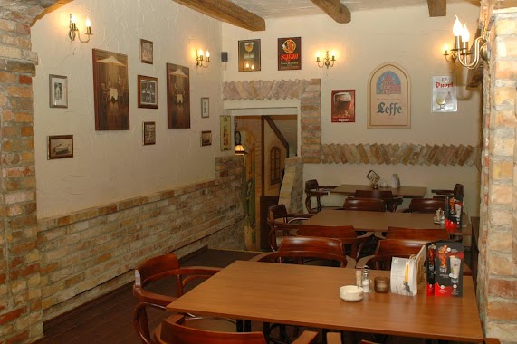
Black Dog Pub & Pizzéria
Érd, Balatoni út 21
Restaurant
read more
303 m
Poirot Belga Étterem
Érd, Szegfű utca 24
Restaurant
read more
331 m
Bicsérdi Söröző-Borozó
Érd, Rába utca 21
Restaurant
read more
359 m
Golden River Chinese Restaurant
Érd, Balatoni út 62/a
Restaurant
read more
359 m
Arany Főnix Grill És Wok Étterem
Érd, Balatoni út 62/a
Restaurant
read more
369 m
Arany Főnix étterem
Érd, Balatoni út 62
Restaurant
read more
380 m
Branco Steakhouse
Érd, Balatoni út 13
Restaurant
read more
407 m
Osváth Cukrászda és Étterem
Érd, Balatoni út 71
Restaurant
read more
584 m
Lottozzo
Érd, Madžarska, Kamilla utca 15
Restaurant
read more
626 m
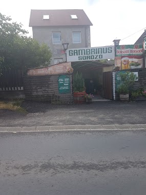
Gambrinus Söröző
Érd, Diósdi út 72
Restaurant
read more
648 m
Csirkeól
Érd, Balatoni út 77
Restaurant
read more
657 m
Vivi Ételbár
Érd, 2036
Restaurant
read more
756 m
Négy Évszak Tánczenekar
Budapest, körönd 1
Restaurant
read more
796 m
Kaja Kunyhó
Érd, Riminyáki út 10
Restaurant
read more
809 m
Pizza Karaván Érd
Érd
Restaurant
read more
825 m
Club 49
Érd, Diósdi út 51
Restaurant
read more
865 m
Irish Dog Kft.
Érd, Antal utca 17
Restaurant
read more
865 m
Irish Dog Pub
Érd, Antal utca 17
Restaurant
read more
1.012 km
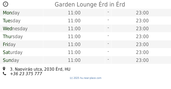
Garden Lounge Érd
Érd, Napvirág utca 3
Restaurant
read more
1.251 km
Ínyencbár Pecsenyéző
Érd, Budai út 76
Restaurant
read more
1.356 km
Burger Station
Érd, Diósdi út 6
Restaurant
read more
1.591 km
Halsütő & halbolt
Diósd, Balatoni út
Restaurant
read more
1.627 km
Diósd Garden Étterem és Kávézó
Diósd, Gyár utca 34-36
Restaurant
read more
1.855 km
Snacki Bisztró
Érd, Szabadság tér 13
Restaurant
read more
2.099 km
Fa-Ló Gyorsétkezde
Érd, Felső utca 50
Restaurant
read more
📑
all categories
Accounting
Administrative area level 1
Administrative area level 2
Airport
Amusement park
Aquarium
Art gallery
Atm
Bakery
Bank
Bar
Beauty salon
Bicycle store
Book store
Bowling alley
Bus station
Cafe
Campground
Car dealer
Car rental
Car repair
Car wash
Casino
Cemetery
Church
City hall
Clothing store
Colloquial area
Convenience store
Country
Courthouse
Dentist
Department store
Doctor
Electrician
Electronics store
Embassy
Finance
Fire station
Florist
Food
Funeral home
Furniture store
Gas station
General contractor
Grocery or supermarket
Gym
Hair care
Hardware store
Health
Hindu Temple
Home goods store
Hospital
Insurance agency
Intersection
Jewelry store
Laundry
Lawyer
Library
Light rail station
Liquor store
Local government office
Locality
Locksmith
Lodging
Meal delivery
Meal takeaway
Mosque
Movie rental
Movie theater
Moving company
Museum
Natural feature
Neighborhood
Night club
Painter
Park
Parking
Pet store
Pharmacy
Physiotherapist
Place of worship
Plumber
Point of interest
Police
Political
Post office
Premise
Real estate agency
Restaurant
Roofing contractor
Route
Rv park, camping
School
Shoe store
Shopping mall
Spa
Stadium
Storage
Store
Subpremise
Subway station
Supermarket
Synagogue
Taxi stand
Train station
Transit station
Travel agency
University
Veterinary care
Zoo
administrative area level 3
sublocality level 1
↑