Restaurant nearby Gyros Kuckó
Hungary
Restaurant nearby Gyros Kuckó
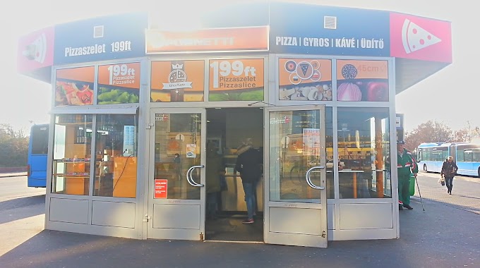
Gyros Kuckó
Budapest, Szentmihályi út 23 Magyarország
contacts phone
:
+36
Latitude:
47.5092796
, Longitude:
19.1490522
read more
nearest Restaurant
306 m
La Guna Étterem
Budapest, Rákosfalva park 1-3
Restaurant
read more
451 m
Kínai büfé
Budapest, Vezér utca 39
Restaurant
read more
564 m
McDonald's
Budapest, Kerepesi út 73
Restaurant
read more
703 m
Ropogós Bistro & Garden
Budapest, Rákosi út 9
Restaurant
read more
785 m
Autós Büfé - Falatozó
Budapest, 1103, Keresztúri út 10
Restaurant
read more
880 m
Sweet Dream Restaurant
Budapest, Kerepesi út 87
Restaurant
read more
899 m
Falatka Bistro
Budapest, Szent Korona utca 2
Restaurant
read more
965 m
Dobai Food
Budapest, Cziráki utca 31
Restaurant
read more
1.011 km
Főzelékfaló Ételbár
Budapest, Örs vezér tere
Restaurant
read more
1.015 km
Sörkert Büfé
Budapest, Kerepesi út 82-88
Restaurant
read more
1.028 km
Grillcsirke
Budapest, Vezér utca 74
Restaurant
read more
1.051 km
shanghai gyorsétterem
bubapest, Örs vezér tere 24
Restaurant
read more
1.057 km
Sakura Ramen
Budapest, Örs vezér tere 25
Restaurant
read more
1.058 km
Star Kebab
Budapest Árkád Bevásárlóközpont, Örs vezér tere 25A
Restaurant
read more
1.068 km
Király Lángos
Budapest, Kerepesi út 82-88
Restaurant
read more
1.068 km
KFC
Budapest, Árkád, Örs vezér tere 25
Restaurant
read more
1.109 km
Falatozó
Budapest, Rákosi út
Restaurant
read more
1.12 km
Purple Panda
Budapest, Árkád 1
Restaurant
read more
1.125 km
Arany kínai Folyó
Budapest, Rákosi út
Restaurant
read more
1.135 km
Arany Folyó Kínai Étterem
Budapest, Rákosi út 48
Restaurant
read more
1.197 km
Séf Sandwich
Budapest, Kerepesi út
Restaurant
read more
1.213 km
SÉF BÜFÉ
Budapest, Kerepesi út 80d
Restaurant
read more
1.219 km
Döner Kebab
Budapest, Fehér út 1
Restaurant
read more
1.28 km
Fornetti
Budapest, Fehér út 1
Restaurant
read more
1.357 km
Lángos
Budapest, Fehér út 3
Restaurant
read more
📑
all categories
Accounting
Administrative area level 1
Administrative area level 2
Airport
Amusement park
Aquarium
Art gallery
Atm
Bakery
Bank
Bar
Beauty salon
Bicycle store
Book store
Bowling alley
Bus station
Cafe
Campground
Car dealer
Car rental
Car repair
Car wash
Casino
Cemetery
Church
City hall
Clothing store
Colloquial area
Convenience store
Country
Courthouse
Dentist
Department store
Doctor
Electrician
Electronics store
Embassy
Finance
Fire station
Florist
Food
Funeral home
Furniture store
Gas station
General contractor
Grocery or supermarket
Gym
Hair care
Hardware store
Health
Hindu Temple
Home goods store
Hospital
Insurance agency
Intersection
Jewelry store
Laundry
Lawyer
Library
Light rail station
Liquor store
Local government office
Locality
Locksmith
Lodging
Meal delivery
Meal takeaway
Mosque
Movie rental
Movie theater
Moving company
Museum
Natural feature
Neighborhood
Night club
Painter
Park
Parking
Pet store
Pharmacy
Physiotherapist
Place of worship
Plumber
Point of interest
Police
Political
Post office
Premise
Real estate agency
Restaurant
Roofing contractor
Route
Rv park, camping
School
Shoe store
Shopping mall
Spa
Stadium
Storage
Store
Subpremise
Subway station
Supermarket
Synagogue
Taxi stand
Train station
Transit station
Travel agency
University
Veterinary care
Zoo
administrative area level 3
sublocality level 1
↑