Restaurant nearby Budmil büfé
Hungary
Restaurant nearby Budmil büfé
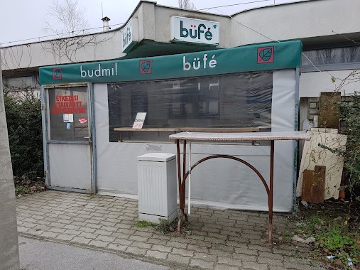
Budmil büfé
3, Szőlőkert köz, 1033, Budapest, HU Hungary
contacts phone
:
+36
Latitude:
47.5569105
, Longitude:
19.0384557
larger map & directions
read more
nearest Restaurant
301 m
Anyu Konyha
Budapest, Kaszásdűlő utca 2
Restaurant
read more
385 m
JÖSSZ is MÉSZIs büfé
Budapest, Szérűskert utca 39
Restaurant
read more
401 m
köles étterem
Budapest, Pethe Ferenc tér 1
Restaurant
read more
495 m
Házisárkány Étkezde
Budapest, Huszti út 21
Restaurant
read more
505 m
3 Haver Söröző
Budapest, Búza utca 6
Restaurant
read more
517 m
Pizza Piazza
Budapest, Búza utca 6
Restaurant
read more
517 m
Lovegame teniszklub
Budapest, Rádl árok 1
Restaurant
read more
530 m
Duna Autó Étterem
Budapest, Zay út 30
Restaurant
read more
569 m
Burger House Óbuda
Budapest, Reményi Ede utca 1
Restaurant
read more
594 m
Smokey Monkies BBQ
Budapest, Szentendrei út 95
Restaurant
read more
613 m
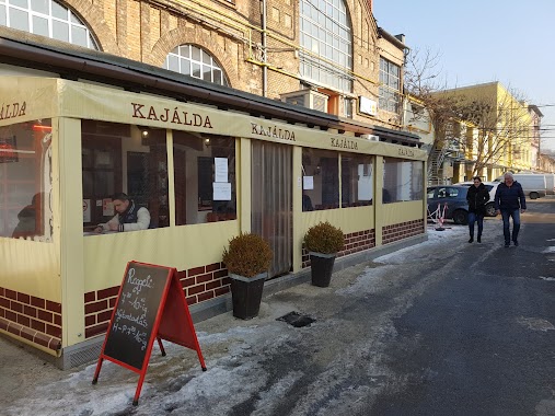
Kajálda
Budapest, PP center, Szentendrei út 89-93
Restaurant
read more
629 m
Laci konyha
Budapest, Reményi Ede utca 1
Restaurant
read more
669 m
Bojtár Büfé
Budapest, Bojtár utca 37
Restaurant
read more
679 m
Pulled Chicken Bistro
Budapest, Szentendrei út 40
Restaurant
read more
769 m
Dallas Étterem
Budapest, Zay út 5
Restaurant
read more
806 m
Kisbojtár Vendéglő
Budapest, Bojtár utca 29
Restaurant
read more
816 m
KFC
Budapest, Szentendrei út 104
Restaurant
read more
816 m
KFC Óbuda
Budapest, Szentendrei út 104
Restaurant
read more
834 m
Menzay büfé és étterem
Budapest, Zay út
Restaurant
read more
846 m
Csibefaló Auchan
Budapest
Restaurant
read more
945 m
Sunny
Budapest, Szentendrei út 36/a
Restaurant
read more
1.03 km
Harap6 Pickup! Drive & Grill Terasz
Budapest, Bécsi út 265
Restaurant
read more
1.031 km
Döner Kebab Budapest
Budapest, Bécsi út 265
Restaurant
read more
1.087 km
Inyenc kert étterem & kávéház
Budapest, Vörösvári út 131
Restaurant
read more
1.189 km
Papírtigris
Budapest, Bécsi út 170
Restaurant
read more
📑
all categories
Accounting
Administrative area level 1
Administrative area level 2
Airport
Amusement park
Aquarium
Art gallery
Atm
Bakery
Bank
Bar
Beauty salon
Bicycle store
Book store
Bowling alley
Bus station
Cafe
Campground
Car dealer
Car rental
Car repair
Car wash
Casino
Cemetery
Church
City hall
Clothing store
Colloquial area
Convenience store
Country
Courthouse
Dentist
Department store
Doctor
Electrician
Electronics store
Embassy
Finance
Fire station
Florist
Food
Funeral home
Furniture store
Gas station
General contractor
Grocery or supermarket
Gym
Hair care
Hardware store
Health
Hindu Temple
Home goods store
Hospital
Insurance agency
Intersection
Jewelry store
Laundry
Lawyer
Library
Light rail station
Liquor store
Local government office
Locality
Locksmith
Lodging
Meal delivery
Meal takeaway
Mosque
Movie rental
Movie theater
Moving company
Museum
Natural feature
Neighborhood
Night club
Painter
Park
Parking
Pet store
Pharmacy
Physiotherapist
Place of worship
Plumber
Point of interest
Police
Political
Post office
Premise
Real estate agency
Restaurant
Roofing contractor
Route
Rv park, camping
School
Shoe store
Shopping mall
Spa
Stadium
Storage
Store
Subpremise
Subway station
Supermarket
Synagogue
Taxi stand
Train station
Transit station
Travel agency
University
Veterinary care
Zoo
administrative area level 3
sublocality level 1
↑