Restaurant nearby Bástya
Hungary
Restaurant nearby Bástya
Bástya
Budapest, Tóth Árpád sétány 27 Ungarn
contacts phone
:
+36
Latitude:
47.5010462
, Longitude:
19.031442
read more
nearest Restaurant
312 m
Halászbástya Étterem
Budapest, Budai Vár, Halászbástya Északi Híradástorony
Restaurant
read more
340 m
Halaszbastya Restaurant (17 mai)
Budapest, Gimnázium utca
Restaurant
read more
424 m
Déryné Bisztró
Budapest, Krisztina tér 3
Restaurant
read more
425 m
Baltazár étterem
Budapest, Nándor utca 9
Restaurant
read more
506 m
Manna Euthentic Lounge
Budapest, Palota út 17
Restaurant
read more
550 m
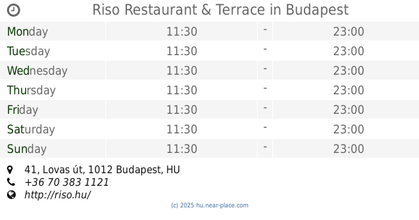
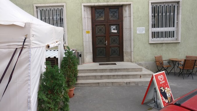
Riso Restaurant & Terrace
Budapest, Lovas út 41
Restaurant
read more
587 m
上海飯店
Budapest, Budapest, 1011, Fő utca
Restaurant
read more
587 m
上海飯店
Budapest, Fő utca 29
Restaurant
read more
590 m
Pavillon de Paris
Budapest, Fő utca 20
Restaurant
read more
611 m
Márványmenyasszony Étterem és Rendezvényház
Budapest, Márvány utca 6
Restaurant
read more
747 m
9 Sárkány Kínai Étterem
Budapest
Restaurant
read more
798 m
Budapest Terrace
Budapest
Restaurant
read more
813 m
Gül baba büfé
Budapest, Batthyány utca 2
Restaurant
read more
835 m
Saigon Vietnamese Restaurant
Budapest, Győri utca 2
Restaurant
read more
875 m
MTI Étkezde
Krisztinaváros
Restaurant
read more
879 m
Marvelosa Restaurant
Budapest, Lánchíd utca 13
Restaurant
read more
916 m
Városfal Vendéglö
Budapest, Bakfark Bálint utca 2
Restaurant
read more
916 m
Vitézfaloda
Budapest, Vitéz utca 14/A
Restaurant
read more
921 m
McDonald's
Budapest, Margit körút 103
Restaurant
read more
935 m
Jóasszony Gyorsétterem.Hu
Budapest, Lövőház utca 2-6
Restaurant
read more
953 m
1201-es ételbolt
Budapest, Böszörményi út 3c
Restaurant
read more
974 m
á Table!
Budapest
Restaurant
read more
981 m
Duran Szendvics Kft.
Budapest, Retek utca 18
Restaurant
read more
1.131 km
Káplár Söröző
Budapest, Szilágyi Erzsébet fasor 1
Restaurant
read more
1.251 km
Aranyszarvas Étterem
Budapest, Szarvas tér 1
Restaurant
read more
📑
all categories
Accounting
Administrative area level 1
Administrative area level 2
Airport
Amusement park
Aquarium
Art gallery
Atm
Bakery
Bank
Bar
Beauty salon
Bicycle store
Book store
Bowling alley
Bus station
Cafe
Campground
Car dealer
Car rental
Car repair
Car wash
Casino
Cemetery
Church
City hall
Clothing store
Colloquial area
Convenience store
Country
Courthouse
Dentist
Department store
Doctor
Electrician
Electronics store
Embassy
Finance
Fire station
Florist
Food
Funeral home
Furniture store
Gas station
General contractor
Grocery or supermarket
Gym
Hair care
Hardware store
Health
Hindu Temple
Home goods store
Hospital
Insurance agency
Intersection
Jewelry store
Laundry
Lawyer
Library
Light rail station
Liquor store
Local government office
Locality
Locksmith
Lodging
Meal delivery
Meal takeaway
Mosque
Movie rental
Movie theater
Moving company
Museum
Natural feature
Neighborhood
Night club
Painter
Park
Parking
Pet store
Pharmacy
Physiotherapist
Place of worship
Plumber
Point of interest
Police
Political
Post office
Premise
Real estate agency
Restaurant
Roofing contractor
Route
Rv park, camping
School
Shoe store
Shopping mall
Spa
Stadium
Storage
Store
Subpremise
Subway station
Supermarket
Synagogue
Taxi stand
Train station
Transit station
Travel agency
University
Veterinary care
Zoo
administrative area level 3
sublocality level 1
↑