Restaurant nearby Agro lángos
Hungary
Restaurant nearby Agro lángos
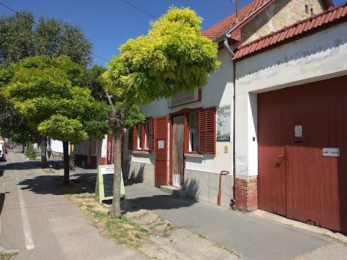
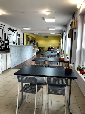
Agro lángos
166, Dorozsmai út, 6791, Szeged, HU Hungary
contacts phone
:
+36
Latitude:
46.2734313
, Longitude:
20.0691515
larger map & directions
read more
nearest Restaurant
279 m
Borostyánkő kisvendéglő
Szeged, Dorozsmai út 183
Restaurant
read more
352 m
Lángos büfé
Szeged, Vadliba utca 3
Restaurant
read more
512 m
Szélmalom Vendéglő
Szeged, Negyvennyolcas út 7
Restaurant
read more
512 m
Szélmalom Vendéglő
Szeged, Negyvennyolcas utca 7
Restaurant
read more
773 m
Vadliba Vendéglő
Szeged, Széchenyi István utca 59
Restaurant
read more
2.648 km
Útkaparó Csárda
Szeged, Bajai út 16
Restaurant
read more
3.271 km
GrillMegálló
Szeged, Fonógyári út 43
Restaurant
read more
3.34 km
Halaszcsarda
Szeged
Restaurant
read more
3.853 km
SZIKI VIGADÓ
Szeged, 4, Vereshomok út
Restaurant
read more
4.188 km
Jobb Mint Otthon Kisvendéglő
Szeged, Napos út 5/b
Restaurant
read more
4.311 km
Zebra Büfé
Szeged, Kálvária sugárút 98
Restaurant
read more
4.729 km
Pizza Monster
Szeged, Vásárhelyi Pál út
Restaurant
read more
4.73 km
Monster Streetfood & Grill
Szeged, Vásárhelyi Pál út 3-5.
Restaurant
read more
4.79 km
Kati vendéglő
Szeged, Rohonci utca 1
Restaurant
read more
4.794 km
Grillgyár
Szeged, Bakay Nándor utca 29
Restaurant
read more
4.811 km
Mami Hami Büfé
Szeged, Vásárhelyi Pál út 1
Restaurant
read more
4.89 km
Les Degesz Tésztaház
Szeged, Rókusi körút 29
Restaurant
read more
5.102 km
Kuriózum Pizzéria
Szeged, Szabadkai út 66
Restaurant
read more
5.104 km
Mix Étterem és pizzeria
Szeged, Szabadkai út 66
Restaurant
read more
5.143 km
Super Hamburger
Szeged, Kálvária tér 20
Restaurant
read more
5.15 km
Hamburger
Szeged, Szabadkai út 7
Restaurant
read more
5.231 km
Hektárlángos
Szeged
Restaurant
read more
5.89 km
Gringos Cantina
Szeged, Petőfi Sándor sugárút 81/a
Restaurant
read more
6.327 km
La Rosa Pizzéria
Szeged, Sárkány utca 2
Restaurant
read more
6.327 km
Imex Antal Kft. Club Bizarre Pizzéria
Szeged, Sárkány utca 2
Restaurant
read more
📑
all categories
Accounting
Administrative area level 1
Administrative area level 2
Airport
Amusement park
Aquarium
Art gallery
Atm
Bakery
Bank
Bar
Beauty salon
Bicycle store
Book store
Bowling alley
Bus station
Cafe
Campground
Car dealer
Car rental
Car repair
Car wash
Casino
Cemetery
Church
City hall
Clothing store
Colloquial area
Convenience store
Country
Courthouse
Dentist
Department store
Doctor
Electrician
Electronics store
Embassy
Finance
Fire station
Florist
Food
Funeral home
Furniture store
Gas station
General contractor
Grocery or supermarket
Gym
Hair care
Hardware store
Health
Hindu Temple
Home goods store
Hospital
Insurance agency
Intersection
Jewelry store
Laundry
Lawyer
Library
Light rail station
Liquor store
Local government office
Locality
Locksmith
Lodging
Meal delivery
Meal takeaway
Mosque
Movie rental
Movie theater
Moving company
Museum
Natural feature
Neighborhood
Night club
Painter
Park
Parking
Pet store
Pharmacy
Physiotherapist
Place of worship
Plumber
Point of interest
Police
Political
Post office
Premise
Real estate agency
Restaurant
Roofing contractor
Route
Rv park, camping
School
Shoe store
Shopping mall
Spa
Stadium
Storage
Store
Subpremise
Subway station
Supermarket
Synagogue
Taxi stand
Train station
Transit station
Travel agency
University
Veterinary care
Zoo
administrative area level 3
sublocality level 1
↑