Parking nearby P + R car parks
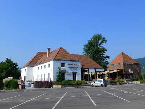
Hungary
Parking nearby P + R car parks
P + R car parks
Leányvár, 2518 Hungary
contacts phone
:
+36
Latitude:
47.6876306
, Longitude:
18.7719265
larger map & directions
read more
nearest Parking
3.721 km
Tesco parkoló
Dorog, Eötvös József utca 39
Parking
read more
4.397 km
parking SZTK
Dorog, Mária út
Parking
read more
4.397 km
Sztk parkoló
Dorog, Mária út
Parking
read more
4.491 km
Zrínyi iskola parkoló
Dorog, Kossuth Lajos utca
Parking
read more
5.329 km
Parkoló
Dorog, Esztergomi út 20
Parking
read more
7.252 km
Ostrihom Autohof
Esztergom, 2509, Damjanich utca 10
Parking
read more
7.811 km
Pilisszántó, Zöld turista-ösvény Parking
Budapest, Pilisszántó, Zöld Turista-ösvény
Parking
read more
9.138 km
Fizetős Parkoló
Pilisszentkereszt, Unnamed Road
Parking
read more
9.279 km
Máriahalom - starthely
Gyermely
Parking
read more
10.024 km
Fizető parkoló
Pilisszentkereszt
Parking
read more
11.783 km
Erzsébet mélygarázs
Esztergom, Kossuth Lajos utca 18
Parking
read more
11.879 km
Jági tanösvény Parkoló
Pilisszentiván
Parking
read more
12.65 km
Parkoló
Esztergom, Iskola utca
Parking
read more
12.752 km
Parkolás
Esztergom, Szent István tér
Parking
read more
12.752 km
Nyakas Pince Borszaküzlet, Parkoló
Tök
Parking
read more
12.777 km
Pilisszentiván Príma Parkoló
Pilisszentiván, Szabadság út 91-93
Parking
read more
13.66 km
Dömös parking
Dömös
Parking
read more
13.66 km
Dömös parkoló
Dömös
Parking
read more
16.008 km
Háziréti tó parkoló
Pilisvörösvár, Ürgemalom dűlő
Parking
read more
16.76 km
P+R PARKOLÓ
Solymár, Vasút utca 1
Parking
read more
17.275 km
Parkolohely a hegyestetői Julianus kilatohoz
Nagymaros, Diófa utca 97
Parking
read more
18.012 km
Visegrád, Royal Club, Parkoló
Parking
read more
18.36 km
Parking bezpłatny
Visegrád, Unnamed Road
Parking
read more
18.744 km
Parkoló
Visegrád, 11
Parking
read more
18.761 km
Buszparkoló
Visegrád, 11
Parking
read more
📑
all categories
Accounting
Administrative area level 1
Administrative area level 2
Airport
Amusement park
Aquarium
Art gallery
Atm
Bakery
Bank
Bar
Beauty salon
Bicycle store
Book store
Bowling alley
Bus station
Cafe
Campground
Car dealer
Car rental
Car repair
Car wash
Casino
Cemetery
Church
City hall
Clothing store
Colloquial area
Convenience store
Country
Courthouse
Dentist
Department store
Doctor
Electrician
Electronics store
Embassy
Finance
Fire station
Florist
Food
Funeral home
Furniture store
Gas station
General contractor
Grocery or supermarket
Gym
Hair care
Hardware store
Health
Hindu Temple
Home goods store
Hospital
Insurance agency
Intersection
Jewelry store
Laundry
Lawyer
Library
Light rail station
Liquor store
Local government office
Locality
Locksmith
Lodging
Meal delivery
Meal takeaway
Mosque
Movie rental
Movie theater
Moving company
Museum
Natural feature
Neighborhood
Night club
Painter
Park
Parking
Pet store
Pharmacy
Physiotherapist
Place of worship
Plumber
Point of interest
Police
Political
Post office
Premise
Real estate agency
Restaurant
Roofing contractor
Route
Rv park, camping
School
Shoe store
Shopping mall
Spa
Stadium
Storage
Store
Subpremise
Subway station
Supermarket
Synagogue
Taxi stand
Train station
Transit station
Travel agency
University
Veterinary care
Zoo
administrative area level 3
sublocality level 1
↑