Park nearby THSE-SASHALOM focipálya
Hungary
Park nearby THSE-SASHALOM focipálya
THSE-SASHALOM focipálya
Budapest, Őrmester utca, 1163 Magyarország
contacts phone
:
+36
Latitude:
47.5107131
, Longitude:
19.1599327
larger map & directions
read more
nearest Park
717 m
Havashalmi Futo Park Budapest, Hungary, 1163
Budapest, Karát utca 4
Park
read more
791 m
Sashalom City Center
Budapest, Karát utca 6-14
Park
read more
791 m
Sashalom Városközpont
Budapest, Karát utca 6-14
Park
read more
913 m
Reformátorok Tere
Budapest, Sashalom utca 6
Park
read more
920 m
Reformációs Park
Budapest, Homokdomb utca
Park
read more
1.107 km
Trianon Emlékhely
Budapest, József utca 1
Park
read more
1.359 km
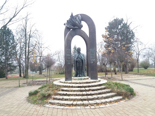
Hősi emlékmű
Budapest, Álmos vezér tere 1
Park
read more
1.4 km
Gépmadár tornapark
Budapest, Gépmadár utca 15
Park
read more
1.4 km
Kondipark
Budapest, Felsőrákos
Park
read more
1.41 km
Heroes' Square
Budapest, Hősök tere 6
Park
read more
1.41 km
Hősök tere
Budapest, Hősök tere 6
Park
read more
1.48 km
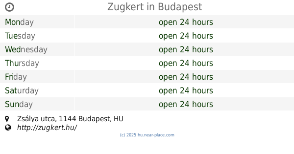
Zugkert
Budapest, Zsálya utca
Park
read more
1.488 km
Kutyafuttato A New Garden Mögött
Budapest, Ond vezér útja 7
Park
read more
1.535 km
Pálffy tér
Budapeszt
Park
read more
1.535 km
Pálffy tér
Budapest
Park
read more
1.706 km
City Green - Plant Care A-Z
Budapest, Bonyhádi út 102a
Park
read more
1.706 km
CityGreen - Növénygondozás A-tól Z-ig
Budapest, Bonyhádi út 102a
Park
read more
1.947 km
Kutyafuttató - Örs vezér tere
Budapest, Örs vezér tere 11
Park
read more
2.025 km
Terebesi erdő
Budapest
Park
read more
2.721 km
Wass Albert tér
XIV. kerület
Park
read more
2.903 km
T-TAKÁCS, Ltd.
Budapest, Maglódi út 12b
Park
read more
2.924 km
Egressy tér
Budapest
Park
read more
3.24 km
Rottenbiller park
Budapest, Rottenbiller park
Park
read more
3.24 km
Hermina Sports and Leisure Park
Budapest, Hermina út
Park
read more
3.382 km
Magyar Oltár
Budapest
Park
read more
📑
all categories
Accounting
Administrative area level 1
Administrative area level 2
Airport
Amusement park
Aquarium
Art gallery
Atm
Bakery
Bank
Bar
Beauty salon
Bicycle store
Book store
Bowling alley
Bus station
Cafe
Campground
Car dealer
Car rental
Car repair
Car wash
Casino
Cemetery
Church
City hall
Clothing store
Colloquial area
Convenience store
Country
Courthouse
Dentist
Department store
Doctor
Electrician
Electronics store
Embassy
Finance
Fire station
Florist
Food
Funeral home
Furniture store
Gas station
General contractor
Grocery or supermarket
Gym
Hair care
Hardware store
Health
Hindu Temple
Home goods store
Hospital
Insurance agency
Intersection
Jewelry store
Laundry
Lawyer
Library
Light rail station
Liquor store
Local government office
Locality
Locksmith
Lodging
Meal delivery
Meal takeaway
Mosque
Movie rental
Movie theater
Moving company
Museum
Natural feature
Neighborhood
Night club
Painter
Park
Parking
Pet store
Pharmacy
Physiotherapist
Place of worship
Plumber
Point of interest
Police
Political
Post office
Premise
Real estate agency
Restaurant
Roofing contractor
Route
Rv park, camping
School
Shoe store
Shopping mall
Spa
Stadium
Storage
Store
Subpremise
Subway station
Supermarket
Synagogue
Taxi stand
Train station
Transit station
Travel agency
University
Veterinary care
Zoo
administrative area level 3
sublocality level 1
↑