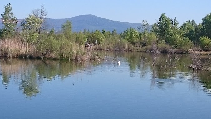
Park nearby Tahitótfalui focipálya
Hungary
Park nearby Tahitótfalui focipálya
Tahitótfalui focipálya
Tahitótfalu, Bajcsy-Zsilinszky út, 2021 Magyarország
contacts phone
:
+36
Latitude:
47.7507141
, Longitude:
19.0956549
larger map & directions
read more
nearest Park
664 m
Heroes' Monument
Tahitótfalu, Hősök tere 17
Park
read more
664 m
56-os Emlékmű
Tahitótfalu, Hősök tere 17
Park
read more
664 m
Hősök emlékműve
Tahitótfalu, Hősök tere 17
Park
read more
2.692 km
Castrum Cirpi, Római erőd romjai
Dunabogdány
Park
read more
3.165 km
Duna-Ipoly Nemzeti Park
Ócsa, Lőrinc utca 1
Park
read more
3.398 km
Hétvályús Forrás
Tahitótfalu
Park
read more
3.428 km
Váci Ártéri Tanösvény
Vác, Duna-parti ártéri erdő
Park
read more
3.571 km
Sződliget kikötő
Danube
Park
read more
3.789 km
Leányfalui focipálya
Leányfalu
Park
read more
3.863 km
Közpark
Leányfalu
Park
read more
3.906 km
I. világháborús emlékmű
Vác, Március 15. tér 7
Park
read more
4.177 km
Posta park Vác
Vác, Posta park 6
Park
read more
4.496 km
DCM Horgásztó
Vác
Park
read more
4.933 km
GALLO IRON kerti csap, EM kert & kertépítés
Pócsmegyer, Muskotály u. 8.
Park
read more
5.312 km
Első Profikertész Kft.
Göd, Otthon utca 20
Park
read more
5.312 km
First Master Gardener Ltd.
Göd, Otthon utca 20
Park
read more
5.576 km
DDC Sporttelep
Vác
Park
read more
6.23 km
Kapcsolat park
Göd, Kálmán utca 39 2132, Áldás utca 38
Park
read more
6.582 km
Global Garden Kft
Szentendre, Róka utca
Park
read more
7.815 km
Kisforrás park
Szentendre, Kisforrás utca 63
Park
read more
9.671 km
Spartacus-ösvény
Visegrád
Park
read more
10.498 km
Köztársaság téri park
Kismaros, Dózsa György út 2
Park
read more
13.039 km
Atilla szobor
Dunakeszi, Attila utca
Park
read more
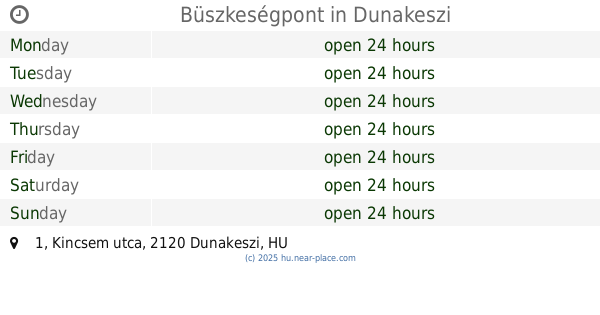
14.053 km
Büszkeségpont
Dunakeszi, Kincsem utca 1
Park
read more
14.187 km
Csomádi focipálya
Csomád
Park
read more
📑
all categories
Accounting
Administrative area level 1
Administrative area level 2
Airport
Amusement park
Aquarium
Art gallery
Atm
Bakery
Bank
Bar
Beauty salon
Bicycle store
Book store
Bowling alley
Bus station
Cafe
Campground
Car dealer
Car rental
Car repair
Car wash
Casino
Cemetery
Church
City hall
Clothing store
Colloquial area
Convenience store
Country
Courthouse
Dentist
Department store
Doctor
Electrician
Electronics store
Embassy
Finance
Fire station
Florist
Food
Funeral home
Furniture store
Gas station
General contractor
Grocery or supermarket
Gym
Hair care
Hardware store
Health
Hindu Temple
Home goods store
Hospital
Insurance agency
Intersection
Jewelry store
Laundry
Lawyer
Library
Light rail station
Liquor store
Local government office
Locality
Locksmith
Lodging
Meal delivery
Meal takeaway
Mosque
Movie rental
Movie theater
Moving company
Museum
Natural feature
Neighborhood
Night club
Painter
Park
Parking
Pet store
Pharmacy
Physiotherapist
Place of worship
Plumber
Point of interest
Police
Political
Post office
Premise
Real estate agency
Restaurant
Roofing contractor
Route
Rv park, camping
School
Shoe store
Shopping mall
Spa
Stadium
Storage
Store
Subpremise
Subway station
Supermarket
Synagogue
Taxi stand
Train station
Transit station
Travel agency
University
Veterinary care
Zoo
administrative area level 3
sublocality level 1
↑