Park nearby Lajoskomáromi focipálya
Hungary
Park nearby Lajoskomáromi focipálya
Lajoskomáromi focipálya
Lajoskomárom Hungary
contacts phone
:
+36
Latitude:
46.8351496
, Longitude:
18.3341237
read more
nearest Park
3.269 km
Pusztavár
Szabadhídvég
Park
read more
5.64 km
Felsőnyéki focipálya
Felsőnyék
Park
read more
9.434 km
Dégi focipálya
Dég
Park
read more
10.75 km
Mezőszilasi focipálya
Mezőszilas
Park
read more
11.229 km
Enyingi focipálya
Enying
Park
read more
11.571 km
Hősök tere
Mezőszilas
Park
read more
12.124 km
Petőfi Park
Enying, 8130, Petőfi Sándor utca
Park
read more
12.14 km
Magyarkeszii focipálya
Magyarkeszi
Park
read more
13.78 km
Nagyberényi focipálya
Nagyberény
Park
read more
13.902 km
Ádándi focipálya
Ádánd
Park
read more
15.092 km
Kislángi focipálya
Kisláng
Park
read more
15.45 km
Nagyszokolyi Emlékpark
Nagyszokoly, Deák Ferenc utca 342
Park
read more
17.129 km
Kálozi focipálya
Káloz
Park
read more
22.464 km
Széchenyi István Emlékmű
Siófok, Széchenyi utca 14
Park
read more
22.671 km
Sárvíz-völgye Landscape Protection Area
Sárkeresztúr
Park
read more
22.676 km
Sárvíz-völgye Tájvédelmi körzet
Hungary
Park
read more
22.706 km
Sárbogárdi focipálya
Sárbogárd
Park
read more
22.959 km
Békás-tó/ Csépány-tó
Siófok, Békás-tó/Csépány-tó
Park
read more
22.96 km
Cecei focipálya
Cece
Park
read more
23.509 km
Siófok, Rózsaliget
Siófok, Unnamed Road
Park
read more
25.232 km
Kányai focipálya
Kánya
Park
read more
27.696 km
Széchenyi park
Balatonkenese, 8174
Park
read more
32.279 km
Szoborpark, /Szent Erzsébet park, Öregpark/
Balatonalmádi, Véghely Dezső utca
Park
read more
32.286 km
BSE Sporttelep
Balatonalmádi
Park
read more
32.807 km
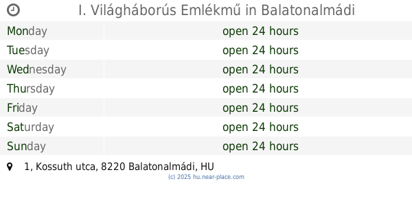
I. Világháborús Emlékmű
Balatonalmádi, Kossuth utca 1
Park
read more
📑
all categories
Accounting
Administrative area level 1
Administrative area level 2
Airport
Amusement park
Aquarium
Art gallery
Atm
Bakery
Bank
Bar
Beauty salon
Bicycle store
Book store
Bowling alley
Bus station
Cafe
Campground
Car dealer
Car rental
Car repair
Car wash
Casino
Cemetery
Church
City hall
Clothing store
Colloquial area
Convenience store
Country
Courthouse
Dentist
Department store
Doctor
Electrician
Electronics store
Embassy
Finance
Fire station
Florist
Food
Funeral home
Furniture store
Gas station
General contractor
Grocery or supermarket
Gym
Hair care
Hardware store
Health
Hindu Temple
Home goods store
Hospital
Insurance agency
Intersection
Jewelry store
Laundry
Lawyer
Library
Light rail station
Liquor store
Local government office
Locality
Locksmith
Lodging
Meal delivery
Meal takeaway
Mosque
Movie rental
Movie theater
Moving company
Museum
Natural feature
Neighborhood
Night club
Painter
Park
Parking
Pet store
Pharmacy
Physiotherapist
Place of worship
Plumber
Point of interest
Police
Political
Post office
Premise
Real estate agency
Restaurant
Roofing contractor
Route
Rv park, camping
School
Shoe store
Shopping mall
Spa
Stadium
Storage
Store
Subpremise
Subway station
Supermarket
Synagogue
Taxi stand
Train station
Transit station
Travel agency
University
Veterinary care
Zoo
administrative area level 3
sublocality level 1
↑