Park nearby Barcika tér
Hungary
Park nearby Barcika tér
Barcika tér
Budapeszt Węgry
contacts phone
:
+36
Latitude:
47.4283083
, Longitude:
19.2281602
read more
nearest Park
Barcika tér
Budapest
Park
read more
789 m
Hét vezér tér
Budapeszt
Park
read more
789 m
Hét vezér tér
Budapest
Park
read more
1.174 km
Kandó tér
Budapest
Park
read more
1.174 km
Kandó tér
Budapeszt
Park
read more
1.409 km
Vilmos Endre Sportcentrum
Budapest
Park
read more
1.463 km
Kertcoop.hu
Vecsés, Széchenyi utca 90
Park
read more
1.579 km
Tátrafüred tér
Budapest
Park
read more
1.68 km
Hargita tér
Budapest, Hargita tér 16
Park
read more
1.721 km
Herrich Károly Square
Budapest
Park
read more
1.721 km
Herrich Károly tér
Budapest
Park
read more
1.91 km
Artasat Emlékmű
Budapest, Szent Imre-kertváros, 1182
Park
read more
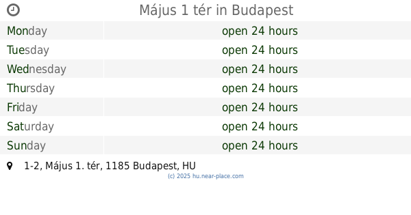
2.043 km
Május 1 tér
Budapest, Május 1. tér 1-2
Park
read more
2.092 km
Landmann Hungária
Vecsés, Almáskert út, 4.
Park
read more
2.373 km
Pöstyén tér
Budapeszt
Park
read more
2.373 km
Pöstyén tér
Budapest
Park
read more
2.621 km
Magyar polgári légiközlekedés áldozazainak emlékkműve
Vecsés
Park
read more
2.783 km
Moka-Garden Kft.
Budapest, Wlassics Gyula utca 154
Park
read more
3.177 km
Dózsa György úti sporttelep
Vecsés
Park
read more
4.053 km
Pestszentlőrinc, Kossuth Lajos tér
Budapest, Kossuth Lajos tér
Park
read more
4.621 km
Kutya Futtató
Budapest
Park
read more
4.625 km
Szantofold
13567/553, 1523 Helyrajzi szám utca
Park
read more
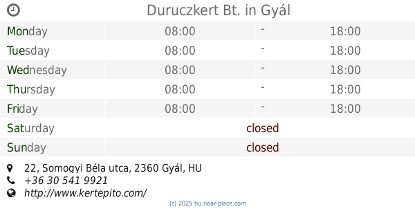
5.005 km
Duruczkert Bt.
Gyál, Somogyi Béla utca 22
Park
read more
5.19 km
SRMaster - "Kulcsrakész" kert
Budapest, Bélavár utca 77
Park
read more
6.735 km
Táj-kertész 84 Kft - Dísznövény Kis- Nagykereskedés - Gazdabolt, Kertépítés, Öntözőrendszerek
Budapest, Pesti út 239
Park
read more
📑
all categories
Accounting
Administrative area level 1
Administrative area level 2
Airport
Amusement park
Aquarium
Art gallery
Atm
Bakery
Bank
Bar
Beauty salon
Bicycle store
Book store
Bowling alley
Bus station
Cafe
Campground
Car dealer
Car rental
Car repair
Car wash
Casino
Cemetery
Church
City hall
Clothing store
Colloquial area
Convenience store
Country
Courthouse
Dentist
Department store
Doctor
Electrician
Electronics store
Embassy
Finance
Fire station
Florist
Food
Funeral home
Furniture store
Gas station
General contractor
Grocery or supermarket
Gym
Hair care
Hardware store
Health
Hindu Temple
Home goods store
Hospital
Insurance agency
Intersection
Jewelry store
Laundry
Lawyer
Library
Light rail station
Liquor store
Local government office
Locality
Locksmith
Lodging
Meal delivery
Meal takeaway
Mosque
Movie rental
Movie theater
Moving company
Museum
Natural feature
Neighborhood
Night club
Painter
Park
Parking
Pet store
Pharmacy
Physiotherapist
Place of worship
Plumber
Point of interest
Police
Political
Post office
Premise
Real estate agency
Restaurant
Roofing contractor
Route
Rv park, camping
School
Shoe store
Shopping mall
Spa
Stadium
Storage
Store
Subpremise
Subway station
Supermarket
Synagogue
Taxi stand
Train station
Transit station
Travel agency
University
Veterinary care
Zoo
administrative area level 3
sublocality level 1
↑