Night club nearby Petőfi Pub
Hungary
Night club nearby Petőfi Pub
Petőfi Pub
22, Arany János utca, 8000, Székesfehérvár, HU Ungarn
contacts phone
:
+36 30 974 5569
Latitude:
47.1892493
, Longitude:
18.4108855
larger map & directions
read more
nearest Night club
28 m
Megyeháza utca
Székesfehérvár, Megyeház utca 23
Night club
read more
263 m
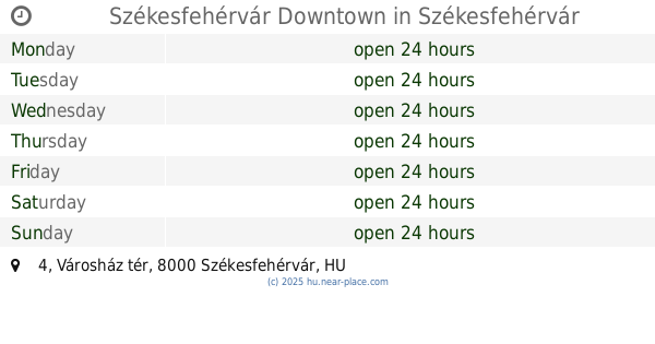
Székesfehérvár Downtown
Székesfehérvár, Városház tér 4
Night club
read more
263 m
Székesfehérvár belváros
Székesfehérvár, Városház tér 4
Night club
read more
299 m
Dodge City
Székesfehérvár, Piac tér 1
Night club
read more
328 m
Goldziher Ignac Emlektabla
Székesfehérvár, Goldziher Ignác köz
Night club
read more
618 m
8-as Műhely
Székesfehérvár, Horvát István utca
Night club
read more
728 m
Zichy Színpad
Székesfehérvár
Night club
read more
728 m
Zichy Stage
Székesfehérvár
Night club
read more
770 m
Paraba
Székesfehérvár, Jancsár köz 4
Night club
read more
788 m
Club Le Baron
Székesfehérvár, Szabadságharcos út 40
Night club
read more
922 m
Lecsó Fesztivàl Székesfehérvàr
Székesfehérvár, Deák Ferenc utca 35
Night club
read more
1.392 km
Prospero Színkör
Székesfehérvár, Fürdősor 3
Night club
read more
1.428 km
icon club
Székesfehérvár, Fürdősor 1
Night club
read more
1.428 km
Ikon Club
Székesfehérvár, Fürdősor 1
Night club
read more
1.448 km
Royal Flush Poker Club
Székesfehérvár, Gyár utca 23
Night club
read more
1.573 km
LaserZone
Székesfehérvár, Hadiárva utca 4
Night club
read more
1.757 km
KINXTOWN
Székesfehérvár, Bregyó köz 4
Night club
read more
1.866 km
Fezen Club
Székesfehérvár, Takarodó út 1
Night club
read more
1.866 km
Fezen Klub
Székesfehérvár, Takarodó út 1
Night club
read more
3.991 km
4. Műszak söröző
Székesfehérvár
Night club
read more
7.128 km
Kutyaszerviz
Szabadbattyán
Night club
read more
8.129 km
Cifra Fishing
Szabadbattyán, Mártírok útja 1
Night club
read more
13.082 km
Faluház Magyaralmás
Magyaralmás, Iskola utca 5
Night club
read more
14.718 km
Agárdi Popstrand
Gárdony, Chernel István utca 1
Night club
read more
16.945 km
The Beach
Fehérvárcsurgó, Hungary
Night club
read more
📑
all categories
Accounting
Administrative area level 1
Administrative area level 2
Airport
Amusement park
Aquarium
Art gallery
Atm
Bakery
Bank
Bar
Beauty salon
Bicycle store
Book store
Bowling alley
Bus station
Cafe
Campground
Car dealer
Car rental
Car repair
Car wash
Casino
Cemetery
Church
City hall
Clothing store
Colloquial area
Convenience store
Country
Courthouse
Dentist
Department store
Doctor
Electrician
Electronics store
Embassy
Finance
Fire station
Florist
Food
Funeral home
Furniture store
Gas station
General contractor
Grocery or supermarket
Gym
Hair care
Hardware store
Health
Hindu Temple
Home goods store
Hospital
Insurance agency
Intersection
Jewelry store
Laundry
Lawyer
Library
Light rail station
Liquor store
Local government office
Locality
Locksmith
Lodging
Meal delivery
Meal takeaway
Mosque
Movie rental
Movie theater
Moving company
Museum
Natural feature
Neighborhood
Night club
Painter
Park
Parking
Pet store
Pharmacy
Physiotherapist
Place of worship
Plumber
Point of interest
Police
Political
Post office
Premise
Real estate agency
Restaurant
Roofing contractor
Route
Rv park, camping
School
Shoe store
Shopping mall
Spa
Stadium
Storage
Store
Subpremise
Subway station
Supermarket
Synagogue
Taxi stand
Train station
Transit station
Travel agency
University
Veterinary care
Zoo
administrative area level 3
sublocality level 1
↑