Lodging nearby Panoráma Nyaraló
Hungary
Lodging nearby Panoráma Nyaraló
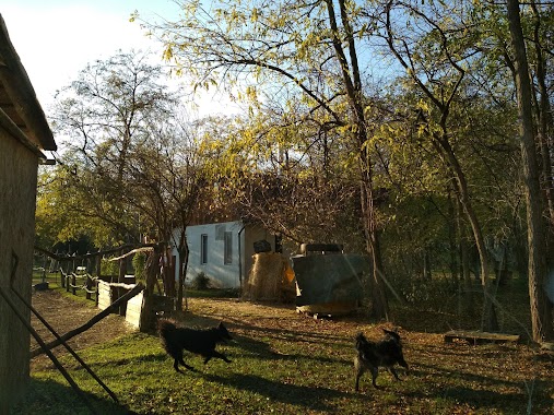
Panoráma Nyaraló
Tahitótfalu, Vöröskő út 68 Magyarország
contacts phone
:
+36
Latitude:
47.746092
, Longitude:
19.073051
read more
nearest Lodging
318 m
Tiny house in a wood-like environment
Tahitótfalu, Kisfaludy utca 20
Lodging
read more
599 m
Dunakanyar Apartment
Tahitótfalu, Erdész utca 12
Lodging
read more
610 m
Baptista Üdülô, Tahi
Tahitótfalu, Ereszvények 52
Lodging
read more
767 m
Danube Camping
Tahitótfalu, Kemping utca 1
Lodging
read more
903 m
Tahiti Vendégpark
Tahitótfalu, Dunasor 10
Lodging
read more
1.138 km
Jeka Lehár
Tahitótfalu, Ifjúság út 3
Lodging
read more
1.219 km
Caravan Vendégház
Tahitótfalu, gát utca 16
Lodging
read more
1.829 km
Ulászló Panzió
Leányfalu, Móricz Zsigmond út 267
Lodging
read more
1.915 km
Retro Wood House
Leányfalu, Csaba utca 35
Lodging
read more
2.034 km
Tahi Református Üdülő
Tahitótfalu
Lodging
read more
2.306 km
Donauknie-Perle Panorama Ferienhaus
Leányfalu, Felsöerdö utca 25
Lodging
read more
2.514 km
Fészek apartmanok
Leányfalu, Hunyadi János utca 1
Lodging
read more
2.921 km
Villa Székely Training House
Leányfalu, Mókus utca 5
Lodging
read more
2.921 km
Székely Villa Tréningház
Leányfalu, Mókus utca 5
Lodging
read more
2.94 km
Igricz Camp
Pócsmegyer
Lodging
read more
2.941 km
Igricz Tanya
Veresegyház, Igric utca 3
Lodging
read more
2.956 km
Leányvirág Vendégház
Leányfalu, Mátyás király utca 66
Lodging
read more
3.039 km
Durst Major
Dunabogdány
Lodging
read more
3.13 km
Fortuna Leányfalu
Leányfalu, Móricz Zsigmond út 169
Lodging
read more
3.893 km
Vadkacsa egyesület
Leányfalu, Petőfi sétány 7
Lodging
read more
5.29 km
Bellevue Vendégház
Vác, B, Eszterházy Károly utca 12
Lodging
read more
5.317 km
Eszterházy Apartman
Vác, Eszterházy Károly utca 3
Lodging
read more
5.384 km
Tabán House
Vác, 11, Dombay utca
Lodging
read more
5.552 km
VATUS Apartmanház Vác
Vác, Kossuth Lajos utca 4
Lodging
read more
5.946 km
Danube embankment Holiday homes
Göd, Jósika utca 14
Lodging
read more
📑
all categories
Accounting
Administrative area level 1
Administrative area level 2
Airport
Amusement park
Aquarium
Art gallery
Atm
Bakery
Bank
Bar
Beauty salon
Bicycle store
Book store
Bowling alley
Bus station
Cafe
Campground
Car dealer
Car rental
Car repair
Car wash
Casino
Cemetery
Church
City hall
Clothing store
Colloquial area
Convenience store
Country
Courthouse
Dentist
Department store
Doctor
Electrician
Electronics store
Embassy
Finance
Fire station
Florist
Food
Funeral home
Furniture store
Gas station
General contractor
Grocery or supermarket
Gym
Hair care
Hardware store
Health
Hindu Temple
Home goods store
Hospital
Insurance agency
Intersection
Jewelry store
Laundry
Lawyer
Library
Light rail station
Liquor store
Local government office
Locality
Locksmith
Lodging
Meal delivery
Meal takeaway
Mosque
Movie rental
Movie theater
Moving company
Museum
Natural feature
Neighborhood
Night club
Painter
Park
Parking
Pet store
Pharmacy
Physiotherapist
Place of worship
Plumber
Point of interest
Police
Political
Post office
Premise
Real estate agency
Restaurant
Roofing contractor
Route
Rv park, camping
School
Shoe store
Shopping mall
Spa
Stadium
Storage
Store
Subpremise
Subway station
Supermarket
Synagogue
Taxi stand
Train station
Transit station
Travel agency
University
Veterinary care
Zoo
administrative area level 3
sublocality level 1
↑