Lodging nearby Gabóca Vendégház
Hungary
Lodging nearby Gabóca Vendégház
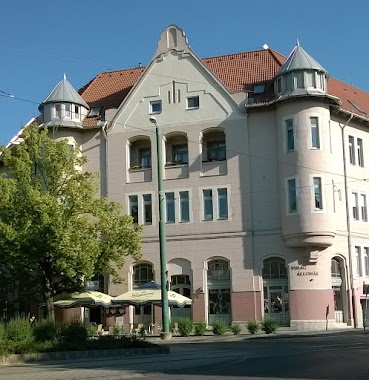
Gabóca Vendégház
Szeged, Veres Ács utca Magyarország
contacts phone
:
+36
Latitude:
46.2492056
, Longitude:
20.1333009
read more
nearest Lodging
73 m
"ZÉ" Apartman
Szeged, 26, Veres Ács utca
Lodging
read more
178 m
Rubint Vendégház
Szeged, Kormányos utca 7
Lodging
read more
292 m
Móra Apartment
Szeged, Móra utca 26. szám 3.e.9.
Lodging
read more
382 m
Vén Diófa Vendégház
Szeged, Petőfi Sándor sugárút 47
Lodging
read more
394 m
Apartman Lux
Szeged, Felhő utca 6
Lodging
read more
408 m
Jázmin Apartman
Szeged, 61 B. I/4., Petőfi Sándor sugárút 55
Lodging
read more
540 m
BOSS Apartman
Szeged, Gyertyámos utca 6
Lodging
read more
554 m
Szamóca Apartman
Szeged, KALVARIA TER 12 III/15.
Lodging
read more
560 m
Best Apartments Szeged
Szeged, Londoni körút 28
Lodging
read more
562 m
Ádám Apartman
Szeged, Zoltán utca 10
Lodging
read more
653 m
Szeged Gyöngye Apartment
Szeged, Alföldi utca 22
Lodging
read more
701 m
OKSZI Vendégház
Szeged, Bécsi körút 24
Lodging
read more
735 m
Kalman House
Szeged, Jósika utca 20
Lodging
read more
793 m
Mentha Apartman Szeged
Szeged, Szentháromság utca 59
Lodging
read more
816 m
Mosoly Apartman
Szeged, Szentháromság utca 38
Lodging
read more
828 m
Babits Apartman
Szeged, Vitéz utca 16
Lodging
read more
829 m
Kata Panzió
Szeged, Bolyai János utca 20
Lodging
read more
831 m
Sun House Apartment
Szeged, Szentháromság utca 23
Lodging
read more
836 m
Astar Stúdió
Szeged, 1/14, Petőfi Sándor sugárút 1/B
Lodging
read more
987 m
Boldog Asszony Apartman
Szeged, Boldogasszony sugárút 13
Lodging
read more
1.028 km
Auris Hotel
Szeged, Boldogasszony sugárút 14
Lodging
read more
1.045 km
Solaris-Szeged Apartman
Szeged, Szivárvány utca 8/B (II/12)
Lodging
read more
1.056 km
Hotel Szavija
Szeged, Boldogasszony sgt. 55.
Lodging
read more
1.076 km
A Vasút A Gyermekekért Alapítvány Diákotthona
Szeged, Boldogasszony sugárút 44
Lodging
read more
1.178 km
Bors Apartman
Szeged, Szent Ferenc utca 8
Lodging
read more
📑
all categories
Accounting
Administrative area level 1
Administrative area level 2
Airport
Amusement park
Aquarium
Art gallery
Atm
Bakery
Bank
Bar
Beauty salon
Bicycle store
Book store
Bowling alley
Bus station
Cafe
Campground
Car dealer
Car rental
Car repair
Car wash
Casino
Cemetery
Church
City hall
Clothing store
Colloquial area
Convenience store
Country
Courthouse
Dentist
Department store
Doctor
Electrician
Electronics store
Embassy
Finance
Fire station
Florist
Food
Funeral home
Furniture store
Gas station
General contractor
Grocery or supermarket
Gym
Hair care
Hardware store
Health
Hindu Temple
Home goods store
Hospital
Insurance agency
Intersection
Jewelry store
Laundry
Lawyer
Library
Light rail station
Liquor store
Local government office
Locality
Locksmith
Lodging
Meal delivery
Meal takeaway
Mosque
Movie rental
Movie theater
Moving company
Museum
Natural feature
Neighborhood
Night club
Painter
Park
Parking
Pet store
Pharmacy
Physiotherapist
Place of worship
Plumber
Point of interest
Police
Political
Post office
Premise
Real estate agency
Restaurant
Roofing contractor
Route
Rv park, camping
School
Shoe store
Shopping mall
Spa
Stadium
Storage
Store
Subpremise
Subway station
Supermarket
Synagogue
Taxi stand
Train station
Transit station
Travel agency
University
Veterinary care
Zoo
administrative area level 3
sublocality level 1
↑