Gas station nearby MOL - Sárkeresztes
Hungary
Gas station nearby MOL - Sárkeresztes
MOL - Sárkeresztes
Sárkeresztes, 81-es főút Hungary
contacts phone
:
+36
Latitude:
47.2548
, Longitude:
18.344101
read more
nearest Gas station
6.679 km
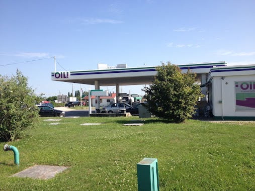
OIL!
Székesfehérvár, Mészáros Lázár utca
Gas station
read more
6.815 km
Envi
Székesfehérvár, Jezsuita u. 1
Gas station
read more
7.966 km
ONE
Fehérvárcsurgó
Gas station
read more
8.076 km
Shell
Székesfehérvár, Palotai út
Gas station
read more
8.384 km
Shell
Székesfehérvár, Olaj utca 1
Gas station
read more
9.115 km
SPAR Express OMV
Székesfehérvár, Budai út 29
Gas station
read more
9.271 km
OMV Töltőállomás
Székesfehérvár, Balatoni út
Gas station
read more
9.902 km
OMV Töltőállomás
Székesfehérvár, Kadocsa út 86
Gas station
read more
10.671 km
SZABI Benzinkút
Székesfehérvár, Seregélyesi út 83
Gas station
read more
10.694 km
MOL Benzinkút
Székesfehérvár, Seregélyesi út 66
Gas station
read more
11.1 km
MOL Benzinkút
Székesfehérvár, Seregélyesi út 113
Gas station
read more
11.263 km
OMV Töltőállomás
Székesfehérvár, Budai út
Gas station
read more
11.351 km
MOL
Székesfehérvár, Balatoni út
Gas station
read more
11.351 km
MOL Benzinkút
Székesfehérvár, Balatoni út
Gas station
read more
11.431 km
MOL Benzinkút
Székesfehérvár, Sárkeresztúri út
Gas station
read more
12.667 km
Greco Petrol
Székesfehérvár, Seregélyesi út 118
Gas station
read more
12.667 km
Petrol Greco
Székesfehérvár, Seregélyesi út 118
Gas station
read more
13.233 km
Shell
Székesfehérvár M7 59 KMSZ
Gas station
read more
13.308 km
Shell
Székesfehérvár, M7 KM59 - Bal Oldal
Gas station
read more
13.344 km
Auchan
Székesfehérvár
Gas station
read more
13.715 km
Pajor Kft.
8151 Szabadbattyán, Emmaróza 70-es út
Gas station
read more
15.569 km
MOL Benzinkút
Várpalota, 8.sz.fkl. út I. (jobb)
Gas station
read more
16.856 km
K&V Töltőállomás
Csákvár, Széchenyi utca 80
Gas station
read more
16.962 km
Mór-Tank Töltőállomás
Mór, 2 Velegi út
Gas station
read more
17.834 km
MOL Benzinkút
Mór, Ipar utca
Gas station
read more
📑
all categories
Accounting
Administrative area level 1
Administrative area level 2
Airport
Amusement park
Aquarium
Art gallery
Atm
Bakery
Bank
Bar
Beauty salon
Bicycle store
Book store
Bowling alley
Bus station
Cafe
Campground
Car dealer
Car rental
Car repair
Car wash
Casino
Cemetery
Church
City hall
Clothing store
Colloquial area
Convenience store
Country
Courthouse
Dentist
Department store
Doctor
Electrician
Electronics store
Embassy
Finance
Fire station
Florist
Food
Funeral home
Furniture store
Gas station
General contractor
Grocery or supermarket
Gym
Hair care
Hardware store
Health
Hindu Temple
Home goods store
Hospital
Insurance agency
Intersection
Jewelry store
Laundry
Lawyer
Library
Light rail station
Liquor store
Local government office
Locality
Locksmith
Lodging
Meal delivery
Meal takeaway
Mosque
Movie rental
Movie theater
Moving company
Museum
Natural feature
Neighborhood
Night club
Painter
Park
Parking
Pet store
Pharmacy
Physiotherapist
Place of worship
Plumber
Point of interest
Police
Political
Post office
Premise
Real estate agency
Restaurant
Roofing contractor
Route
Rv park, camping
School
Shoe store
Shopping mall
Spa
Stadium
Storage
Store
Subpremise
Subway station
Supermarket
Synagogue
Taxi stand
Train station
Transit station
Travel agency
University
Veterinary care
Zoo
administrative area level 3
sublocality level 1
↑