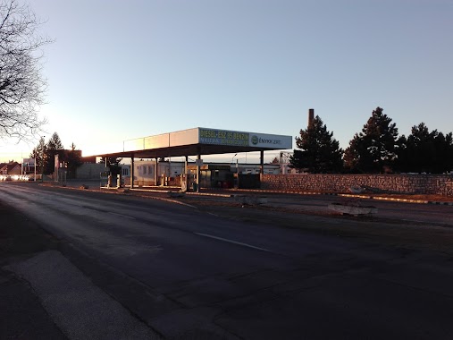
Gas station nearby MOL Benzinkút
Hungary
Gas station nearby MOL Benzinkút
MOL Benzinkút
Nagyvázsony, Templom kert Hungary
contacts phone
:
+36
Latitude:
46.98887
, Longitude:
17.70437
read more
nearest Gas station
9.203 km
Gas Station
Szentantalfa
Gas station
read more
9.204 km
Magán - Szentantalfa
Szentantalfa, Fő utca 96
Gas station
read more
12.698 km
Magán - Balatonfüred
Balatonfüred, Bajcsy-Zsilinszky utca 53
Gas station
read more
13.229 km
Mobil Petrol - Balatonfüred
Balatonfüred, Fürdő utca 20
Gas station
read more
13.232 km
M. Petrol
Balatonfüred, Fürdő utca 20
Gas station
read more
13.281 km
Magán - Balatonfüred
Balatonfüred, Lapostelki utca 3
Gas station
read more
13.284 km
M-Oil
Balatonfüred, Lapostelki utca 15
Gas station
read more
13.934 km
MOL Benzinkút
Balatonfüred, Széchenyi István utca 55
Gas station
read more
14.187 km
Shell
Balatonfüred, Széchenyi tér
Gas station
read more
14.187 km
Shell
Balatonfüred, Széchenyi István utca
Gas station
read more
14.59 km
eni
Szentgál, Hunyadi utca 77
Gas station
read more
17.175 km
OMV Töltőállomás
Ajka, Petőfi Sándor utca
Gas station
read more
17.763 km
MOL Benzinkút
Ajka, Fő út
Gas station
read more
18.053 km
MOL Benzinkút
Veszprém, Pápai út 42
Gas station
read more
18.155 km
Shell
Ajka, Fő út 66
Gas station
read more
18.303 km
Volán benzinkút
Ajka, Hársfa utca 4
Gas station
read more
18.709 km
Magán - Veszprém
Veszprém, Pápai út 30
Gas station
read more
18.744 km
Ènykk Zrt. Benzinkút
Veszprém, Pápai út 30
Gas station
read more
18.761 km
Mobil Petrol
Ajka, Fő út 31
Gas station
read more
18.761 km
Klub Petrol
Ajka, Fő út
Gas station
read more
19.326 km
Bakonytruck Kft
Veszprém, Kistó utca 17
Gas station
read more
19.638 km
AS24
Veszprém, Házgyári út 1
Gas station
read more
20.948 km
MOL
Veszprém, Budapest út 91
Gas station
read more
22.946 km
OMV töltőállomások
Balatonlelle M 7 138. km 7
Gas station
read more
24.135 km
MOL
Devecser, Pápai út 17
Gas station
read more
📑
all categories
Accounting
Administrative area level 1
Administrative area level 2
Airport
Amusement park
Aquarium
Art gallery
Atm
Bakery
Bank
Bar
Beauty salon
Bicycle store
Book store
Bowling alley
Bus station
Cafe
Campground
Car dealer
Car rental
Car repair
Car wash
Casino
Cemetery
Church
City hall
Clothing store
Colloquial area
Convenience store
Country
Courthouse
Dentist
Department store
Doctor
Electrician
Electronics store
Embassy
Finance
Fire station
Florist
Food
Funeral home
Furniture store
Gas station
General contractor
Grocery or supermarket
Gym
Hair care
Hardware store
Health
Hindu Temple
Home goods store
Hospital
Insurance agency
Intersection
Jewelry store
Laundry
Lawyer
Library
Light rail station
Liquor store
Local government office
Locality
Locksmith
Lodging
Meal delivery
Meal takeaway
Mosque
Movie rental
Movie theater
Moving company
Museum
Natural feature
Neighborhood
Night club
Painter
Park
Parking
Pet store
Pharmacy
Physiotherapist
Place of worship
Plumber
Point of interest
Police
Political
Post office
Premise
Real estate agency
Restaurant
Roofing contractor
Route
Rv park, camping
School
Shoe store
Shopping mall
Spa
Stadium
Storage
Store
Subpremise
Subway station
Supermarket
Synagogue
Taxi stand
Train station
Transit station
Travel agency
University
Veterinary care
Zoo
administrative area level 3
sublocality level 1
↑