Gas station nearby MOL Benzinkút
Hungary
Gas station nearby MOL Benzinkút
MOL Benzinkút
Kerepes, Szabadság út Magyarország
contacts phone
:
+36
Latitude:
47.550989
, Longitude:
19.268046
read more
nearest Gas station
210 m
OMV Töltőállomás
Kistarcsa, Szabadság u. 56
Gas station
read more
2.054 km
Auchan gas station
Csömör, Határ út 6
Gas station
read more
2.054 km
Auchan benzinkút
Csömör, Határ út 6
Gas station
read more
3.23 km
AVIA
Nagytarcsa, 3102
Gas station
read more
3.341 km
CNG töltőállomás
Nagytarcsa, Naplás út
Gas station
read more
3.343 km
BGW
Nagytarcsa, Naplás út 1
Gas station
read more
3.343 km
Magán - Nagytarcsa
Nagytarcsa, Naplás út 1
Gas station
read more
3.343 km
BGW CNG Töltőállomás
Nagytarcsa, Naplás út 1
Gas station
read more
3.343 km
BGW Autómosó
Nagytarcsa, Naplás út 1
Gas station
read more
3.358 km
BGW Autómosó
Nagytarcsa
Gas station
read more
3.359 km
MOL
Budapest, Szabadföld út 73
Gas station
read more
3.383 km
MOL Benzinkút
Budapest, Szabadföld út 81
Gas station
read more
3.93 km
Magán - Csömör
Csömör, Major u. 0182/11 hrsz.
Gas station
read more
4.121 km
Mogyoród MOL
Mogyoród
Gas station
read more
4.121 km
MOL
Mogyoród
Gas station
read more
4.122 km
MOL Benzinkút
Mogyoród, Hungaroring
Gas station
read more
4.404 km
Magán - Budapest - Vidámvásár
Budapest, Vidámvásár utca 143
Gas station
read more
4.731 km
Kézi Autómosó
Csömör, Csöbör utca 20
Gas station
read more
4.993 km
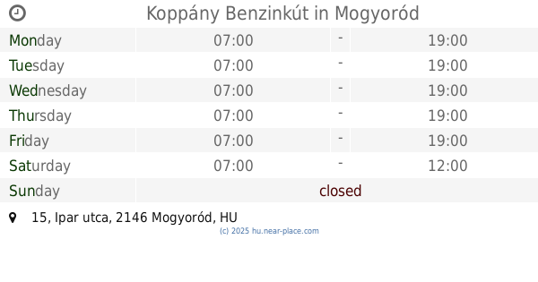
Koppány Benzinkút
Mogyoród, Ipar utca 15
Gas station
read more
5.483 km
OMV Töltőállomás
Budapest, Szabadföldi u. 1
Gas station
read more
6.378 km
Mobil Petrol
Gödöllő, Pattantyús Ábrahám körút 4
Gas station
read more
13.697 km
OIL!
Maglód, 2234, Liszt Ferenc utca 6
Gas station
read more
13.888 km
Shell
Budapest, Béke utca 58
Gas station
read more
14.288 km
OMV
Budapest, Váci út 16-18
Gas station
read more
17.919 km
Mobil Petrol - Bag
Bag, M3 autópálya 39. km lehajtó (Ipari Park)
Gas station
read more
📑
all categories
Accounting
Administrative area level 1
Administrative area level 2
Airport
Amusement park
Aquarium
Art gallery
Atm
Bakery
Bank
Bar
Beauty salon
Bicycle store
Book store
Bowling alley
Bus station
Cafe
Campground
Car dealer
Car rental
Car repair
Car wash
Casino
Cemetery
Church
City hall
Clothing store
Colloquial area
Convenience store
Country
Courthouse
Dentist
Department store
Doctor
Electrician
Electronics store
Embassy
Finance
Fire station
Florist
Food
Funeral home
Furniture store
Gas station
General contractor
Grocery or supermarket
Gym
Hair care
Hardware store
Health
Hindu Temple
Home goods store
Hospital
Insurance agency
Intersection
Jewelry store
Laundry
Lawyer
Library
Light rail station
Liquor store
Local government office
Locality
Locksmith
Lodging
Meal delivery
Meal takeaway
Mosque
Movie rental
Movie theater
Moving company
Museum
Natural feature
Neighborhood
Night club
Painter
Park
Parking
Pet store
Pharmacy
Physiotherapist
Place of worship
Plumber
Point of interest
Police
Political
Post office
Premise
Real estate agency
Restaurant
Roofing contractor
Route
Rv park, camping
School
Shoe store
Shopping mall
Spa
Stadium
Storage
Store
Subpremise
Subway station
Supermarket
Synagogue
Taxi stand
Train station
Transit station
Travel agency
University
Veterinary care
Zoo
administrative area level 3
sublocality level 1
↑