Gas station nearby MOL
Hungary
Gas station nearby MOL
MOL
Aszód, Pesti út 3 Magyarország
contacts phone
:
+36
Latitude:
47.64933
, Longitude:
19.4700801
read more
nearest Gas station
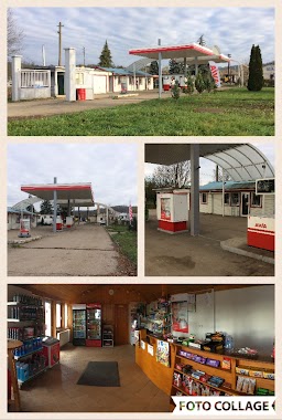
MOL Benzinkút
Aszód, Pesti út 3
Gas station
read more
196 m
Immocom Kft.
Aszód, Galga utca
Gas station
read more
459 m
GYŐRIGÁZ
Aszód, Pesti út 25
Gas station
read more
891 m
Mobil Petrol - Bag
Bag, M3 autópálya 39. km lehajtó (Ipari Park)
Gas station
read more
1.34 km
OMV Töltőállomás
Bag, Dózsa Gy. u. 2
Gas station
read more
1.345 km
Nova Petrol Bt
Bag, Dózsa György út 2
Gas station
read more
1.356 km
M. Petrol
Bag, Sallai utca 6-7
Gas station
read more
2.583 km
AVIA
Aszód, Falujárók útja 44
Gas station
read more
3.953 km
V-Petrol Benzinkút & Shop
Iklad
Gas station
read more
3.954 km
Magán - Iklad
Iklad, Alsómajor 057/59 hrsz.
Gas station
read more
4.541 km
MOL
Kartal, Rákóczi út 1
Gas station
read more
4.541 km
MOL Benzinkút
Kartal, Rákóczi út 1
Gas station
read more
5.654 km
Gohér Kft.
Hévízgyörk, Ady Endre utca 71
Gas station
read more
5.691 km
Magán - Hévízgyörk
Hévízgyörk, Ady Endre utca 71
Gas station
read more
5.692 km
Benzinkút
Hévízgyörk, Deák Ferenc utca 2
Gas station
read more
8.669 km
Benzinkút
Tura, Galgahévízi út 29
Gas station
read more
8.67 km
MOL automata benzinkút 0-24
Tura, Galgahévízi út 29
Gas station
read more
11.752 km
Mol - Hatvan - M3 (Észak)
Hatvan, M3 II. - Észak 2
Gas station
read more
13.1 km
Well-Gas LPG- Autógáz Töltőállomás
Veresegyház, Szadai utca 17/c
Gas station
read more
13.337 km
MOL Benzinkút
Hatvan, Rákóczi út 101
Gas station
read more
13.991 km
Lukoil
Gödöllő, Jakabpusztai pihenő
Gas station
read more
14.708 km
Sipos Car Benzinkút
Hatvan, Bercsényi út 76
Gas station
read more
14.726 km
Bomix Benzinkút
Zsámbok
Gas station
read more
14.798 km
MOL Benzinkút
Isaszeg, Rákóczi u. hrsz. 455
Gas station
read more
16.904 km
MOL Benzinkút
Lőrinci, 21.sz. fkl. út
Gas station
read more
📑
all categories
Accounting
Administrative area level 1
Administrative area level 2
Airport
Amusement park
Aquarium
Art gallery
Atm
Bakery
Bank
Bar
Beauty salon
Bicycle store
Book store
Bowling alley
Bus station
Cafe
Campground
Car dealer
Car rental
Car repair
Car wash
Casino
Cemetery
Church
City hall
Clothing store
Colloquial area
Convenience store
Country
Courthouse
Dentist
Department store
Doctor
Electrician
Electronics store
Embassy
Finance
Fire station
Florist
Food
Funeral home
Furniture store
Gas station
General contractor
Grocery or supermarket
Gym
Hair care
Hardware store
Health
Hindu Temple
Home goods store
Hospital
Insurance agency
Intersection
Jewelry store
Laundry
Lawyer
Library
Light rail station
Liquor store
Local government office
Locality
Locksmith
Lodging
Meal delivery
Meal takeaway
Mosque
Movie rental
Movie theater
Moving company
Museum
Natural feature
Neighborhood
Night club
Painter
Park
Parking
Pet store
Pharmacy
Physiotherapist
Place of worship
Plumber
Point of interest
Police
Political
Post office
Premise
Real estate agency
Restaurant
Roofing contractor
Route
Rv park, camping
School
Shoe store
Shopping mall
Spa
Stadium
Storage
Store
Subpremise
Subway station
Supermarket
Synagogue
Taxi stand
Train station
Transit station
Travel agency
University
Veterinary care
Zoo
administrative area level 3
sublocality level 1
↑