Gas station nearby Magán - Nagycserkesz
Hungary
Gas station nearby Magán - Nagycserkesz
Magán - Nagycserkesz
Nagycserkesz, Vasvári Pál utca 102 Hungary
contacts phone
:
+36
Latitude:
47.9622259
, Longitude:
21.5532139
read more
nearest Gas station
7 m
CserkeszKút
Nagycserkesz, Vasvári Pál utca 102/6
Gas station
read more
6.757 km
Mobil Petrol
Kálmánháza, M3, Kálmánházi pihenő
Gas station
read more
6.905 km
Mobil Petrol
Kálmánháza
Gas station
read more
9.869 km
OMV
Nyíregyháza, Tiszavasvári út
Gas station
read more
11.239 km
Shell
Nyíregyháza, Mező utca 28-40
Gas station
read more
11.24 km
Shell
Nyíregyháza, Orosi út 22
Gas station
read more
11.29 km
MOL Benzinkút
Nyíregyháza, Vasgyár utca 18
Gas station
read more
11.363 km
MOL Benzinkút
Nyíregyháza, Széna tér
Gas station
read more
12.258 km
Nemzeti Közművek
Nyíregyháza, Nagy Imre tér 1
Gas station
read more
12.644 km
OMV Töltőállomás
Nyíregyháza, Debreceni út 99
Gas station
read more
12.644 km
OMV
Nyíregyháza, Debreceni út 99
Gas station
read more
12.769 km
Shell
Nyíregyháza, Korányi Frigyes utca 14
Gas station
read more
12.836 km
MOL Benzinkút
Nyíregyháza, László utca
Gas station
read more
12.884 km
MOL Benzinkút
Nyíregyháza, Pazonyi út
Gas station
read more
12.937 km
omw
Nyíregyháza, Kert utca 45
Gas station
read more
12.942 km
OMV Töltőállomás
Nyíregyháza, Kert utca 47
Gas station
read more
13.048 km
LPG
Nyíregyháza, Jég utca 4
Gas station
read more
13.15 km
Benzinkút
Tiszavasvári, Nánási út 2
Gas station
read more
13.601 km
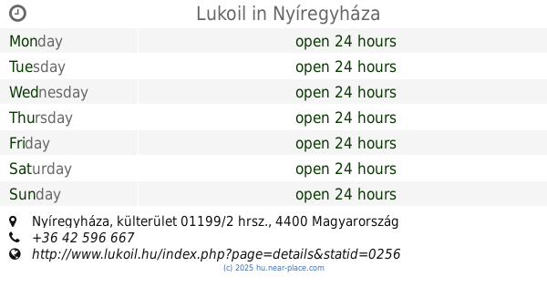
Lukoil
Nyíregyháza, külterület 01199/2 hrsz.
Gas station
read more
13.764 km
Shell
Nyíregyháza, Pazonyi út 36
Gas station
read more
13.908 km
MOL Benzinkút
Nyíregyháza, Kállói út 71
Gas station
read more
14.383 km
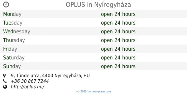
OPLUS
Nyíregyháza, Tünde utca 9
Gas station
read more
14.815 km
Magán - Nyíregyháza
Nyíregyháza, Kemecsei út 26
Gas station
read more
14.822 km
Sóstó Petrol
Nyíregyháza-Sóstófürdő, Kemecsei út 26
Gas station
read more
18.422 km
MOL Benzinkút
Újfehértó, Nyíregyházi utca 108
Gas station
read more
📑
all categories
Accounting
Administrative area level 1
Administrative area level 2
Airport
Amusement park
Aquarium
Art gallery
Atm
Bakery
Bank
Bar
Beauty salon
Bicycle store
Book store
Bowling alley
Bus station
Cafe
Campground
Car dealer
Car rental
Car repair
Car wash
Casino
Cemetery
Church
City hall
Clothing store
Colloquial area
Convenience store
Country
Courthouse
Dentist
Department store
Doctor
Electrician
Electronics store
Embassy
Finance
Fire station
Florist
Food
Funeral home
Furniture store
Gas station
General contractor
Grocery or supermarket
Gym
Hair care
Hardware store
Health
Hindu Temple
Home goods store
Hospital
Insurance agency
Intersection
Jewelry store
Laundry
Lawyer
Library
Light rail station
Liquor store
Local government office
Locality
Locksmith
Lodging
Meal delivery
Meal takeaway
Mosque
Movie rental
Movie theater
Moving company
Museum
Natural feature
Neighborhood
Night club
Painter
Park
Parking
Pet store
Pharmacy
Physiotherapist
Place of worship
Plumber
Point of interest
Police
Political
Post office
Premise
Real estate agency
Restaurant
Roofing contractor
Route
Rv park, camping
School
Shoe store
Shopping mall
Spa
Stadium
Storage
Store
Subpremise
Subway station
Supermarket
Synagogue
Taxi stand
Train station
Transit station
Travel agency
University
Veterinary care
Zoo
administrative area level 3
sublocality level 1
↑