Gas station nearby Lukoil
Hungary
Gas station nearby Lukoil
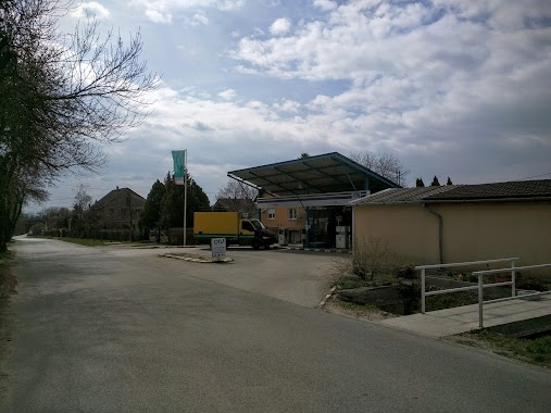
Lukoil
237g, Pesti út, 1173, Budapest, HU Hungary
contacts phone
:
+36 1 253 8351
website:
www.lukoil.hu
Latitude:
47.4732333
, Longitude:
19.2734399
larger map & directions
read more
nearest Gas station
530 m
Shell
Budapest, Pesti út 273C
Gas station
read more
2.419 km
Magán - Budapest - Táncsics Mihály u.
Budapest, Táncsics Mihály út 47
Gas station
read more
3.101 km
OMV Töltőállomás
Budapest, Pesti út 16-18
Gas station
read more
3.223 km
MOL Benzinkút
Budapest, Cinkotai út
Gas station
read more
3.393 km
Shell
Budapest, Pesti út 6
Gas station
read more
3.51 km
OMV
Budapest, Rákóczi Ferenc utca 189
Gas station
read more
3.51 km
OMV Töltőállomás
Budapest, Rákóczi Ferenc utca 189
Gas station
read more
3.672 km
MOL Benzinkút
Budapest, Pesti út 5
Gas station
read more
3.692 km
OMV
Budapest, Cinkotai út 51
Gas station
read more
3.692 km
OMV Töltőállomás
Budapest, Cinkotai út 51
Gas station
read more
3.982 km
Lukoil
Budapest, Pesti út 2
Gas station
read more
4.909 km
Auchan Benzinkút
Maglód, Eszterházy János utca
Gas station
read more
5.036 km
MOL Benzinkút
Pécel, Köztársaság tér
Gas station
read more
5.036 km
MOL Gas station
Pécel, Köztársaság tér
Gas station
read more
5.054 km
Benzinkút
Ecser, Zrínyi utca 1
Gas station
read more
5.054 km
Benzinkút
Ecser, 3101 9-27, 2233
Gas station
read more
5.068 km
Agip
Ecser, Zrínyi utca 1
Gas station
read more
5.484 km
Magán - Budapest - Vidámvásár
Budapest, Vidámvásár utca 143
Gas station
read more
6.636 km
OMV Töltőállomás
Budapest, Szabadföldi u. 1
Gas station
read more
6.692 km
OIL!
Maglód, 2234, Liszt Ferenc utca 6
Gas station
read more
7.78 km
Dobro car parking
Vecsés, Új Ecseri út 7
Gas station
read more
9.889 km
Lukoil benzinkút
Üllő, Pesti út
Gas station
read more
12.011 km
OMV Töltőállomás
Budapest, Fogarasi út 56/A
Gas station
read more
15.955 km
Shell
Budapest, Béke utca 58
Gas station
read more
17.797 km
OMV
Budapest, Váci út 16-18
Gas station
read more
📑
all categories
Accounting
Administrative area level 1
Administrative area level 2
Airport
Amusement park
Aquarium
Art gallery
Atm
Bakery
Bank
Bar
Beauty salon
Bicycle store
Book store
Bowling alley
Bus station
Cafe
Campground
Car dealer
Car rental
Car repair
Car wash
Casino
Cemetery
Church
City hall
Clothing store
Colloquial area
Convenience store
Country
Courthouse
Dentist
Department store
Doctor
Electrician
Electronics store
Embassy
Finance
Fire station
Florist
Food
Funeral home
Furniture store
Gas station
General contractor
Grocery or supermarket
Gym
Hair care
Hardware store
Health
Hindu Temple
Home goods store
Hospital
Insurance agency
Intersection
Jewelry store
Laundry
Lawyer
Library
Light rail station
Liquor store
Local government office
Locality
Locksmith
Lodging
Meal delivery
Meal takeaway
Mosque
Movie rental
Movie theater
Moving company
Museum
Natural feature
Neighborhood
Night club
Painter
Park
Parking
Pet store
Pharmacy
Physiotherapist
Place of worship
Plumber
Point of interest
Police
Political
Post office
Premise
Real estate agency
Restaurant
Roofing contractor
Route
Rv park, camping
School
Shoe store
Shopping mall
Spa
Stadium
Storage
Store
Subpremise
Subway station
Supermarket
Synagogue
Taxi stand
Train station
Transit station
Travel agency
University
Veterinary care
Zoo
administrative area level 3
sublocality level 1
↑