Gas station nearby Avia - Hernádkak
Hungary
Gas station nearby Avia - Hernádkak
Avia - Hernádkak
Hernádkak, Széchenyi István utca 1 Magyarország
contacts phone
:
+36
Latitude:
48.0942053
, Longitude:
20.9668817
read more
nearest Gas station
10 m
Benzol Kft.
Hernádkak, Széchenyi István utca 1/A
Gas station
read more
8.399 km
MOL Benzinkút
Felsőzsolca, 3. sz. főút hrsz. 2034/14
Gas station
read more
9.282 km
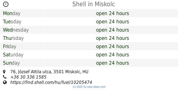
Shell
Miskolc, Fo út 3, Felsozsolcai Korforg
Gas station
read more
9.766 km
Auchan Benzinkút
Miskolc, József Attila utca 87
Gas station
read more
9.988 km
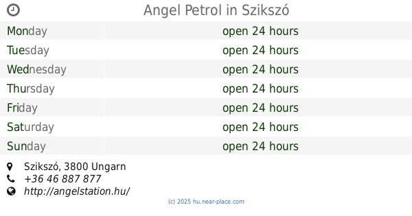
Angel Petrol
Szikszó
Gas station
read more
10.982 km
AVIA
Miskolc, Miskolci út, 0235/72 hrsz.
Gas station
read more
10.994 km
Shell
Miskolc, József Attila utca 76
Gas station
read more
12.973 km
MOL Benzinkút
Miskolc, Király utca 1/A
Gas station
read more
13.184 km
SPAR Express OMV
Miskolc, 16, Búza tér
Gas station
read more
13.184 km
SPAR
Miskolc, 16, Búza tér
Gas station
read more
13.19 km
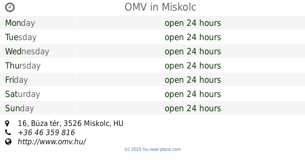
OMV
Miskolc, Búza tér 16
Gas station
read more
13.291 km
MOL Benzinkút
Miskolc, Pesti út II. (kijövő)
Gas station
read more
13.291 km
Mol - Miskolc - Pesti út II
Miskolc, Pesti út II. (kijövő)
Gas station
read more
13.313 km
Luis Garage Kft
Miskolc, Besenyői utca 24,Miskolc, 3527
Gas station
read more
13.451 km
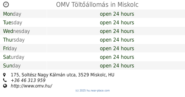
OMV Töltőállomás
Miskolc, Soltész Nagy Kálmán utca 175
Gas station
read more
13.582 km
OMV
Miskolc, Testvérvárosok útja 2/A
Gas station
read more
13.99 km
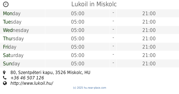
Lukoil
Miskolc, Szentpéteri kapu 80
Gas station
read more
14.108 km
ENVI benzinkút
Miskolc, Mésztelep utca 24
Gas station
read more
14.108 km
Envi
Miskolc, Mésztelep utca 24
Gas station
read more
14.146 km
Shell
Miskolc, Szentpéteri kapu
Gas station
read more
14.737 km
Shell
Miskolc, Vologda utca
Gas station
read more
14.846 km
26-os Út Miskolci Kivezető
Szirmabesenyő
Gas station
read more
15.29 km
NON STOP
Nyékládháza, Kossuth Lajos út
Gas station
read more
15.433 km
Avia
Szirmabesenyő
Gas station
read more
15.619 km
OMV Töltőállomás
Nyékládháza, Viola u 182/1
Gas station
read more
📑
all categories
Accounting
Administrative area level 1
Administrative area level 2
Airport
Amusement park
Aquarium
Art gallery
Atm
Bakery
Bank
Bar
Beauty salon
Bicycle store
Book store
Bowling alley
Bus station
Cafe
Campground
Car dealer
Car rental
Car repair
Car wash
Casino
Cemetery
Church
City hall
Clothing store
Colloquial area
Convenience store
Country
Courthouse
Dentist
Department store
Doctor
Electrician
Electronics store
Embassy
Finance
Fire station
Florist
Food
Funeral home
Furniture store
Gas station
General contractor
Grocery or supermarket
Gym
Hair care
Hardware store
Health
Hindu Temple
Home goods store
Hospital
Insurance agency
Intersection
Jewelry store
Laundry
Lawyer
Library
Light rail station
Liquor store
Local government office
Locality
Locksmith
Lodging
Meal delivery
Meal takeaway
Mosque
Movie rental
Movie theater
Moving company
Museum
Natural feature
Neighborhood
Night club
Painter
Park
Parking
Pet store
Pharmacy
Physiotherapist
Place of worship
Plumber
Point of interest
Police
Political
Post office
Premise
Real estate agency
Restaurant
Roofing contractor
Route
Rv park, camping
School
Shoe store
Shopping mall
Spa
Stadium
Storage
Store
Subpremise
Subway station
Supermarket
Synagogue
Taxi stand
Train station
Transit station
Travel agency
University
Veterinary care
Zoo
administrative area level 3
sublocality level 1
↑