Food nearby Pusztazámori Baromfi Kft.
Hungary
Food nearby Pusztazámori Baromfi Kft.
Pusztazámori Baromfi Kft.
Pusztazámor, Móricz Zsigmond utca 54 Magyarország
contacts phone
:
+36
Latitude:
47.399175
, Longitude:
18.7879308
read more
nearest Food
571 m
Peridot-Line Kft.
Pusztazámor, Móricz Zsigmond utca 1
Food
read more
5.032 km
Buzál-Mórocza Pincészet
Etyek, Eperfás út 18
Food
read more
5.22 km
Hunyadi Hacienda
Tordas, Rizling u. 1820
Food
read more
5.284 km
Fetzer Pince
Etyek, hrsz. 2025
Food
read more
5.417 km
BudaPrés Cider
Etyek, hrsz: 2901
Food
read more
5.444 km
Kálna Pincze
Etyek, GPS: +47° 26' 36.00", +18° 45' 33.42", Sóskúti út
Food
read more
5.475 km
Pécseli Pince
Etyek, Öreghegyi út 48
Food
read more
5.693 km
ANONYM PINCE
Etyek, Öreghegy 2635/3 hrsz
Food
read more
5.951 km
Wéber Pince Etyek
Etyek, Horváth utca 16
Food
read more
6.492 km
Kácsor Kíra Cellar
Etyek, Újhegyi út HRSZ. 4154
Food
read more
6.745 km
Rókusfalvy Birtok
Etyek, Újhegy
Food
read more
8.508 km
Fény és Harmónia Kft.
Érd, Holló utca 12
Food
read more
9.659 km
Gábor-Major Kft.
Martonvásár Gábor major, Gábor major
Food
read more
10.261 km
MEAT-LAND 65 Kft.
Érd, Ercsi út 23km, (Fazekas dűlő)
Food
read more
10.262 km
Meat-Land 65 Kft.
Érd, Fazekas dűlő 24901 hrsz.
Food
read more
10.4 km
Gál-Gazdabolt Kereskedelmi Kft.
Érd, Diósdi út 49/a
Food
read more
10.591 km
Hollósy Birtok
Vál
Food
read more
11.329 km
Tabajdi Pálinkafőzde
Tabajd, Petőfi utca 46
Food
read more
11.591 km
Kalifa Kft.
Páty, Kerekdombi Ut 7.
Food
read more
12.477 km
Hollósy Cukrászda
Budaörs, Ibolya utca 1
Food
read more
12.66 km
Gáborok Háza
Páty
Food
read more
13.26 km
Sania Homebrew
Páty
Food
read more
14.252 km
Chipita Hungary Kft.
Budaörs, Vasút utca 11
Food
read more
15.331 km
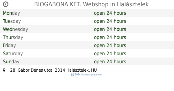
BIOGABONA KFT. Webshop
Halásztelek, Gábor Dénes utca 28
Food
read more
16.149 km
Pázmándi Vizimalom
Pázmánd
Food
read more
📑
all categories
Accounting
Administrative area level 1
Administrative area level 2
Airport
Amusement park
Aquarium
Art gallery
Atm
Bakery
Bank
Bar
Beauty salon
Bicycle store
Book store
Bowling alley
Bus station
Cafe
Campground
Car dealer
Car rental
Car repair
Car wash
Casino
Cemetery
Church
City hall
Clothing store
Colloquial area
Convenience store
Country
Courthouse
Dentist
Department store
Doctor
Electrician
Electronics store
Embassy
Finance
Fire station
Florist
Food
Funeral home
Furniture store
Gas station
General contractor
Grocery or supermarket
Gym
Hair care
Hardware store
Health
Hindu Temple
Home goods store
Hospital
Insurance agency
Intersection
Jewelry store
Laundry
Lawyer
Library
Light rail station
Liquor store
Local government office
Locality
Locksmith
Lodging
Meal delivery
Meal takeaway
Mosque
Movie rental
Movie theater
Moving company
Museum
Natural feature
Neighborhood
Night club
Painter
Park
Parking
Pet store
Pharmacy
Physiotherapist
Place of worship
Plumber
Point of interest
Police
Political
Post office
Premise
Real estate agency
Restaurant
Roofing contractor
Route
Rv park, camping
School
Shoe store
Shopping mall
Spa
Stadium
Storage
Store
Subpremise
Subway station
Supermarket
Synagogue
Taxi stand
Train station
Transit station
Travel agency
University
Veterinary care
Zoo
administrative area level 3
sublocality level 1
↑