Food nearby Olívia Kft.
Hungary
Food nearby Olívia Kft.
Olívia Kft.
Lajosmizse, Mizse tanya 94 Magyarország
contacts phone
:
+36
Latitude:
47.0566721
, Longitude:
19.5273854
read more
nearest Food
1.878 km
Kuning Baromfifeldolgozó Kft.
Felsőlajos, Közös 163
Food
read more
1.886 km
Kuning Kft.
Felsőlajos, Közös 165
Food
read more
2.306 km
Keresztes-Mizse Kft.
Lajosmizse, Közös tanya 3
Food
read more
4.486 km
Kroll és Kroll Kft
Lajosmizse, Vörösmarty utca 41
Food
read more
6.886 km
Sipos Horgásztó
Lajosmizse, Koncsik dűlő
Food
read more
13.479 km
Nagy Gomba Kert Kft
Kecskemét
Food
read more
13.686 km
Szijártó Bt.
Kerekegyháza, Fő utca 44
Food
read more
13.719 km
H.Húsfarm Kft.
Hernád, Gyóni út 11
Food
read more
13.941 km
Auditker- Lamborghini traktor
Kecskemét, Belsőnyír 150
Food
read more
14.077 km
EAgro Kft
Csemő, Szent István út 2
Food
read more
14.119 km
Biotojás Kft
Kerekegyháza
Food
read more
14.927 km
Szijjártó Tojás Kft
Kerekegyháza
Food
read more
15.175 km
Omikron
Kecskemét, Hetény vezér utca 7
Food
read more
15.682 km
Herbro Kft
Hernád, Keltető utca
Food
read more
15.821 km
Univer Konzervüzem
Kecskemét, Hetény-Úrihegy tanya 291
Food
read more
16.104 km
Finomhusi Kft.
Hernád
Food
read more
16.222 km
Primőr Frukt Kft.
Csemő, Ceglédi út 4
Food
read more
17.902 km
NKGY - Nagykőrösi konzervgyár Zrt.
Nagykőrös, József Attila utca 1
Food
read more
18.01 km
Royal Traktor Kecskemét
Kecskemét, Budai utca 137
Food
read more
18.551 km
D-Meat Kft.
Dabas, Tatárszentgyörgyi út 68
Food
read more
20.318 km
Manna ice
Újhartyán, Ipari park
Food
read more
20.504 km
Árpa Bt.
Kunadacs, Dámányadacs tanya
Food
read more
21.202 km
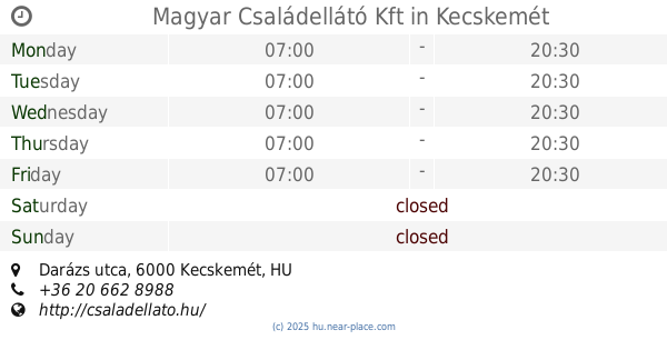
Magyar Családellátó Kft
Kecskemét, 1, Darázs utca
Food
read more
21.815 km
Hetényi Pincészet
Ballószög, Bem utca 13
Food
read more
28.695 km
Csövi Hús Kft.
Cegléd
Food
read more
📑
all categories
Accounting
Administrative area level 1
Administrative area level 2
Airport
Amusement park
Aquarium
Art gallery
Atm
Bakery
Bank
Bar
Beauty salon
Bicycle store
Book store
Bowling alley
Bus station
Cafe
Campground
Car dealer
Car rental
Car repair
Car wash
Casino
Cemetery
Church
City hall
Clothing store
Colloquial area
Convenience store
Country
Courthouse
Dentist
Department store
Doctor
Electrician
Electronics store
Embassy
Finance
Fire station
Florist
Food
Funeral home
Furniture store
Gas station
General contractor
Grocery or supermarket
Gym
Hair care
Hardware store
Health
Hindu Temple
Home goods store
Hospital
Insurance agency
Intersection
Jewelry store
Laundry
Lawyer
Library
Light rail station
Liquor store
Local government office
Locality
Locksmith
Lodging
Meal delivery
Meal takeaway
Mosque
Movie rental
Movie theater
Moving company
Museum
Natural feature
Neighborhood
Night club
Painter
Park
Parking
Pet store
Pharmacy
Physiotherapist
Place of worship
Plumber
Point of interest
Police
Political
Post office
Premise
Real estate agency
Restaurant
Roofing contractor
Route
Rv park, camping
School
Shoe store
Shopping mall
Spa
Stadium
Storage
Store
Subpremise
Subway station
Supermarket
Synagogue
Taxi stand
Train station
Transit station
Travel agency
University
Veterinary care
Zoo
administrative area level 3
sublocality level 1
↑