Food nearby Lukácsy Pince
Hungary
Food nearby Lukácsy Pince
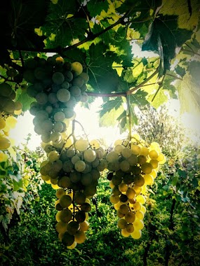
Lukácsy Pince
87, Bajcsy-Zsilinszky utca, 2200, Monor, HU Magyarország
contacts phone
:
+36 30 337 8361
website:
lukacsypince.hu
Latitude:
47.362247
, Longitude:
19.4584051
larger map & directions
read more
nearest Food
43 m
BJ Wine Cellar
Monor
Food
read more
994 m
Schmidt Pince
Monor, burgundi sor
Food
read more
1.084 km
Sárosi pince
Monor, Sárosi pince
Food
read more
1.092 km
Kugel Pince
Monor, Kadarka sor
Food
read more
1.141 km
Bokros-Kovács Pince
Monor, Unnamed Rd,
Food
read more
1.226 km
Monori Pincefalu
Monor, Monori Pincefalu Szent Orbán tér
Food
read more
1.256 km
Szabószázforintos pince
Monor, Mézes Sor
Food
read more
1.278 km
VMSZ Pince
Monor
Food
read more
1.348 km
Duchenka Családi Pince
Monor, Strázsa-hegy, HRSZ10089, Rizling dűlő és Locsodi út kereszteződés
Food
read more
1.426 km
Csillagudvar
Monor, Unnamed Road,
Food
read more
1.648 km
Csuzi Családi Pincészet
Monor, Somogyi Béla utca 29
Food
read more
1.755 km
Első Pesti Malom- és Sütőipari Zrt.
Monor, Péteri utca 1
Food
read more
2.193 km
evedd.hu
Monor, Jókai utca 5
Food
read more
3.484 km
Atlasz Hűtőház
Monor, Ceglédi út 50
Food
read more
3.484 km
ATLAS COLD meat wholesale and retail trade
Monor, Ceglédi út 50
Food
read more
4.565 km
Óhegy Borház
Péteri
Food
read more
4.781 km
Fejér Családi Pince
Péteri
Food
read more
4.817 km
Geér Pince
Péteri
Food
read more
7.406 km
Csiló és Társa Kft. Sertés, Marha vágóhíd és feldolgozó
Csévharaszt
Food
read more
7.737 km
Csikósfarm
Mende
Food
read more
10.601 km
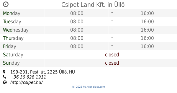
Csipet Land Kft.
Üllő, Pesti út 199-201
Food
read more
12.177 km
Maglód Projekt Kft.
Maglód, Fő utca 12
Food
read more
13.377 km
Pacsi-Hús HÚSÜZEM Kft.
Pánd, Fő út 41
Food
read more
15.564 km
Gastland Kft
Vecsés
Food
read more
17.82 km
Bevilija KFT
Budapest, Strázsahegyi dűlő 7
Food
read more
📑
all categories
Accounting
Administrative area level 1
Administrative area level 2
Airport
Amusement park
Aquarium
Art gallery
Atm
Bakery
Bank
Bar
Beauty salon
Bicycle store
Book store
Bowling alley
Bus station
Cafe
Campground
Car dealer
Car rental
Car repair
Car wash
Casino
Cemetery
Church
City hall
Clothing store
Colloquial area
Convenience store
Country
Courthouse
Dentist
Department store
Doctor
Electrician
Electronics store
Embassy
Finance
Fire station
Florist
Food
Funeral home
Furniture store
Gas station
General contractor
Grocery or supermarket
Gym
Hair care
Hardware store
Health
Hindu Temple
Home goods store
Hospital
Insurance agency
Intersection
Jewelry store
Laundry
Lawyer
Library
Light rail station
Liquor store
Local government office
Locality
Locksmith
Lodging
Meal delivery
Meal takeaway
Mosque
Movie rental
Movie theater
Moving company
Museum
Natural feature
Neighborhood
Night club
Painter
Park
Parking
Pet store
Pharmacy
Physiotherapist
Place of worship
Plumber
Point of interest
Police
Political
Post office
Premise
Real estate agency
Restaurant
Roofing contractor
Route
Rv park, camping
School
Shoe store
Shopping mall
Spa
Stadium
Storage
Store
Subpremise
Subway station
Supermarket
Synagogue
Taxi stand
Train station
Transit station
Travel agency
University
Veterinary care
Zoo
administrative area level 3
sublocality level 1
↑