Food nearby Gelbmann Szőlősbirtok
Hungary
Food nearby Gelbmann Szőlősbirtok
Gelbmann Szőlősbirtok
Süttő, 2543, Bikoli út hrsz Magyarország
contacts phone
:
+36
Latitude:
47.740809
, Longitude:
18.428449
read more
nearest Food
5.24 km
Szöllősi Pincészet Kft.
Neszmély, Kásáshegyalja út 6
Food
read more
5.361 km
Gottwald Borászat-szállás, borászat
Dunaszentmiklós, Belterület hrsz. 504
Food
read more
5.956 km
Kősziklás Borászat Kft.
Dunaszentmiklós, Rákóczi Ferenc utca 15
Food
read more
8.026 km
Kiss János pincészet, Szomód
Szomód, Új-hegy
Food
read more
8.152 km
Simecz Pince
Dunaalmás
Food
read more
8.847 km
Fülöp Pince (palackozó #miegymás)
Nyergesújfalu, Béke tér
Food
read more
10.79 km
Borboléta Pincészet
Baj, Szent András dűlő
Food
read more
11.058 km
Hauzer Pince
Baj, 47.647672,18.376350
Food
read more
11.065 km
Hauzer Pince
47.647672,18.376350
Food
read more
11.308 km
Turay Pincészet
Baj
Food
read more
11.599 km
Harap-lak Ételbár
Baj, Petőfi Sándor utca 12
Food
read more
11.642 km
Rotáció Kft.
Tata, Bacsó Béla utca 39
Food
read more
11.765 km
Depó-Trade '94 Bt - Élelmiszer Nagykereskedés
Baj, Petőfi Sándor utca 2
Food
read more
12.462 km
RecePece sajtos tallér
Tata, Bajcsy-Zsilinszky utca 26
Food
read more
12.667 km
Ruppert-vagy Miklós-malom
Tata, Ady Endre utca
Food
read more
12.811 km
Pötörke-malom Tata
Tata, Tópart utca 9.
Food
read more
14.248 km
Gombos Kertigép Kft
Tata, Arany János utca 8
Food
read more
14.721 km
M.C.I. Kft. - Machine Center International
Vértesszőlős, N47.61182 E18.38460, Bánhidai u. 7.
Food
read more
14.772 km
Servitec Kft.
Tata, Fácános kert 79
Food
read more
14.903 km
Tokodi pincevölgy
Tokod, Nagy Völgy dűlő
Food
read more
19.016 km
Zöld Farm Tech kft
Tarján, Jókai Mór utca 5
Food
read more
23.427 km
Tujafa
Esztergom, Petz testvérek utca 18
Food
read more
25.711 km
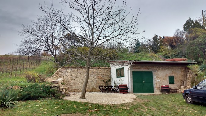
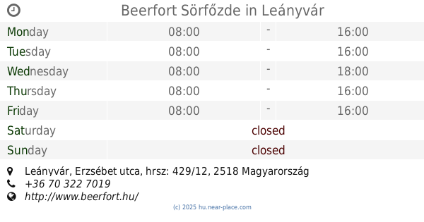
Beerfort Sörfőzde
Leányvár, Erzsébet utca, hrsz: 429/12
Food
read more
29.697 km
KOVÁCS PINCE
Tök, Pincesor 1334/1
Food
read more
30.325 km
Gravetti Kft.
Zsámbék, Petőfi S. u. 108.
Food
read more
📑
all categories
Accounting
Administrative area level 1
Administrative area level 2
Airport
Amusement park
Aquarium
Art gallery
Atm
Bakery
Bank
Bar
Beauty salon
Bicycle store
Book store
Bowling alley
Bus station
Cafe
Campground
Car dealer
Car rental
Car repair
Car wash
Casino
Cemetery
Church
City hall
Clothing store
Colloquial area
Convenience store
Country
Courthouse
Dentist
Department store
Doctor
Electrician
Electronics store
Embassy
Finance
Fire station
Florist
Food
Funeral home
Furniture store
Gas station
General contractor
Grocery or supermarket
Gym
Hair care
Hardware store
Health
Hindu Temple
Home goods store
Hospital
Insurance agency
Intersection
Jewelry store
Laundry
Lawyer
Library
Light rail station
Liquor store
Local government office
Locality
Locksmith
Lodging
Meal delivery
Meal takeaway
Mosque
Movie rental
Movie theater
Moving company
Museum
Natural feature
Neighborhood
Night club
Painter
Park
Parking
Pet store
Pharmacy
Physiotherapist
Place of worship
Plumber
Point of interest
Police
Political
Post office
Premise
Real estate agency
Restaurant
Roofing contractor
Route
Rv park, camping
School
Shoe store
Shopping mall
Spa
Stadium
Storage
Store
Subpremise
Subway station
Supermarket
Synagogue
Taxi stand
Train station
Transit station
Travel agency
University
Veterinary care
Zoo
administrative area level 3
sublocality level 1
↑