Car rental nearby Avis
Hungary
Car rental nearby Avis
Avis
Budapest, BUD Nemzetközi Repülőtér, 2B, 1185 Ungarn
contacts phone
:
+36 1 296 6421
website:
www.avis.hu
Latitude:
47.433825
, Longitude:
19.2621342
larger map & directions
read more
nearest Car rental
Avis Autókölcsönző Budapest repülőtéri iroda - Avis Car Rental BUD airport
Budapest, BUD Nemzetközi Repülőtér, 2B
Car rental
read more
6 m
Europcar
Budapest, Liszt Ferenc Repülőtér
Car rental
read more
6 m
Europcar
Liszt Ferenc Repülőtér
Car rental
read more
51 m
Hertz
Budapest, Ferihegyi Repülőtér
Car rental
read more
114 m
Sixt
Budapest, Liszt Ferenc Terminal 2B
Car rental
read more
114 m
Sixt Rent a Car
Budapest, Liszt Ferenc Terminal 2B
Car rental
read more
198 m
Budget Hungary
Budapest
Car rental
read more
348 m
Sixt
Vecsés, Unnamed Road, 2220
Car rental
read more
348 m
Flughafen Budapest Car Rental Return Sixt
Vecsés, Unnamed Road, 2220
Car rental
read more
2.027 km
Capitol City Rent
Vecsés, Fő út 246
Car rental
read more
2.038 km
GAME Rentacar
Vecsés, Lincoln út 1
Car rental
read more
2.065 km
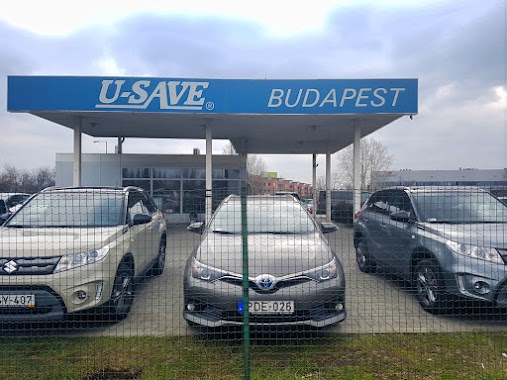
U-Save Autókölcsönző
Vecsés, Fő út 250
Car rental
read more
2.122 km
Autonom
Vecsés, Üllői út 859
Car rental
read more
2.162 km
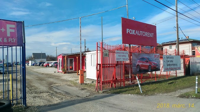
Fox Autorent, Budapest Airport
Budapest, Üllői út 849
Car rental
read more
2.162 km
Fox Auto Rent
Budapest, Üllői út 849
Car rental
read more
2.181 km
Bér-Elek Kft.
Budapest, Üllői út 809/A
Car rental
read more
2.183 km
Klass Wagen
Budapest, Üllői út 822
Car rental
read more
2.183 km
Schiller Rent A Car
Vecsés, Üllői út 822
Car rental
read more
2.183 km
Klass Wagen
Vecsés, Üllői út 822
Car rental
read more
2.187 km
Klass Wagen Rent a Car
Vecsés, Üllői út 822
Car rental
read more
2.202 km
Auto Rent Hungary
Vecsés, Üllői út 847
Car rental
read more
2.202 km
Autorent Hungary
Vecsés, Üllői út 847
Car rental
read more
2.247 km
ACE Rent A Car
Vecsés, Üllői út 829
Car rental
read more
2.247 km
ClickRent Rent a Car
Budapest, Üllői út 829
Car rental
read more
2.495 km
BeeRides
Vecsés, Lőrinci utca 55
Car rental
read more
📑
all categories
Accounting
Administrative area level 1
Administrative area level 2
Airport
Amusement park
Aquarium
Art gallery
Atm
Bakery
Bank
Bar
Beauty salon
Bicycle store
Book store
Bowling alley
Bus station
Cafe
Campground
Car dealer
Car rental
Car repair
Car wash
Casino
Cemetery
Church
City hall
Clothing store
Colloquial area
Convenience store
Country
Courthouse
Dentist
Department store
Doctor
Electrician
Electronics store
Embassy
Finance
Fire station
Florist
Food
Funeral home
Furniture store
Gas station
General contractor
Grocery or supermarket
Gym
Hair care
Hardware store
Health
Hindu Temple
Home goods store
Hospital
Insurance agency
Intersection
Jewelry store
Laundry
Lawyer
Library
Light rail station
Liquor store
Local government office
Locality
Locksmith
Lodging
Meal delivery
Meal takeaway
Mosque
Movie rental
Movie theater
Moving company
Museum
Natural feature
Neighborhood
Night club
Painter
Park
Parking
Pet store
Pharmacy
Physiotherapist
Place of worship
Plumber
Point of interest
Police
Political
Post office
Premise
Real estate agency
Restaurant
Roofing contractor
Route
Rv park, camping
School
Shoe store
Shopping mall
Spa
Stadium
Storage
Store
Subpremise
Subway station
Supermarket
Synagogue
Taxi stand
Train station
Transit station
Travel agency
University
Veterinary care
Zoo
administrative area level 3
sublocality level 1
↑