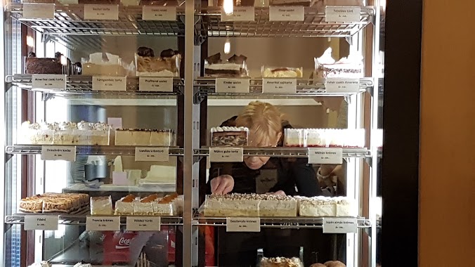
Cafe nearby Terasz
Hungary
Cafe nearby Terasz
Terasz
6, Szent Imre tér, 2120, Dunakeszi, HU Hungría
contacts phone
:
+36
Latitude:
47.6317255
, Longitude:
19.1489432
larger map & directions
read more
nearest Cafe
733 m
Kalitka kávézó
Dunakeszi, Esch Győző utca 1
Cafe
read more
1.041 km
Napsütötte Sütöde
Dunakeszi, Verseny utca 20/b
Cafe
read more
1.4 km
A Kávéház
Dunakeszi, Dózsa György tér
Cafe
read more
1.44 km
rezsarkany presszo
Dunakeszi, Tábor utca 16
Cafe
read more
1.501 km
CSOKIHÁZ
Dunakeszi, Fő út 73
Cafe
read more
1.81 km
Kun Cukrászműhely
Dunakeszi, Fő út 106
Cafe
read more
1.86 km
Caffe Service Kft.
Dunakeszi, Berek utca 19
Cafe
read more
2.61 km
Aniko Büfé
Fót, Rév út 3
Cafe
read more
2.985 km
Ambrosia Cukrászda - tortarendelés, torta házhozszállítás
Fót, Móricz Zsigmond út 96
Cafe
read more
3.582 km
Coffeeshop Company
Dunakeszi, Auchan
Cafe
read more
4.399 km
Melange Coffee & Wine
Budapest, Homoktövis utca 106
Cafe
read more
5.048 km
cafe del zorro
Budapest, Külső Szilágyi út 70
Cafe
read more
5.42 km
Fagyi-zóna
Budapest, 9,, Bőrfestő utca 5
Cafe
read more
6.988 km
Móka Kàvézó
Budapest, Királyok útja 291
Cafe
read more
13.015 km
Smankerli Cukrászda és Kávézó
Budapest, Róna utca 161
Cafe
read more
13.239 km
Dori's lunchroom
Budapest, Viza utca 5
Cafe
read more
13.844 km
Julien Boulangerie et Patisserie
Budapest, Hegedűs Gyula utca 89b
Cafe
read more
15.285 km
The Goat Herder - Espresso Bar
Budapest, István utca 5
Cafe
read more
15.305 km
Kalicka Bisztró
Budapest, 1077, Rottenbiller utca 32
Cafe
read more
15.346 km
BUBU Bubble Tea
Budapest, 1066, Teréz körút 38
Cafe
read more
15.866 km
Meltdown Budapest
Budapest, Zichy Jenő utca 4
Cafe
read more
16.335 km
Isolabella Café
Budapest, Iskola utca 36
Cafe
read more
16.868 km
Lánchíd Söröző
Budapest, Fő utca 4
Cafe
read more
17.096 km
Majorka Kávézó
Budapest, Szilágyi Erzsébet fasor 16
Cafe
read more
17.675 km
Board Game Café
Budapest, Nagyenyed utca 16
Cafe
read more
📑
all categories
Accounting
Administrative area level 1
Administrative area level 2
Airport
Amusement park
Aquarium
Art gallery
Atm
Bakery
Bank
Bar
Beauty salon
Bicycle store
Book store
Bowling alley
Bus station
Cafe
Campground
Car dealer
Car rental
Car repair
Car wash
Casino
Cemetery
Church
City hall
Clothing store
Colloquial area
Convenience store
Country
Courthouse
Dentist
Department store
Doctor
Electrician
Electronics store
Embassy
Finance
Fire station
Florist
Food
Funeral home
Furniture store
Gas station
General contractor
Grocery or supermarket
Gym
Hair care
Hardware store
Health
Hindu Temple
Home goods store
Hospital
Insurance agency
Intersection
Jewelry store
Laundry
Lawyer
Library
Light rail station
Liquor store
Local government office
Locality
Locksmith
Lodging
Meal delivery
Meal takeaway
Mosque
Movie rental
Movie theater
Moving company
Museum
Natural feature
Neighborhood
Night club
Painter
Park
Parking
Pet store
Pharmacy
Physiotherapist
Place of worship
Plumber
Point of interest
Police
Political
Post office
Premise
Real estate agency
Restaurant
Roofing contractor
Route
Rv park, camping
School
Shoe store
Shopping mall
Spa
Stadium
Storage
Store
Subpremise
Subway station
Supermarket
Synagogue
Taxi stand
Train station
Transit station
Travel agency
University
Veterinary care
Zoo
administrative area level 3
sublocality level 1
↑