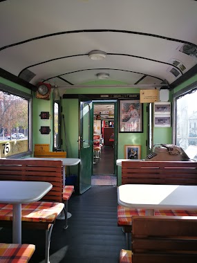
Cafe nearby Korona presszo
Hungary
Cafe nearby Korona presszo
Korona presszo
47-49, Dózsa György út, 5600, Békéscsaba, HU Hungría
contacts phone
:
+36
Latitude:
46.6735244
, Longitude:
21.1024595
larger map & directions
read more
nearest Cafe
746 m
Cafe Frei
Békéscsaba, Andrássy út 4
Cafe
read more
746 m
Cafe Frei Békéscsaba
Békéscsaba, Andrássy út 4
Cafe
read more
790 m
Édes Keserű Csokibolt
Békéscsaba, Andrássy út 7
Cafe
read more
791 m
Artist Cafe Békéscsaba
Békéscsaba, Andrássy út 1-3
Cafe
read more
791 m
Művész Kávéház Békéscsaba
Békéscsaba, Andrássy út 1-3
Cafe
read more
839 m
Cafe One
Békéscsaba, Andrássy út 21
Cafe
read more
920 m
Nikos Cafe & Bar
Békéscsaba, Szent István tér 10
Cafe
read more
984 m
Tiroli Rétesbolt
Békéscsaba, Csaba utca 13
Cafe
read more
987 m
Jankay Kávéház És Étterem Csaba Center
Békéscsaba, Csaba Center, Andrássy út 37-43
Cafe
read more
996 m
Jankay Kávéház és Étterem
Békéscsaba, Andrássy út 37
Cafe
read more
997 m
Coffee Bár
Békéscsaba, Andrássy út 43
Cafe
read more
1000 m
Peron Presszó
Békéscsaba, Gőzmalom tér 101
Cafe
read more
1.084 km
Wake Cup
Békéscsaba, Andrássy út 49
Cafe
read more
1.192 km
Csarnok Bisztró
Békéscsaba
Cafe
read more
3.384 km
Bejó Süteménybolt és cukrászat
Békéscsaba, 5600, Orosházi utca 127
Cafe
read more
11.153 km
Juhász cukrászda és fagyizó"
Békés, Széchenyi tér 6
Cafe
read more
11.171 km
Nagy-féle Cukrászat / Cukrászda
Békés, Kossuth Lajos utca 2
Cafe
read more
12.755 km
Odds Caffé
Gyula, Kétegyházi út 1
Cafe
read more
12.893 km
Kastély Cafe
Doboz, Kossuth Lajos utca
Cafe
read more
13.329 km
Jetty CHOCO
Gyula, Doktor Adler Ignác utca 3
Cafe
read more
13.429 km
Bodoky Kávéműhely
Gyula, Dózsa György utca 45
Cafe
read more
13.434 km
Manuel Caffé
Gyula, Eszperantó tér 3
Cafe
read more
14.176 km
Kastély Kávézó
Óváros Gyula
Cafe
read more
15.769 km
Omnia Kávézó
Kétegyháza, Márki Sándor utca
Cafe
read more
15.785 km
Nosztalgia
Kétegyháza, Gyulai út
Cafe
read more
📑
all categories
Accounting
Administrative area level 1
Administrative area level 2
Airport
Amusement park
Aquarium
Art gallery
Atm
Bakery
Bank
Bar
Beauty salon
Bicycle store
Book store
Bowling alley
Bus station
Cafe
Campground
Car dealer
Car rental
Car repair
Car wash
Casino
Cemetery
Church
City hall
Clothing store
Colloquial area
Convenience store
Country
Courthouse
Dentist
Department store
Doctor
Electrician
Electronics store
Embassy
Finance
Fire station
Florist
Food
Funeral home
Furniture store
Gas station
General contractor
Grocery or supermarket
Gym
Hair care
Hardware store
Health
Hindu Temple
Home goods store
Hospital
Insurance agency
Intersection
Jewelry store
Laundry
Lawyer
Library
Light rail station
Liquor store
Local government office
Locality
Locksmith
Lodging
Meal delivery
Meal takeaway
Mosque
Movie rental
Movie theater
Moving company
Museum
Natural feature
Neighborhood
Night club
Painter
Park
Parking
Pet store
Pharmacy
Physiotherapist
Place of worship
Plumber
Point of interest
Police
Political
Post office
Premise
Real estate agency
Restaurant
Roofing contractor
Route
Rv park, camping
School
Shoe store
Shopping mall
Spa
Stadium
Storage
Store
Subpremise
Subway station
Supermarket
Synagogue
Taxi stand
Train station
Transit station
Travel agency
University
Veterinary care
Zoo
administrative area level 3
sublocality level 1
↑