Cafe nearby Cafe Frei
Hungary
Cafe nearby Cafe Frei
Cafe Frei
Árkád, 1106, Budapest, HU Magyarország
contacts phone
:
+36 1 434 8241
website:
www.cafefrei.hu
Latitude:
47.5030584
, Longitude:
19.1386825
larger map & directions
read more
nearest Cafe
Cafe Frei - Árkád
Budapest, Árkád
Cafe
read more
13 m
Tchibo Árkád
Budapest, Örs vezér tere 25/A
Cafe
read more
21 m
Costa Coffee - Árkád
Budapest, Árkád 3
Cafe
read more
29 m
Coffeeshop Company in Árkád
Budapest, Árkád
Cafe
read more
29 m
Coffeeshop Company
Budapest, Árkád
Cafe
read more
91 m
Hoop Café
Budapest, Árkád
Cafe
read more
133 m
Coffee With Sugar
Budapest, Örs vezér tere 24
Cafe
read more
135 m
CWS Club & Lounge
Budapest, Kerepesi út 90
Cafe
read more
142 m
G2Café
Budapest, Örs vezér tere 25
Cafe
read more
146 m
Nespresso Boutique ÁRKÁD
Budapest, Örs vezér tere 25/a
Cafe
read more
167 m
Starbucks Árkád
Budapest, Árkád, Kerepesi út 61
Cafe
read more
167 m
Starbucks
Budapest, Árkád, Kerepesi út 61
Cafe
read more
198 m
Vízipipa Kávézó
Budapest, 1106, Fehér út 3
Cafe
read more
307 m
Trabant Presszó
Budapest, Kerepesi út 104
Cafe
read more
706 m
Inmedio
Budapest, Rákosfalva park 5
Cafe
read more
741 m
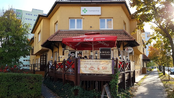
Cserepes kávézó, cukrászda
Budapest, Vezér út 28/b
Cafe
read more
757 m
Cserepes cukrászda, kávézó-büfé
Budapest
Cafe
read more
995 m
Fogarasi Pékség és Cukrászda
Budapest, Fogarasi út 69
Cafe
read more
1.437 km
Füzér kávézó cukrászda
Budapest, 1103, Kőrösi Csoma sétány
Cafe
read more
1.786 km
Multech Kft.
Budapest, Cziráki utca 32
Cafe
read more
2.103 km
Paskál Kávézó
Budapest, Egressy út 178e
Cafe
read more
2.622 km
Deák Ferenc Square
Budapest, Bosnyák tér 7
Cafe
read more
2.622 km
Deák Ferenc tér
Budapest, Bosnyák tér 7
Cafe
read more
2.726 km
Heszperidák Kertje - Cukrászda-Pékség-Fagyizó
Budapest, Rákosi út 98
Cafe
read more
2.981 km
Smankerli Cukrászda és Kávézó
Budapest, Róna utca 161
Cafe
read more
📑
all categories
Accounting
Administrative area level 1
Administrative area level 2
Airport
Amusement park
Aquarium
Art gallery
Atm
Bakery
Bank
Bar
Beauty salon
Bicycle store
Book store
Bowling alley
Bus station
Cafe
Campground
Car dealer
Car rental
Car repair
Car wash
Casino
Cemetery
Church
City hall
Clothing store
Colloquial area
Convenience store
Country
Courthouse
Dentist
Department store
Doctor
Electrician
Electronics store
Embassy
Finance
Fire station
Florist
Food
Funeral home
Furniture store
Gas station
General contractor
Grocery or supermarket
Gym
Hair care
Hardware store
Health
Hindu Temple
Home goods store
Hospital
Insurance agency
Intersection
Jewelry store
Laundry
Lawyer
Library
Light rail station
Liquor store
Local government office
Locality
Locksmith
Lodging
Meal delivery
Meal takeaway
Mosque
Movie rental
Movie theater
Moving company
Museum
Natural feature
Neighborhood
Night club
Painter
Park
Parking
Pet store
Pharmacy
Physiotherapist
Place of worship
Plumber
Point of interest
Police
Political
Post office
Premise
Real estate agency
Restaurant
Roofing contractor
Route
Rv park, camping
School
Shoe store
Shopping mall
Spa
Stadium
Storage
Store
Subpremise
Subway station
Supermarket
Synagogue
Taxi stand
Train station
Transit station
Travel agency
University
Veterinary care
Zoo
administrative area level 3
sublocality level 1
↑