Bar nearby Illés Szekere
Hungary
Bar nearby Illés Szekere
Illés Szekere
Győr, Mónus Illés utca 31 Magyarország
contacts phone
:
+36
Latitude:
47.6716361
, Longitude:
17.6406332
read more
nearest Bar
452 m
Randevú Söröző
Győr, Ikva utca 32
Bar
read more
473 m
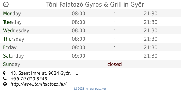
Tóni Falatozó Gyros & Grill
Győr, Szent Imre út 43
Bar
read more
505 m
Arany Ászok Söröző
Győr, Lajta út 9
Bar
read more
529 m
Pannonhalmi Borozó
Győr, Zrínyi utca 06
Bar
read more
567 m
Makk Hetes Borozó
Győr, Herman Ottó utca 8
Bar
read more
625 m
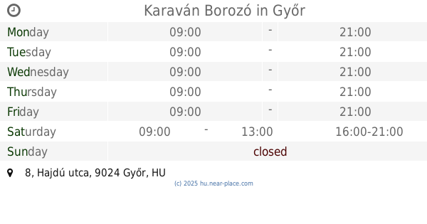
Karaván Borozó
Győr, Hajdú utca 8
Bar
read more
761 m
Sombrero drink Bar
Győr, Doktor Petz Lajos utca
Bar
read more
781 m
Alpesi Söröző
Győr, Déry Tibor utca 3
Bar
read more
849 m
Gondűző Söröző
Győr, Tihanyi Árpád út 68
Bar
read more
887 m
Fehér Holló Söröző
Győr, Tihanyi Árpád út 74
Bar
read more
1.001 km
Rob Roy Whisky Bár
Győr, Tihanyi Árpád út 30
Bar
read more
1.055 km
Torony. Orlando's bar
Győr, Tihanyi Árpád út 23
Bar
read more
1.082 km
Törökverő söröző
Győr, Hunyadi utca 4
Bar
read more
1.084 km
Nyuli Borozó
Győr, Zrínyi utca 6
Bar
read more
1.229 km
Győri Borház - Tokaji Borkereskedés
Győr, Bartók Béla út 1
Bar
read more
1.618 km
A1 Gentleman's Night Club
Győr, Fehérvári út 11
Bar
read more
1.706 km
Pirate Dance Club
Győr, Baross Gábor út 21
Bar
read more
1.708 km
Borka fröccsterasz
Győr, Zechmeister utca
Bar
read more
1.775 km
Conga
Győr, Kisfaludy utca 26
Bar
read more
1.795 km
BarBár - Győr
Győr, Schweidel utca 25
Bar
read more
1.819 km
Elixir Lounge
Győr, Czuzcor G. utca, 6
Bar
read more
1.819 km
HRABAL SÖRÖZŐ
Győr, Czuczor Gergely utca 6
Bar
read more
1.89 km
Éjjeli Műszak Romkocsma
Győr, Liszt Ferenc utca 8
Bar
read more
1.891 km
Tango Bar
Győr, Baross Gábor út 5
Bar
read more
1.945 km
Diána Pub
Győr, Kandó Kálmán utca 4
Bar
read more
📑
all categories
Accounting
Administrative area level 1
Administrative area level 2
Airport
Amusement park
Aquarium
Art gallery
Atm
Bakery
Bank
Bar
Beauty salon
Bicycle store
Book store
Bowling alley
Bus station
Cafe
Campground
Car dealer
Car rental
Car repair
Car wash
Casino
Cemetery
Church
City hall
Clothing store
Colloquial area
Convenience store
Country
Courthouse
Dentist
Department store
Doctor
Electrician
Electronics store
Embassy
Finance
Fire station
Florist
Food
Funeral home
Furniture store
Gas station
General contractor
Grocery or supermarket
Gym
Hair care
Hardware store
Health
Hindu Temple
Home goods store
Hospital
Insurance agency
Intersection
Jewelry store
Laundry
Lawyer
Library
Light rail station
Liquor store
Local government office
Locality
Locksmith
Lodging
Meal delivery
Meal takeaway
Mosque
Movie rental
Movie theater
Moving company
Museum
Natural feature
Neighborhood
Night club
Painter
Park
Parking
Pet store
Pharmacy
Physiotherapist
Place of worship
Plumber
Point of interest
Police
Political
Post office
Premise
Real estate agency
Restaurant
Roofing contractor
Route
Rv park, camping
School
Shoe store
Shopping mall
Spa
Stadium
Storage
Store
Subpremise
Subway station
Supermarket
Synagogue
Taxi stand
Train station
Transit station
Travel agency
University
Veterinary care
Zoo
administrative area level 3
sublocality level 1
↑