Bar nearby Horizont Sörfőzde
Hungary
Bar nearby Horizont Sörfőzde
Horizont Sörfőzde
47, Maglódi út, 1106, Budapest, HU Hungría
contacts phone
:
+36
website:
www.horizontsorok.hu
Latitude:
47.4842365
, Longitude:
19.1564381
larger map & directions
read more
nearest Bar
528 m
Árnyas Söröző
Budapest, Mádi utca 116
Bar
read more
730 m
Dreamland Swingers Club
Budapest, Ungern, Gitár utca 11
Bar
read more
730 m
Swinger Club
Budapest, Ουγγαρία, Gitár utca 11
Bar
read more
836 m
Faház Drinkbár Lottózó
Budapest, Lavotta utca 22
Bar
read more
1.633 km
Kávézó-Söröző
Budapest, Kőrösi Csoma Sándor út 40., fszt. 019.
Bar
read more
1.635 km
Tópressó Bt.
Budapest, Bányató utca 8
Bar
read more
1.644 km
Tó bisztró
Budapest, Bányató utca 12
Bar
read more
1.824 km
Kápolna Pince Borozó
Budapest, Román utca
Bar
read more
1.948 km
Kőbánya felső Resti
Budapest, Albertirsai út 12
Bar
read more
1.98 km
Napközi
Budapest, Állomás utca 20
Bar
read more
1.996 km
Sírkert Büfé
Budapest, Sírkert út 42
Bar
read more
2.178 km
Jubileum Pub
Budapest, Állomás utca 6
Bar
read more
2.418 km
Josefina Blues Bell
Budapest, 1106, Kerepesi út 97
Bar
read more
2.497 km
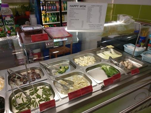
Happy Good Wok Bar / KöKi food court
Budapest, Vak Bottyán utca 75/A-C
Bar
read more
2.503 km
Swan Pub & Brewery
Budapest, Vak Bottyán utca 75
Bar
read more
2.631 km
Reining Söröző
Budapest, Rákosfalva park 5
Bar
read more
2.946 km
Bambusz Kocsma
Budapest, Thököly út 7a
Bar
read more
3.096 km
Tüskés Borozó
Budapest, Sashalmi sétány
Bar
read more
3.145 km
Legenda Sörkert
Budapest, Vezér utca 50
Bar
read more
3.282 km
Állomás Presszó
Budapest, Batsányi János út 2
Bar
read more
3.449 km
Unicum Söröző Pub
Budapest, Fogarasi út
Bar
read more
3.449 km
Unicum Brewery Pub
Budapest, Fogarasi út
Bar
read more
3.514 km
Zugló-Gyöngye Söröző
Budapest, Bagolyvár utca 1/c
Bar
read more
3.525 km
Dreher Bar Oasis
Budapest, Toronyház utca 3
Bar
read more
3.525 km
Dreher Söröző Oazis
Budapest, Toronyház utca 3
Bar
read more
📑
all categories
Accounting
Administrative area level 1
Administrative area level 2
Airport
Amusement park
Aquarium
Art gallery
Atm
Bakery
Bank
Bar
Beauty salon
Bicycle store
Book store
Bowling alley
Bus station
Cafe
Campground
Car dealer
Car rental
Car repair
Car wash
Casino
Cemetery
Church
City hall
Clothing store
Colloquial area
Convenience store
Country
Courthouse
Dentist
Department store
Doctor
Electrician
Electronics store
Embassy
Finance
Fire station
Florist
Food
Funeral home
Furniture store
Gas station
General contractor
Grocery or supermarket
Gym
Hair care
Hardware store
Health
Hindu Temple
Home goods store
Hospital
Insurance agency
Intersection
Jewelry store
Laundry
Lawyer
Library
Light rail station
Liquor store
Local government office
Locality
Locksmith
Lodging
Meal delivery
Meal takeaway
Mosque
Movie rental
Movie theater
Moving company
Museum
Natural feature
Neighborhood
Night club
Painter
Park
Parking
Pet store
Pharmacy
Physiotherapist
Place of worship
Plumber
Point of interest
Police
Political
Post office
Premise
Real estate agency
Restaurant
Roofing contractor
Route
Rv park, camping
School
Shoe store
Shopping mall
Spa
Stadium
Storage
Store
Subpremise
Subway station
Supermarket
Synagogue
Taxi stand
Train station
Transit station
Travel agency
University
Veterinary care
Zoo
administrative area level 3
sublocality level 1
↑