Bar nearby Corner's Pub
Hungary
Bar nearby Corner's Pub
Corner's Pub
Budapest, Rákosi út 114-116 Hungría
contacts phone
:
+36
Latitude:
47.5212227
, Longitude:
19.1673227
read more
nearest Bar
444 m
Borpatika
Budapest, Rákosi út 149
Bar
read more
645 m
Redwood Söröző
Budapest, János utca 106
Bar
read more
657 m
Páfrány Eszpresszó
Budapest, Csömöri út 139
Bar
read more
1.28 km
Tüskés Borozó
Budapest, Sashalmi sétány
Bar
read more
1.433 km
Bambusz Kocsma
Budapest, Thököly út 7a
Bar
read more
1.584 km
Állomás Presszó
Budapest, Batsányi János út 2
Bar
read more
1.725 km
Fekete Lyuk Hangja Bt.
Budapest, Bonyhádi út 141
Bar
read more
1.725 km
Night-bar.com - éjszakai bár, klub, nightclub,inbar
Budapest, Bonyhádi út 141
Bar
read more
1.779 km
Josefina Blues Bell
Budapest, 1106, Kerepesi út 97
Bar
read more
1.965 km
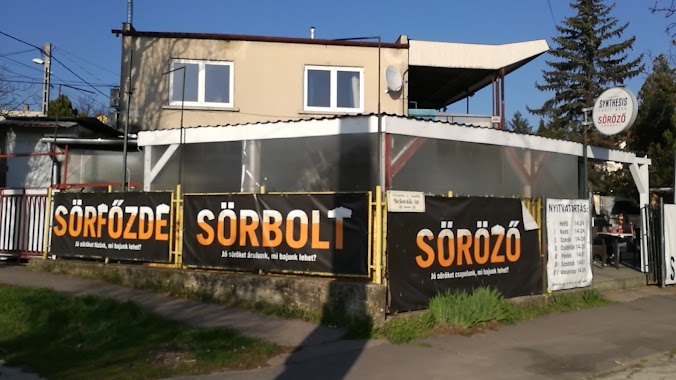
Synthesis Kézműves Söröző, Sörbolt
Budapest, Szlovák út 116
Bar
read more
2.296 km
Legenda Sörkert
Budapest, Vezér utca 50
Bar
read more
2.306 km
Reining Söröző
Budapest, Rákosfalva park 5
Bar
read more
2.318 km
Korondi Borozó
Budapest, Vezér utca 54
Bar
read more
2.385 km
Vezér Borozó
Budapest, Vezér utca 77
Bar
read more
2.561 km
Ámor Söröző
Budapest, Erdőkerülő utca 1
Bar
read more
2.973 km
Club 501
Budapest, Drégelyvár utca 55
Bar
read more
3.058 km
Flakon Sörbár
Budapest, Örs vezér tere 2
Bar
read more
3.09 km
Fruitisimo
Budapest, Örs vezér tere 25/A
Bar
read more
3.196 km
Unicum Söröző Pub
Budapest, Fogarasi út
Bar
read more
3.196 km
Unicum Brewery Pub
Budapest, Fogarasi út
Bar
read more
3.547 km
Üvegház söröző, borozó
Budapest, Apolló utca 31
Bar
read more
3.752 km
Patyolat Kocsma Km
Budapest, Páskomliget utca 35-45
Bar
read more
4.75 km
Borozók
Budapest, Zászlós utca 10
Bar
read more
4.976 km
Félidő
Budapest, Hungária körút 26
Bar
read more
4.978 km
Metró Reklám Kommunikációs Kft.
Budapest, Stefánia út 1
Bar
read more
📑
all categories
Accounting
Administrative area level 1
Administrative area level 2
Airport
Amusement park
Aquarium
Art gallery
Atm
Bakery
Bank
Bar
Beauty salon
Bicycle store
Book store
Bowling alley
Bus station
Cafe
Campground
Car dealer
Car rental
Car repair
Car wash
Casino
Cemetery
Church
City hall
Clothing store
Colloquial area
Convenience store
Country
Courthouse
Dentist
Department store
Doctor
Electrician
Electronics store
Embassy
Finance
Fire station
Florist
Food
Funeral home
Furniture store
Gas station
General contractor
Grocery or supermarket
Gym
Hair care
Hardware store
Health
Hindu Temple
Home goods store
Hospital
Insurance agency
Intersection
Jewelry store
Laundry
Lawyer
Library
Light rail station
Liquor store
Local government office
Locality
Locksmith
Lodging
Meal delivery
Meal takeaway
Mosque
Movie rental
Movie theater
Moving company
Museum
Natural feature
Neighborhood
Night club
Painter
Park
Parking
Pet store
Pharmacy
Physiotherapist
Place of worship
Plumber
Point of interest
Police
Political
Post office
Premise
Real estate agency
Restaurant
Roofing contractor
Route
Rv park, camping
School
Shoe store
Shopping mall
Spa
Stadium
Storage
Store
Subpremise
Subway station
Supermarket
Synagogue
Taxi stand
Train station
Transit station
Travel agency
University
Veterinary care
Zoo
administrative area level 3
sublocality level 1
↑