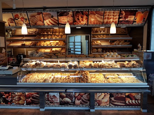
Bakery nearby Riad Pékség
Hungary
Bakery nearby Riad Pékség
Riad Pékség
6, Gyöngyösi sétány, 1138, Budapest, HU Hungría
contacts phone
:
+36
Latitude:
47.550245
, Longitude:
19.0775918
larger map & directions
read more
nearest Bakery
62 m
BCS Cukrászat Kft.
Budapest, Gyöngyösi sétány 12
Bakery
read more
335 m
Fornetti látványpékség
Angyalföld
Bakery
read more
669 m
Lipóti Pékség
Budapest, Gács utca 3
Bakery
read more
944 m
Fiesta Peck-Snack látványpékség
Budapest, Balzsam utca 6
Bakery
read more
1.109 km
Csocsaj bakery
Budapest, Pozsonyi utca
Bakery
read more
1.116 km
Napfényes Cukrászat Kft.
Budapest, Dolmány utca 7
Bakery
read more
1.359 km
Norbi Update Újpest
Budapest, Árpád út 55
Bakery
read more
1.464 km
Princess Fejedelmi Péksütemények
Budapest
Bakery
read more
1.501 km
Fornetti
Budapest, Kassai utca 36
Bakery
read more
1.531 km
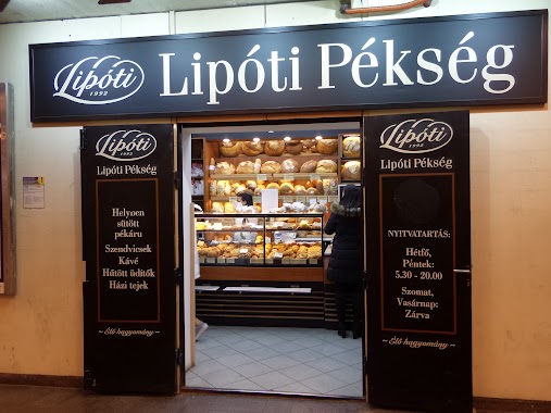
Lipóti Pékség
Újpest
Bakery
read more
1.576 km
Pékáru Vegyes Élelmiszer - Pékáru KKt
Budapest, Szent László út 164
Bakery
read more
1.62 km
San Giusto Cukrászda
Budapest, Váci út 87
Bakery
read more
1.666 km
Hagyományőrző Pékség
Budapest, Virág utca 7
Bakery
read more
1.738 km
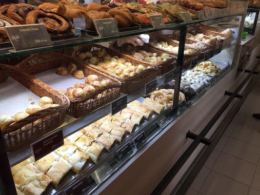
Horváth Confectionery
Budapest, Petőfi utca 35
Bakery
read more
1.738 km
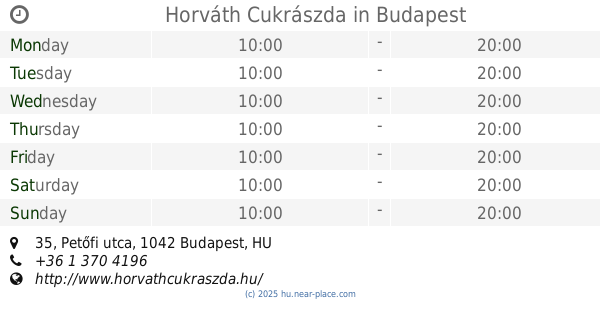
Horváth Cukrászda
Budapest, Petőfi utca 35
Bakery
read more
1.774 km
Sugar!
Újpest
Bakery
read more
1.79 km
Moha & Lédri Pékség
Budapest, 29, Béke utca 21
Bakery
read more
1.819 km
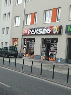
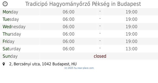
Tradicipó Hagyományőrző Pékség
Budapest, Bercsényi utca 2
Bakery
read more
1.838 km
Cseri Pékség
Budapest, Pap Károly utca 22
Bakery
read more
1.847 km
ADRIA Pékség
Budapest, Deák Ferenc utca 13
Bakery
read more
1.849 km
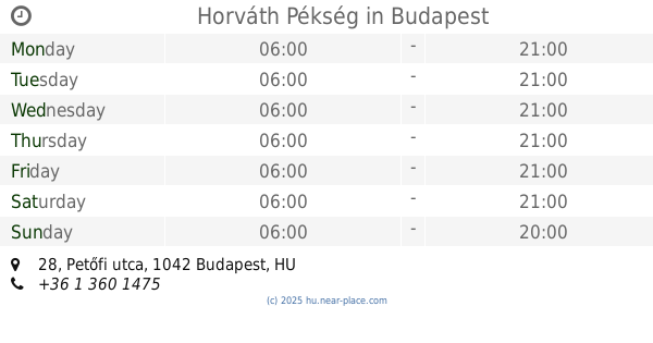
Horváth Pékség
Budapest, Petőfi utca 28
Bakery
read more
2.094 km
Lipóti Bakery
Budapest, Váci út 71
Bakery
read more
2.106 km
Pik Pak Baker
Budapest, aluljáró, Árpád híd
Bakery
read more
2.151 km
Pékség és Gyros
Budapest, Vizafogó sétány 10
Bakery
read more
2.337 km
Sajtos Stangli Kft.
Budapest, Komáromi út 32
Bakery
read more
📑
all categories
Accounting
Administrative area level 1
Administrative area level 2
Airport
Amusement park
Aquarium
Art gallery
Atm
Bakery
Bank
Bar
Beauty salon
Bicycle store
Book store
Bowling alley
Bus station
Cafe
Campground
Car dealer
Car rental
Car repair
Car wash
Casino
Cemetery
Church
City hall
Clothing store
Colloquial area
Convenience store
Country
Courthouse
Dentist
Department store
Doctor
Electrician
Electronics store
Embassy
Finance
Fire station
Florist
Food
Funeral home
Furniture store
Gas station
General contractor
Grocery or supermarket
Gym
Hair care
Hardware store
Health
Hindu Temple
Home goods store
Hospital
Insurance agency
Intersection
Jewelry store
Laundry
Lawyer
Library
Light rail station
Liquor store
Local government office
Locality
Locksmith
Lodging
Meal delivery
Meal takeaway
Mosque
Movie rental
Movie theater
Moving company
Museum
Natural feature
Neighborhood
Night club
Painter
Park
Parking
Pet store
Pharmacy
Physiotherapist
Place of worship
Plumber
Point of interest
Police
Political
Post office
Premise
Real estate agency
Restaurant
Roofing contractor
Route
Rv park, camping
School
Shoe store
Shopping mall
Spa
Stadium
Storage
Store
Subpremise
Subway station
Supermarket
Synagogue
Taxi stand
Train station
Transit station
Travel agency
University
Veterinary care
Zoo
administrative area level 3
sublocality level 1
↑