Bakery nearby Földvári Cukrászda
Hungary
Bakery nearby Földvári Cukrászda
Földvári Cukrászda
Budapest, Bem József utca 24 Magyarország
contacts phone
:
+36
Latitude:
47.511708
, Longitude:
19.034757
read more
nearest Bakery
154 m
Cukormentes Cukrászda
Budapest, Horvát utca 9
Bakery
read more
187 m
fresh Bakery
Budapest, Margit körút 48
Bakery
read more
235 m
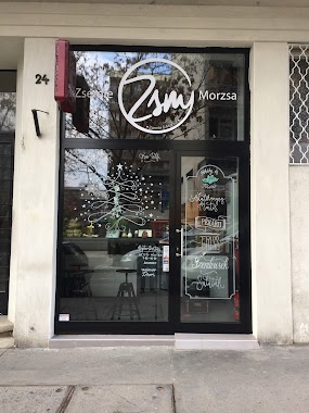
Zsemle&Morzsa
Budapest, Kapás utca 24
Bakery
read more
235 m
Perbáli kenyér
Budapest, Kapás utca 24
Bakery
read more
309 m
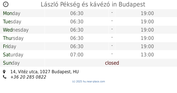
László Pékség és kávézó
Budapest, Vitéz utca 14
Bakery
read more
322 m
Lipóti Pékség
Budapest, Margit körút 59
Bakery
read more
346 m
KéK - Kávé és Kenyér
Budapest, Margit körút 61-63
Bakery
read more
362 m
Marangona Gasztro.Pont
Budapest, Hungary, Bimbó út 2
Bakery
read more
377 m
Josephine Bakery
Budapest, Fényes Elek utca 3
Bakery
read more
542 m
Pillók Cukrászda
Budapest, Batthyány utca 15
Bakery
read more
549 m
Pékműhely
Budapest, Batthyány utca 24
Bakery
read more
585 m
Tortavár cukrászda
Budapest, Keleti Károly utca 25
Bakery
read more
668 m
Princess Bakery & Bistro
Budapest, Batthyány tér 1
Bakery
read more
686 m
Lipóti pékség
Budapest, Batthyány tér
Bakery
read more
703 m
Cupcake Tortaműhely
Budapest, Iskola utca 34
Bakery
read more
722 m
Budai Jégbüfé
Budapest, Fény utca 15
Bakery
read more
741 m
Jókenyér Szaküzlet
Budapest, Lövőház utca 13
Bakery
read more
741 m
Jókenyér Shop
Budapest, Lövőház utca 13
Bakery
read more
781 m
UPDATE Fény
Budapest, Lövőház utca 2
Bakery
read more
793 m
à table!
Budapest, Retek utca 6
Bakery
read more
811 m
Gere Pékség mintabolt
Budapest, Fény utcai piac, Fény utca
Bakery
read more
816 m
Neti Pékség
Budapest, Lövőház utca 22
Bakery
read more
883 m
NOGLU Cukrászda
Budapest, Fény utca 2
Bakery
read more
1.022 km
JM6 Bakery & Café
Budapest, Jászai Mari tér 6
Bakery
read more
1.243 km
Budai Pékség
Budapest, Maros utca 25
Bakery
read more
📑
all categories
Accounting
Administrative area level 1
Administrative area level 2
Airport
Amusement park
Aquarium
Art gallery
Atm
Bakery
Bank
Bar
Beauty salon
Bicycle store
Book store
Bowling alley
Bus station
Cafe
Campground
Car dealer
Car rental
Car repair
Car wash
Casino
Cemetery
Church
City hall
Clothing store
Colloquial area
Convenience store
Country
Courthouse
Dentist
Department store
Doctor
Electrician
Electronics store
Embassy
Finance
Fire station
Florist
Food
Funeral home
Furniture store
Gas station
General contractor
Grocery or supermarket
Gym
Hair care
Hardware store
Health
Hindu Temple
Home goods store
Hospital
Insurance agency
Intersection
Jewelry store
Laundry
Lawyer
Library
Light rail station
Liquor store
Local government office
Locality
Locksmith
Lodging
Meal delivery
Meal takeaway
Mosque
Movie rental
Movie theater
Moving company
Museum
Natural feature
Neighborhood
Night club
Painter
Park
Parking
Pet store
Pharmacy
Physiotherapist
Place of worship
Plumber
Point of interest
Police
Political
Post office
Premise
Real estate agency
Restaurant
Roofing contractor
Route
Rv park, camping
School
Shoe store
Shopping mall
Spa
Stadium
Storage
Store
Subpremise
Subway station
Supermarket
Synagogue
Taxi stand
Train station
Transit station
Travel agency
University
Veterinary care
Zoo
administrative area level 3
sublocality level 1
↑