Supermarket nearby Penny Market
Hungary
Supermarket nearby Penny Market
Penny Market
Lenti, Petőfi út 43/2 hrsz Hungary
contacts phone
:
+36
Latitude:
46.6231625
, Longitude:
16.5473192
read more
nearest Supermarket
267 m
Spar
Lenti, Kisfaludy utca 4
Supermarket
read more
352 m
Kínai Sárkány Áruház
Lenti, Templom tér 9
Supermarket
read more
849 m
Berek ABC
Lenti, Csörgő utca 26
Supermarket
read more
17.445 km
Nemzeti Dohánybolt
Bázakerettye, 8887, Petöfi út 1
Supermarket
read more
25.054 km
Nemzeti Dohánybolt
Letenye, Kossuth Lajos utca 9
Supermarket
read more
25.132 km
SPAR
Letenye, Kossuth Lajos utca 2
Supermarket
read more
25.85 km
Fezo ABC
Őriszentpéter, Városszer 32
Supermarket
read more
32.483 km
SPAR Szupermarket
Zalaegerszeg, Göcseji út 35
Supermarket
read more
32.493 km
Lidl
Zalaegerszeg, Platán sor 8
Supermarket
read more
32.808 km
Penny Market
Zalaegerszeg, Platán sor 17/b
Supermarket
read more
33.06 km
INTERSPAR Hipermarket
Zalaegerszeg, Ola utca 1
Supermarket
read more
33.15 km
Coop Élelmiszer
Zalaegerszeg, Szegfű utca 18
Supermarket
read more
33.217 km
Szinte Minden Áruhaz
Zalaegerszeg, 8900, Kossuth Lajos utca 21-23
Supermarket
read more
34.053 km
CBA
Zalaegerszeg, Stadion utca 5
Supermarket
read more
34.156 km
Tesco
Zalaegerszeg, Sport utca 1
Supermarket
read more
34.546 km
Lidl
Zalaegerszeg, Átkötő utca 3
Supermarket
read more
34.595 km
ALDI Zalaegerszeg
Zalaegerszeg, Balatoni út 13
Supermarket
read more
34.595 km
ALDI
Zalaegerszeg, Balatoni út 13
Supermarket
read more
37.864 km
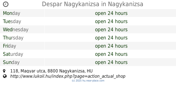
Despar Nagykanizsa
Nagykanizsa, Magyar utca 118
Supermarket
read more
38.205 km
SPAR Szupermarket
Nagykanizsa, Kalmár utca 3
Supermarket
read more
39.687 km
Penny Market
Nagykanizsa, Dózsa György utca 160
Supermarket
read more
43.49 km
SPAR Szupermarket
Körmend, Rákóczi utca 2/C
Supermarket
read more
51.464 km
SPAR Szupermarket
Alsópáhok, Hévizi utca 18
Supermarket
read more
52.14 km
SPAR Szupermarket
Vasvár, Alkotmány utca 95
Supermarket
read more
52.606 km
Coup Szuper
Hévíz
Supermarket
read more
📑
all categories
Accounting
Administrative area level 1
Administrative area level 2
Airport
Amusement park
Aquarium
Art gallery
Atm
Bakery
Bank
Bar
Beauty salon
Bicycle store
Book store
Bowling alley
Bus station
Cafe
Campground
Car dealer
Car rental
Car repair
Car wash
Casino
Cemetery
Church
City hall
Clothing store
Colloquial area
Convenience store
Country
Courthouse
Dentist
Department store
Doctor
Electrician
Electronics store
Embassy
Finance
Fire station
Florist
Food
Funeral home
Furniture store
Gas station
General contractor
Grocery or supermarket
Gym
Hair care
Hardware store
Health
Hindu Temple
Home goods store
Hospital
Insurance agency
Intersection
Jewelry store
Laundry
Lawyer
Library
Light rail station
Liquor store
Local government office
Locality
Locksmith
Lodging
Meal delivery
Meal takeaway
Mosque
Movie rental
Movie theater
Moving company
Museum
Natural feature
Neighborhood
Night club
Painter
Park
Parking
Pet store
Pharmacy
Physiotherapist
Place of worship
Plumber
Point of interest
Police
Political
Post office
Premise
Real estate agency
Restaurant
Roofing contractor
Route
Rv park, camping
School
Shoe store
Shopping mall
Spa
Stadium
Storage
Store
Subpremise
Subway station
Supermarket
Synagogue
Taxi stand
Train station
Transit station
Travel agency
University
Veterinary care
Zoo
administrative area level 3
sublocality level 1
↑