Store nearby Tücsök Papír
Hungary
Store nearby Tücsök Papír
Tücsök Papír
Göd, Ady Endre út 18 Magyarország
contacts phone
:
+36
Latitude:
47.703628
, Longitude:
19.146156
read more
nearest Store
81 m
Tündérfészek Játékbolt Göd
Göd, Ady Endre út 10
Store
read more
81 m
Csepregi Cukrászda
Göd, Ady Endre út 10
Store
read more
177 m
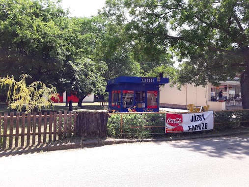
Józsi fagyizó
Göd, Bozóki Gyula tér 8
Store
read more
214 m
Papír-Írószer Nyomtatvány Márton Olga
Göd, Lenkey utca 5
Store
read more
241 m
ERA-Szemcsi Bt.
Göd, Ady Endre utca 2
Store
read more
245 m
Lottozó, hírlap
Göd, Vasút utca 28
Store
read more
250 m
Nemzeti Dohánybolt
47.705259,19
Store
read more
320 m
Gyöngyvirág virág-, ajándékbolt
Göd, Ady Endre út
Store
read more
338 m
Borostyán Csemege
Göd, Duna út 2
Store
read more
359 m
WoLAV Gazdabolt, Felsőgöd
Göd, Duna út 4
Store
read more
372 m
Papír Írószer
Göd, Vasút utca 34
Store
read more
375 m
Kisvakond-Park Kft.
Göd, Rákóczi Ferenc utca 118
Store
read more
381 m
Ahr Med Kft.
Göd, Duna út 6 Herbatár és Bababolt
Store
read more
505 m
Poly-Mix Ltd.
Göd, Rákóczi Ferenc utca 103
Store
read more
505 m
Poly-Mix Kft
Göd, Rákóczi Ferenc utca 103
Store
read more
595 m
Virágzó Dunakanyar Kertészet
Göd, Révay utca 31
Store
read more
608 m
Gyűszűnyi Kézimunkabolt
Göd, Kisfaludy utca 36
Store
read more
729 m
Food and fishing equipment shop, László Imre
Göd, Duna út 34
Store
read more
793 m
Húsdiszkont
Göd, Szent Imre herceg utca 2
Store
read more
816 m
Körömbolt, Műköröm Webáruház
Göd, József utca 31
Store
read more
859 m
Piramis Építőház Kft. Göd
Göd, Pesti út 131
Store
read more
860 m
Göd Vizinövénykertészet
Göd, Jászai Mari utca 7
Store
read more
884 m
Smaragd Kozmetika
Göd, Füzike utca 25
Store
read more
1.309 km
Szeletelt Tégla Göd
Göd, Őszapó utca 135
Store
read more
1.701 km
Kuckó Fagyizó
Göd, Pesti út 93
Store
read more
📑
all categories
Accounting
Administrative area level 1
Administrative area level 2
Airport
Amusement park
Aquarium
Art gallery
Atm
Bakery
Bank
Bar
Beauty salon
Bicycle store
Book store
Bowling alley
Bus station
Cafe
Campground
Car dealer
Car rental
Car repair
Car wash
Casino
Cemetery
Church
City hall
Clothing store
Colloquial area
Convenience store
Country
Courthouse
Dentist
Department store
Doctor
Electrician
Electronics store
Embassy
Finance
Fire station
Florist
Food
Funeral home
Furniture store
Gas station
General contractor
Grocery or supermarket
Gym
Hair care
Hardware store
Health
Hindu Temple
Home goods store
Hospital
Insurance agency
Intersection
Jewelry store
Laundry
Lawyer
Library
Light rail station
Liquor store
Local government office
Locality
Locksmith
Lodging
Meal delivery
Meal takeaway
Mosque
Movie rental
Movie theater
Moving company
Museum
Natural feature
Neighborhood
Night club
Painter
Park
Parking
Pet store
Pharmacy
Physiotherapist
Place of worship
Plumber
Point of interest
Police
Political
Post office
Premise
Real estate agency
Restaurant
Roofing contractor
Route
Rv park, camping
School
Shoe store
Shopping mall
Spa
Stadium
Storage
Store
Subpremise
Subway station
Supermarket
Synagogue
Taxi stand
Train station
Transit station
Travel agency
University
Veterinary care
Zoo
administrative area level 3
sublocality level 1
↑