Store nearby Tattoo Galga
Hungary
Store nearby Tattoo Galga
Tattoo Galga
6, Arany János utca, 2183, Galgamácsa, HU Magyarország
contacts phone
:
+36
website:
www.tetovalomuvesz.com
Latitude:
47.700825
, Longitude:
19.39665
larger map & directions
read more
nearest Store
4.238 km
IMI MINI ABC
Iklad
Store
read more
5.081 km
Langa Bútor Kft.
Iklad, Szabadság út 96
Store
read more
5.531 km
BigFoot Sörfőzde
Domony, 137, Fő út
Store
read more
5.847 km
Dohányüzlet
Iklad, Ráday tér 4
Store
read more
5.858 km
Maxi Coop
Iklad, 2181, Ráday tér 4
Store
read more
5.994 km
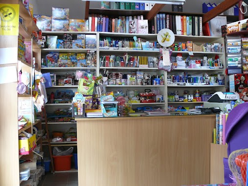
Csipet Bolt Papír-írószer
Iklad, 2181, Iskola tér 1
Store
read more
6.116 km
Pirofilm Kft.
Erdőkertes, Erdőkerülő utca 48
Store
read more
6.317 km
Marcsek Élelmiszer Bolt
Iklad, 2181, Szabadság út 9
Store
read more
7.561 km
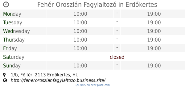
Fehér Oroszlán Fagylaltozó
Erdőkertes, Fő tér 1/b
Store
read more
8.714 km
Dohánybolt
Őrbottyán, Rákóczi Ferenc utca 134
Store
read more
8.799 km
National tobacco shop
Veresegyház, Levendula utca 107
Store
read more
9.698 km
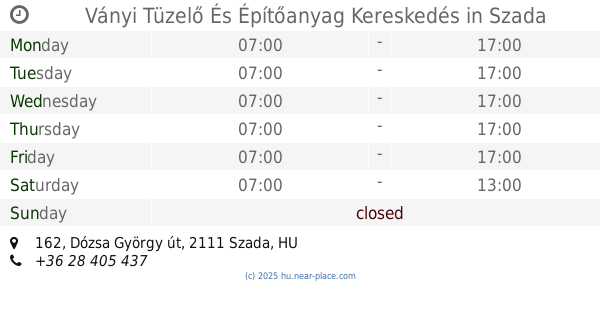
Ványi Tüzelő És Építőanyag Kereskedés
Szada, Dózsa György út 162
Store
read more
10.7 km
Vegyesbolt
Gödöllő, Asbóth Sándor utca 9
Store
read more
10.93 km
Magyar Füstölt Áruk Boltja
Gödöllő, Thegze Lajos utca 2.
Store
read more
11.272 km
Nemzeti Dohánybolt Gödöllő - Máriabesnyő
Gödöllő, Szabadság út 52
Store
read more
11.685 km
BioTech USA
Gödöllő, Kossuth Lajos utca 12
Store
read more
11.773 km
Mazsi Tattoo
Gödöllő, Gábor Áron utca 3
Store
read more
12.09 km
Fit&Sweet Cukormentes Cukrászda
Gödöllő, Szabadság tér 24
Store
read more
12.244 km
Sori Delikát
Hévízgyörk
Store
read more
12.426 km
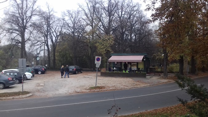
Erzsébet-park Fagyizó
Gödöllő
Store
read more
12.634 km
Stella divat
Gödöllő, Premontrei utca 12
Store
read more
13.047 km
Nemzeti Dohánybolt
Gödöllő, Thököly Imre utca 20
Store
read more
14.532 km
402. sz. ABC
Galgahévíz, Fő út 100
Store
read more
15.646 km
CBA
Penc, Rákóczi út 21
Store
read more
17.446 km
Maros-Épker Kft.
Tura, Rákóczi Ferenc út 112
Store
read more
📑
all categories
Accounting
Administrative area level 1
Administrative area level 2
Airport
Amusement park
Aquarium
Art gallery
Atm
Bakery
Bank
Bar
Beauty salon
Bicycle store
Book store
Bowling alley
Bus station
Cafe
Campground
Car dealer
Car rental
Car repair
Car wash
Casino
Cemetery
Church
City hall
Clothing store
Colloquial area
Convenience store
Country
Courthouse
Dentist
Department store
Doctor
Electrician
Electronics store
Embassy
Finance
Fire station
Florist
Food
Funeral home
Furniture store
Gas station
General contractor
Grocery or supermarket
Gym
Hair care
Hardware store
Health
Hindu Temple
Home goods store
Hospital
Insurance agency
Intersection
Jewelry store
Laundry
Lawyer
Library
Light rail station
Liquor store
Local government office
Locality
Locksmith
Lodging
Meal delivery
Meal takeaway
Mosque
Movie rental
Movie theater
Moving company
Museum
Natural feature
Neighborhood
Night club
Painter
Park
Parking
Pet store
Pharmacy
Physiotherapist
Place of worship
Plumber
Point of interest
Police
Political
Post office
Premise
Real estate agency
Restaurant
Roofing contractor
Route
Rv park, camping
School
Shoe store
Shopping mall
Spa
Stadium
Storage
Store
Subpremise
Subway station
Supermarket
Synagogue
Taxi stand
Train station
Transit station
Travel agency
University
Veterinary care
Zoo
administrative area level 3
sublocality level 1
↑