Store nearby Stefánia fagylaltozo
Coronavirus disease (COVID-19) Situation
confirmed cases
2230232
deaths
49048
Hungary
Store nearby Stefánia fagylaltozo
Stefánia fagylaltozo
Budapest, Thököly út 78 Magyarország
contacts phone
:
+36
Latitude:
47.5082494
, Longitude:
19.0944337
read more
nearest Store
84 m
Korondi Kerámia
Budapest, A. 3., Thököly út 61
Store
read more
250 m
Ajándék most webáruház és poszterbolt
Budapest, Ilka utca 30
Store
read more
314 m
Paintballguru Kft.
Budapest, Zichy Géza utca 5
Store
read more
320 m
Tele-SIGN Ltd.
Budapest, Semsey Andor utca 9
Store
read more
496 m
zenstore Récsei Center
Budapest, Istvánmezei út 6
Store
read more
583 m
BMW - Wallis
Budapest, Hungária körút 95
Store
read more
607 m
Top Games 97 Kft
Budapest, Dózsa György út 17
Store
read more
608 m
Nemzeti Dohánybolt
Budapest, Dózsa György út 13
Store
read more
621 m
AVT élelmiszer
Budapest, Thököly út 44
Store
read more
705 m
Gal Vital Synergytech Kft.
Sajó utca 4-8. fszt. 01/Ü
Store
read more
760 m
Analog Tattoo Budapest
Budapest, Cserhát utca 9
Store
read more
857 m
Minimal Store Kft.
Budapest, Garay tér 15
Store
read more
869 m
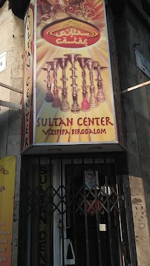
Sultan Vizipipa Center
Budapest, Murányi utca 9
Store
read more
874 m
Hungary Association Opticnet
Budapest, Hungária körút 67. 1. em.
Store
read more
884 m
Órás
Budapest, Garay utca 45
Store
read more
919 m
Bonzoportal.hu
Budapest, Damjanich utca 51
Store
read more
941 m
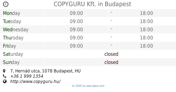
COPYGURU Kft.
Budapest, Hernád utca 7
Store
read more
956 m
TCN SIGN STUDIO
Budapest, Péterfy Sándor utca 40
Store
read more
967 m
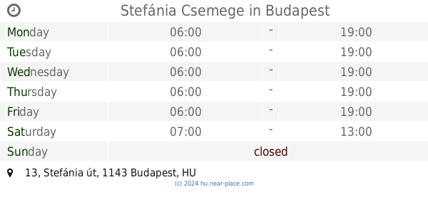
Stefánia Csemege
Budapest, Stefánia út 13
Store
read more
967 m
Forever Toy Store
Budapest, 8, Hernád utca
Store
read more
1.022 km
WS Teleshop Magyarország
Budapest, Thököly út 16
Store
read more
1.172 km
Garay GSM
Budapest, Garay utca
Store
read more
1.21 km
Szabó DTP & Nyomda Kft.
Budapest, Baross tér 12
Store
read more
1.298 km
Nemzeti Dohánybolt
Budapest, Kerepesi út 41
Store
read more
1.302 km
Fülke Fagyizó
Budapest, Thököly út 146b
Store
read more
📑
all categories
Accounting
Administrative area level 1
Administrative area level 2
Airport
Amusement park
Aquarium
Art gallery
Atm
Bakery
Bank
Bar
Beauty salon
Bicycle store
Book store
Bowling alley
Bus station
Cafe
Campground
Car dealer
Car rental
Car repair
Car wash
Casino
Cemetery
Church
City hall
Clothing store
Colloquial area
Convenience store
Country
Courthouse
Dentist
Department store
Doctor
Electrician
Electronics store
Embassy
Finance
Fire station
Florist
Food
Funeral home
Furniture store
Gas station
General contractor
Grocery or supermarket
Gym
Hair care
Hardware store
Health
Hindu Temple
Home goods store
Hospital
Insurance agency
Intersection
Jewelry store
Laundry
Lawyer
Library
Light rail station
Liquor store
Local government office
Locality
Locksmith
Lodging
Meal delivery
Meal takeaway
Mosque
Movie rental
Movie theater
Moving company
Museum
Natural feature
Neighborhood
Night club
Painter
Park
Parking
Pet store
Pharmacy
Physiotherapist
Place of worship
Plumber
Point of interest
Police
Political
Post office
Premise
Real estate agency
Restaurant
Roofing contractor
Route
Rv park, camping
School
Shoe store
Shopping mall
Spa
Stadium
Storage
Store
Subpremise
Subway station
Supermarket
Synagogue
Taxi stand
Train station
Transit station
Travel agency
University
Veterinary care
Zoo
administrative area level 3
sublocality level 1
↑