Store nearby gfgf
Hungary
Store nearby gfgf
gfgf
Budapest, Magaslati utca 1-5 Hungary
contacts phone
:
+36
Latitude:
47.414042
, Longitude:
18.979869
read more
nearest Store
277 m
BV Tempo Kft.Termőföld
Budapest, Balatoni út - Csúcs
Store
read more
834 m
Flora Nostra Kft.
Budapest, Szakiskola utca 50
Store
read more
937 m
Thetford
Budapest, Bartók Béla út 138
Store
read more
949 m
Nagytétényi Tanpálya
Budapest, Dózsa György út
Store
read more
1.351 km
Ibolya ABC Inlernet partner
Budapest, Barackos út 1
Store
read more
1.451 km
Paletta Motors Kft.
Budapest, Kanyar utca
Store
read more
1.494 km
Autogalaxy
Budapest, Diótörő út 129
Store
read more
1.501 km
Balogh Kertészet
Budapest, Diótörő út 122
Store
read more
1.654 km
SIDEX Trade Kft.
Budapest, 105, Dózsa György út
Store
read more
1.704 km
Osváth Cukrászda
Diósd, Balatoni út 3
Store
read more
1.781 km
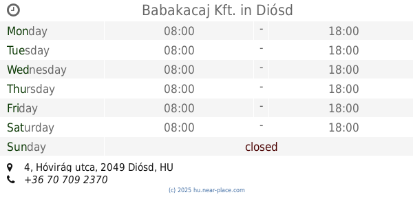
Babakacaj Kft.
Diósd, Hóvirág utca 4
Store
read more
1.808 km
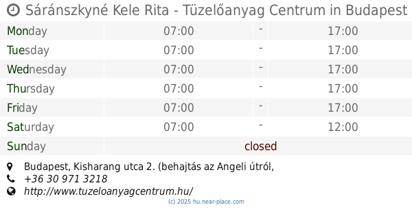
Sáránszkyné Kele Rita - Tüzelőanyag Centrum
Budapest, Kisharang utca 2. (behajtás az Angeli útról, a sínekkel párhuzamos földútra)
Store
read more
1.85 km
Szépségvár Szépségszalon
Budapest, Március 15. utca 53
Store
read more
1.854 km
S.P.S Printing Solution Kft.
Budapest, Dózsa György út 105
Store
read more
1.905 km
Dioptika
Diósd, Balatoni út 2/a
Store
read more
1.905 km
dm-drogerie markt
Diósd, Balatoni út 2/A Interspar
Store
read more
1.925 km
Nemzeti Dohánybolt és lottozó
Budapest, Dózsa György út 29
Store
read more
1.938 km
Fitoland Kertészet Budafok
Budapest, Rókales utca 2-4
Store
read more
1.982 km
Nemzeti Dohánybolt
Diósd, Balatoni út 2
Store
read more
1.982 km
National tobacco shop
Diósd, Balatoni út 2
Store
read more
1.995 km
R+P Raktártechnika Kft
Budapest, Dózsa György út 105
Store
read more
2.025 km
Logo H. Bt.
Budapest, Lídia utca 9/b
Store
read more
2.37 km
National tobacco shop
Budapest, Nagytétényi út 216
Store
read more
2.37 km
Nemzeti Dohánybolt
Budapest, Nagytétényi út 216
Store
read more
2.375 km
Rózsika Varrodája
Budapest, Nagytétényi út 302
Store
read more
📑
all categories
Accounting
Administrative area level 1
Administrative area level 2
Airport
Amusement park
Aquarium
Art gallery
Atm
Bakery
Bank
Bar
Beauty salon
Bicycle store
Book store
Bowling alley
Bus station
Cafe
Campground
Car dealer
Car rental
Car repair
Car wash
Casino
Cemetery
Church
City hall
Clothing store
Colloquial area
Convenience store
Country
Courthouse
Dentist
Department store
Doctor
Electrician
Electronics store
Embassy
Finance
Fire station
Florist
Food
Funeral home
Furniture store
Gas station
General contractor
Grocery or supermarket
Gym
Hair care
Hardware store
Health
Hindu Temple
Home goods store
Hospital
Insurance agency
Intersection
Jewelry store
Laundry
Lawyer
Library
Light rail station
Liquor store
Local government office
Locality
Locksmith
Lodging
Meal delivery
Meal takeaway
Mosque
Movie rental
Movie theater
Moving company
Museum
Natural feature
Neighborhood
Night club
Painter
Park
Parking
Pet store
Pharmacy
Physiotherapist
Place of worship
Plumber
Point of interest
Police
Political
Post office
Premise
Real estate agency
Restaurant
Roofing contractor
Route
Rv park, camping
School
Shoe store
Shopping mall
Spa
Stadium
Storage
Store
Subpremise
Subway station
Supermarket
Synagogue
Taxi stand
Train station
Transit station
Travel agency
University
Veterinary care
Zoo
administrative area level 3
sublocality level 1
↑