Restaurant nearby McDonald's
Hungary
Restaurant nearby McDonald's
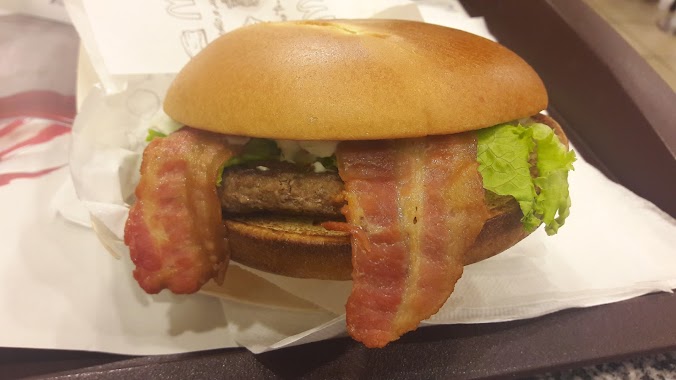
McDonald's
37-45, Nagytétényi út, 1223, Budapest, HU Hungary
contacts phone
:
+36 1 424 3241
website:
www.mcdonalds.hu
Latitude:
47.4098053
, Longitude:
19.021124
larger map & directions
read more
nearest Restaurant
83 m
Gyros Keleti Büfé
Budapest, Jókai Mór utca 2-4
Restaurant
read more
84 m
Gyár Is Bisztró
Budapest, 1223, Jókai Mór utca 2-4
Restaurant
read more
307 m
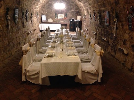
Borköltők Társasága Pince Étterem
Budapest, Jókai Mór utca 26
Restaurant
read more
337 m
McDonald's
Budapest, Nagytétényi út 35
Restaurant
read more
337 m
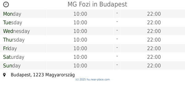
MG Fozi
Budapest
Restaurant
read more
339 m
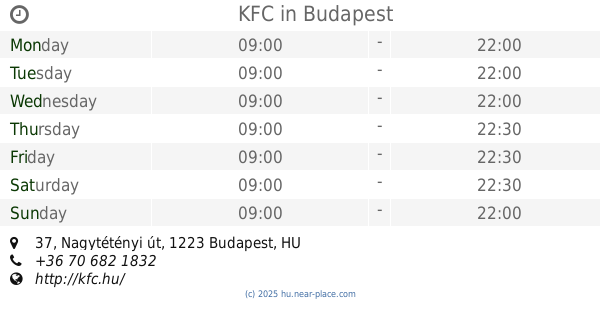
KFC
Budapest, Nagytétényi út 37
Restaurant
read more
342 m
thai restaurant
Budapest
Restaurant
read more
342 m
Hungaro - Streetfood
Budapest
Restaurant
read more
350 m
Pizza Forte Kft.
Budapest, Nagytétényi út 35
Restaurant
read more
356 m
Kerkyra
Budapest, Nagytétényi út 37
Restaurant
read more
357 m
Campona Piramis Keleti Ételek
Budapest, Nagytétényi út 35
Restaurant
read more
367 m
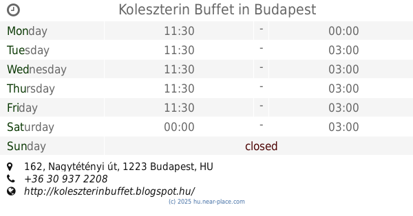
Koleszterin Buffet
Budapest, Nagytétényi út 162
Restaurant
read more
399 m
Háros Grill
Budapest, Háros utca 12
Restaurant
read more
440 m
Cine Cittá Café & Restaurant
Budapest
Restaurant
read more
467 m
Pizza Hut Campona
Nagytétényi 37-48
Restaurant
read more
471 m
Akácos Vendéglő
Budapest, Nagytétényi út 174
Restaurant
read more
587 m
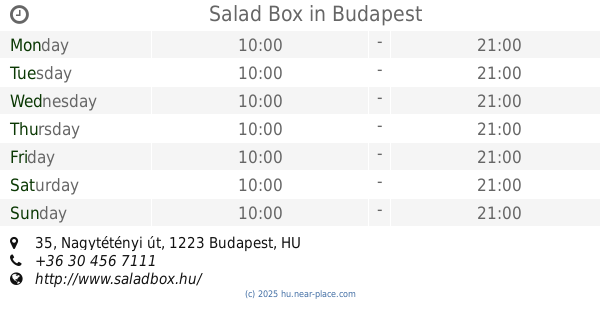
Salad Box
Budapest, Nagytétényi út 35
Restaurant
read more
865 m
Kaja Gyár
Budapest, Gyár utca 15
Restaurant
read more
996 m
Csutak Söröző
Budapest, Angolna utca 2
Restaurant
read more
1.393 km
Palace Catering
Budapest, Nagytétényi út 64
Restaurant
read more
1.393 km
Borkatakomba
Budapest, Nagytétényi út 64
Restaurant
read more
1.526 km
Kompház
Budapest, Gyár utca 1
Restaurant
read more
1.688 km
Desszert Söröző, Darts Terem
Budapest, Kertész utca 15
Restaurant
read more
2.229 km
Budafoki Gyors
Budapest, Kossuth Lajos utca 28
Restaurant
read more
2.328 km
Pasa Kebab
Budapest, Városház tér 17
Restaurant
read more
📑
all categories
Accounting
Administrative area level 1
Administrative area level 2
Airport
Amusement park
Aquarium
Art gallery
Atm
Bakery
Bank
Bar
Beauty salon
Bicycle store
Book store
Bowling alley
Bus station
Cafe
Campground
Car dealer
Car rental
Car repair
Car wash
Casino
Cemetery
Church
City hall
Clothing store
Colloquial area
Convenience store
Country
Courthouse
Dentist
Department store
Doctor
Electrician
Electronics store
Embassy
Finance
Fire station
Florist
Food
Funeral home
Furniture store
Gas station
General contractor
Grocery or supermarket
Gym
Hair care
Hardware store
Health
Hindu Temple
Home goods store
Hospital
Insurance agency
Intersection
Jewelry store
Laundry
Lawyer
Library
Light rail station
Liquor store
Local government office
Locality
Locksmith
Lodging
Meal delivery
Meal takeaway
Mosque
Movie rental
Movie theater
Moving company
Museum
Natural feature
Neighborhood
Night club
Painter
Park
Parking
Pet store
Pharmacy
Physiotherapist
Place of worship
Plumber
Point of interest
Police
Political
Post office
Premise
Real estate agency
Restaurant
Roofing contractor
Route
Rv park, camping
School
Shoe store
Shopping mall
Spa
Stadium
Storage
Store
Subpremise
Subway station
Supermarket
Synagogue
Taxi stand
Train station
Transit station
Travel agency
University
Veterinary care
Zoo
administrative area level 3
sublocality level 1
↑