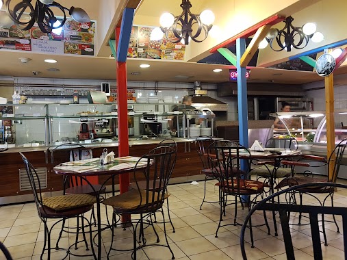
Restaurant nearby Kínai Tianjin Étterem
Hungary
Restaurant nearby Kínai Tianjin Étterem
Kínai Tianjin Étterem
Budapest, Villám utca 29 Magyarország
contacts phone
:
+36
Latitude:
47.481087
, Longitude:
19.101336
read more
nearest Restaurant
23 m
Frédiék vendéglő
Budapest, 65, Bíró Lajos utca 63
Restaurant
read more
95 m
török étterem
Budapest, Könyves Kálmán körút 62
Restaurant
read more
584 m
Csirkefogók Büfé
Budapest, Rezső tér 16
Restaurant
read more
607 m
Tomi Büfé
Budapest
Restaurant
read more
629 m
Ali Baba Török Sütöde
Budapest, Isztambul utca
Restaurant
read more
674 m
Gólvonal Bisztró
Budapest, Üllői út 129
Restaurant
read more
712 m
KFC
Budapest, Könyves Kálmán körút 76
Restaurant
read more
712 m
Kentucky Fried Chicken
Budapest, Könyves Kálmán körút 76
Restaurant
read more
720 m
Hong Lai Kínai Büfé
Budapest, Kőbányai út 31
Restaurant
read more
739 m
Wang Mester Kínai konyhája
Budapest, Kőbányai út 25
Restaurant
read more
741 m
YanYan Cake
Budapest, Kőbányai út 29
Restaurant
read more
742 m
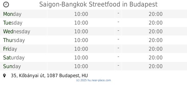
Saigon-Bangkok Streetfood
Budapest, Kőbányai út 35
Restaurant
read more
745 m
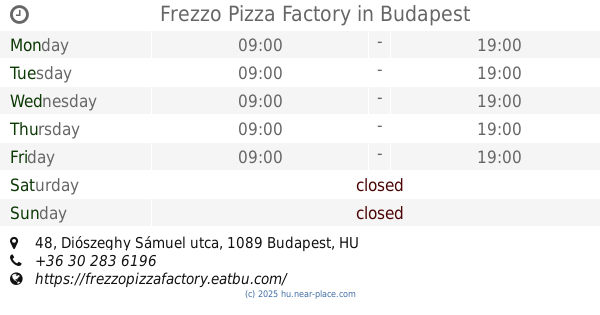
Frezzo Pizza Factory
Budapest, Diószeghy Sámuel utca 48
Restaurant
read more
748 m
香满楼餐厅 WANG RESTAURANT
Budapest, Kőbányai út 25
Restaurant
read more
758 m
McDonald's
Budapest, Könyves Kálmán körút 25
Restaurant
read more
761 m
EUREST Étterem
Budapest, Nagyvárad tér 4
Restaurant
read more
787 m
Da Zhong Mei Si
Budapest, Kőbányai út 25
Restaurant
read more
862 m
Emir Döner
Budapest, Kőbányai út 23
Restaurant
read more
890 m
Risborn Fastfood Nagyvárad Tér
Budapest, Nagyvárad tér
Restaurant
read more
904 m
Taiwan Étterem
Budapest, Albert Flórián út 3
Restaurant
read more
906 m
台湾酒楼
Budapest, Albert Flórián útca 3
Restaurant
read more
932 m
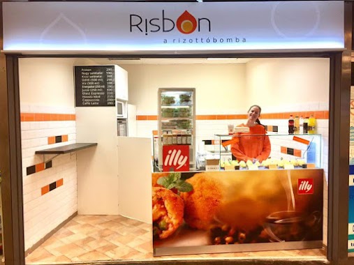
Risbon Hungary Kft
Budapest, Nagyvárad téri aluljáró, 7sz. üzlet
Restaurant
read more
1.021 km
Lialina Arabian Nights
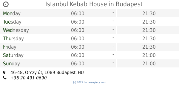
Budapest, Orczy út 46-48
Restaurant
read more
1.039 km
Istanbul Kebab House
Budapest, Orczy út 46-48
Restaurant
read more
1.09 km
稻花香
Budapest, Orczy tér 4a/2
Restaurant
read more
📑
all categories
Accounting
Administrative area level 1
Administrative area level 2
Airport
Amusement park
Aquarium
Art gallery
Atm
Bakery
Bank
Bar
Beauty salon
Bicycle store
Book store
Bowling alley
Bus station
Cafe
Campground
Car dealer
Car rental
Car repair
Car wash
Casino
Cemetery
Church
City hall
Clothing store
Colloquial area
Convenience store
Country
Courthouse
Dentist
Department store
Doctor
Electrician
Electronics store
Embassy
Finance
Fire station
Florist
Food
Funeral home
Furniture store
Gas station
General contractor
Grocery or supermarket
Gym
Hair care
Hardware store
Health
Hindu Temple
Home goods store
Hospital
Insurance agency
Intersection
Jewelry store
Laundry
Lawyer
Library
Light rail station
Liquor store
Local government office
Locality
Locksmith
Lodging
Meal delivery
Meal takeaway
Mosque
Movie rental
Movie theater
Moving company
Museum
Natural feature
Neighborhood
Night club
Painter
Park
Parking
Pet store
Pharmacy
Physiotherapist
Place of worship
Plumber
Point of interest
Police
Political
Post office
Premise
Real estate agency
Restaurant
Roofing contractor
Route
Rv park, camping
School
Shoe store
Shopping mall
Spa
Stadium
Storage
Store
Subpremise
Subway station
Supermarket
Synagogue
Taxi stand
Train station
Transit station
Travel agency
University
Veterinary care
Zoo
administrative area level 3
sublocality level 1
↑