Premise nearby Szentendrei rózsa termőhelye Természetvédelmi terület
Hungary
Premise nearby Szentendrei rózsa termőhelye Természetvédelmi terület
Szentendrei rózsa termőhelye Természetvédelmi terület
Szentendre Magyarország
contacts phone
:
+36
Latitude:
47.6810922
, Longitude:
19.0786229
read more
nearest Premise
1.955 km
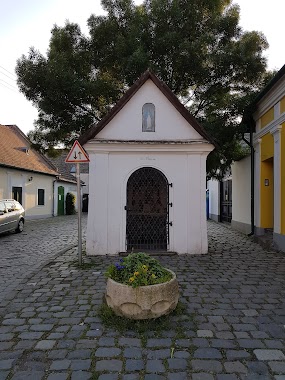
Szent Flórián Kápolna
Szentendre
Premise
read more
2.098 km
Szmolnica játszótér
Szentendre
Premise
read more
3.487 km
Üzemanyagkút
Szentendre
Premise
read more
4.439 km
Koszorú tér
Alsógöd
Premise
read more
4.581 km
Alsógödi sporttelep
Göd
Premise
read more
5.025 km
Izbég lő- és gyakorlótér
Szentendre
Premise
read more
5.19 km
Gödi focipálya
Göd
Premise
read more
9.709 km
BKV végállomás
IV. kerület
Premise
read more
9.927 km
Újpesti Ipari Park
IV. kerület
Premise
read more
10.482 km
REX Kutyaotthon Alapítvány
IV. kerület
Premise
read more
10.587 km
Ligeti stadion edzőpálya
Vác
Premise
read more
10.621 km
Ligeti stadion főépület
Vác
Premise
read more
11.113 km
Püspöki Palota
Vác, Migazzi Kristóf tér 1
Premise
read more
11.981 km
Széchenyi István u. 42
Vác
Premise
read more
12.201 km
Capri
IV. kerület
Premise
read more
12.865 km
A épület
III. kerület
Premise
read more
13.096 km
Posta
IV. kerület
Premise
read more
13.34 km
Kisjátszótér
IV. kerület
Premise
read more
14.05 km
Újrahasznosítható hulladék gyűjtők
Pilisszántó
Premise
read more
14.207 km
IMI Hydronic Engineering
Budapest, Kunigunda útja 60
Premise
read more
14.245 km
Kiskápolna
Pilisszántó
Premise
read more
14.265 km
Gurító parkoló
Pilisszántó
Premise
read more
14.363 km
Páduai Szent Antal Római Katolikus Temploma
Pilisszántó
Premise
read more
14.505 km
Szikla Színház Parkoló
Pilisszántó
Premise
read more
14.537 km
Royal Palace of Matthias Corvinus
Visegrád
Premise
read more
📑
all categories
Accounting
Administrative area level 1
Administrative area level 2
Airport
Amusement park
Aquarium
Art gallery
Atm
Bakery
Bank
Bar
Beauty salon
Bicycle store
Book store
Bowling alley
Bus station
Cafe
Campground
Car dealer
Car rental
Car repair
Car wash
Casino
Cemetery
Church
City hall
Clothing store
Colloquial area
Convenience store
Country
Courthouse
Dentist
Department store
Doctor
Electrician
Electronics store
Embassy
Finance
Fire station
Florist
Food
Funeral home
Furniture store
Gas station
General contractor
Grocery or supermarket
Gym
Hair care
Hardware store
Health
Hindu Temple
Home goods store
Hospital
Insurance agency
Intersection
Jewelry store
Laundry
Lawyer
Library
Light rail station
Liquor store
Local government office
Locality
Locksmith
Lodging
Meal delivery
Meal takeaway
Mosque
Movie rental
Movie theater
Moving company
Museum
Natural feature
Neighborhood
Night club
Painter
Park
Parking
Pet store
Pharmacy
Physiotherapist
Place of worship
Plumber
Point of interest
Police
Political
Post office
Premise
Real estate agency
Restaurant
Roofing contractor
Route
Rv park, camping
School
Shoe store
Shopping mall
Spa
Stadium
Storage
Store
Subpremise
Subway station
Supermarket
Synagogue
Taxi stand
Train station
Transit station
Travel agency
University
Veterinary care
Zoo
administrative area level 3
sublocality level 1
↑